Visitors to the ERO may not notice the canal basin that lies just behind our building – although ‘Wharf Road’ is a bit of a clue. Nevertheless, into the last century the Chelmer and Blackwater Navigation of 1797 (strictly, a river made navigable and not a canal) was an important means of transport for heavy freight. In its way, it is partly responsible for the ERO lying where it does: heavy freight includes coal, coal can be used to produce gas, and so it was natural for Chelmsford’s gasworks to rise beside the basin. Natural gas brought the end of the gasworks, and created a large development site handily close to the town centre.
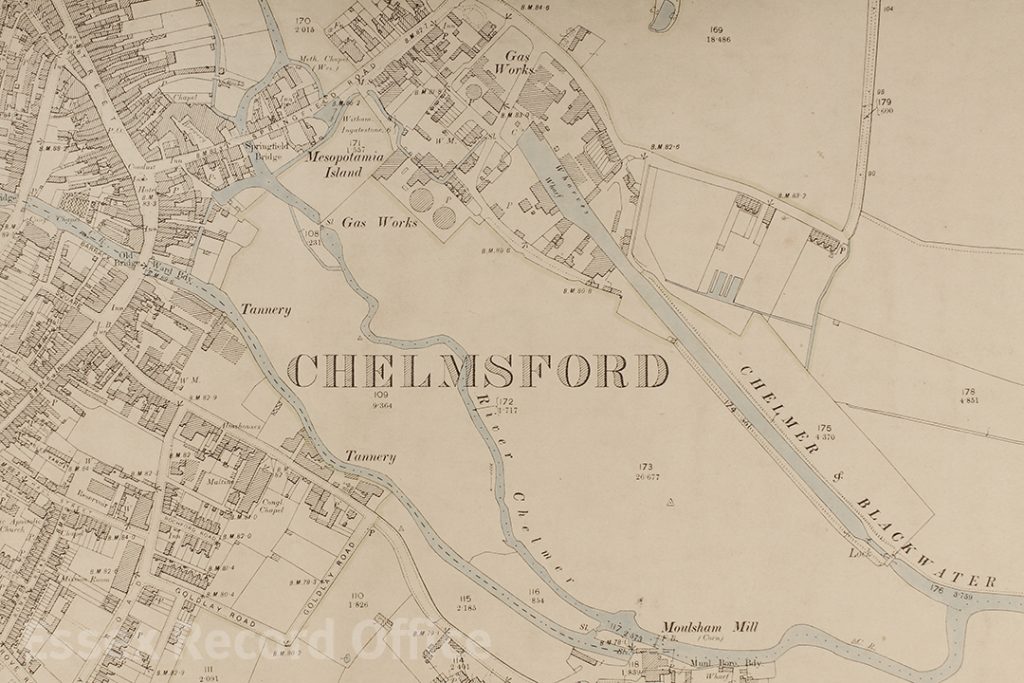
This Ordnance Survey map from 1897 shows the system of waterways to the south west of Chelmsford town centre, where the rivers Chelmer and Can met, and where they fed into the Chelmer and Blackwater Navigation. The Navigation ended at Springfield wharf, where there were timber and coal wharves for unloading the goods brought up the Navigation on barges from Heybridge Basin, 13.5 miles away. The Essex Record Office stands today between the Navigation and the Chelmer, just south of the gasometers.
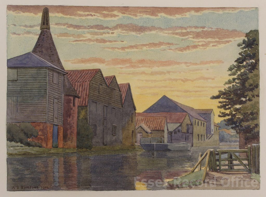
Watercolour of Springield Wharf by A.B. Bamford, 1906 (I/Ba 14/2)
The main archive of the Navigation Company was deposited in the ERO decades ago (reference D/Z 36). What we did not know then is that there were some volumes missing. Three registers of ships berthing between 1886 and 1941 at the far end of the navigation – 13½ miles away in Heybridge, on the Blackwater estuary –had been loaned out to a student. They were never returned, and their whereabouts are now unknown. Fortunately, one of the researchers through whose hands they passed kept a set of photocopies. Through his kindness we have recently been able to borrow the photocopies and make a set of digital copies from them (reference T/B 694).
The digital copies we have been able to make of the missing records are now available on Essex Archives Online, catalogued as T/B 694/1, /2, and /3
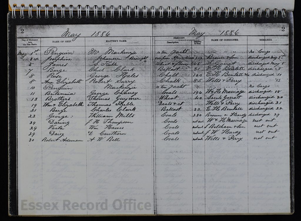
The registers name vessels unloading (or occasionally loading) at Heybridge Basin, with the names of their masters and the nature and tonnage of their cargoes. Now and again a small private yacht turns up, but for the most part this is a record of freight traffic during the last years of canals as a working transport system. As you can see from the images on Essex Archives Online, even in 1886 the navigation handled quite a narrow range of bulk goods for a small band of local companies. Coal, timber, chalk, wheat – all headed up the navigation on horse-drawn lighters. At first some cargoes of fish were also landed, although these disappear after 1901. Steamships made a few entrances, but most of the navigation’s visitors were sailing vessels.

Heybridge Basin in 1910 (I/Mb 182/1/11)
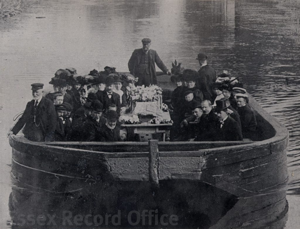
Some more unusual river traffic – a funeral barge on the navigation at Hebridge, 1912 (I/Mb 182/1/11)
As its trade was taken over by rail and then by road transport, the navigation slowly shrank into a backwater. As late as 1927 the gas company was still bringing in coal, but soon only the timber trade was left – and only one customer, Brown and Son Ltd of Navigation Road, Chelmsford. The last delivery to be registered was on 21 November 1941, although commercial traffic on the navigation did not actually cease until 1972.
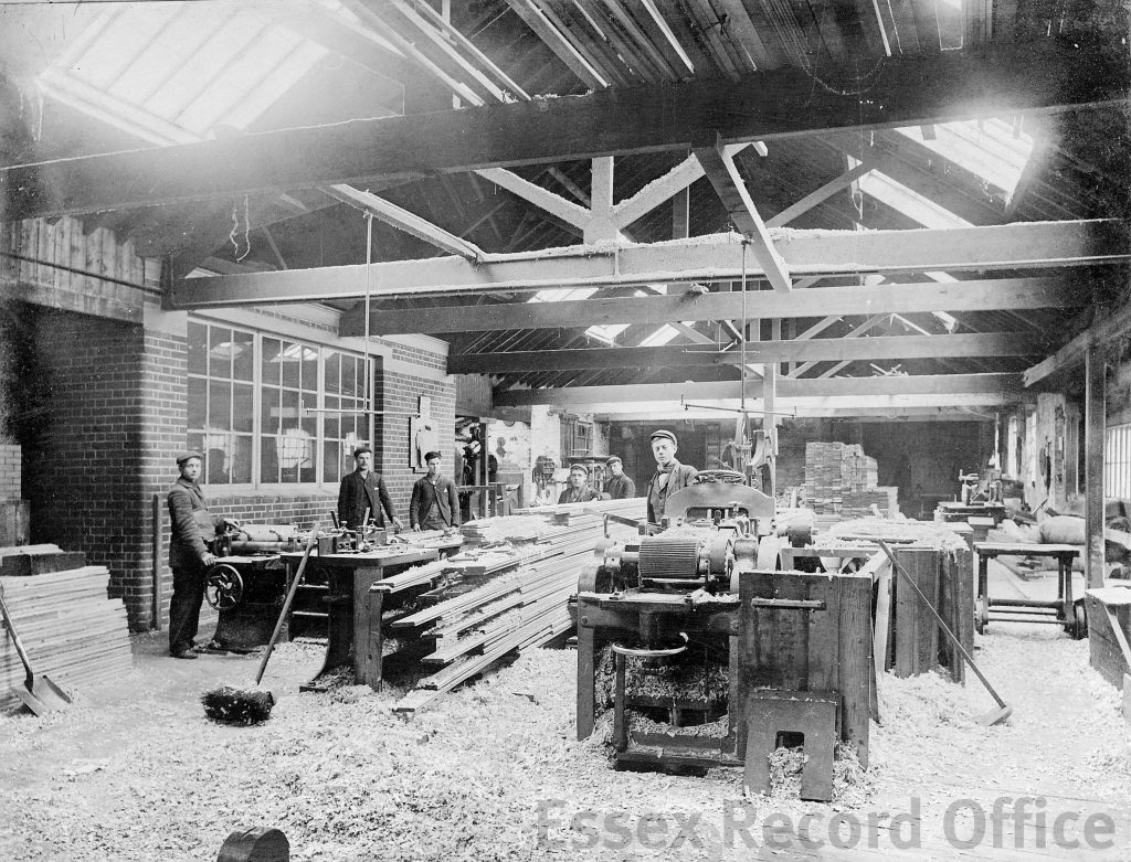
Brown’s timber yard in Springfield wharf. Photo by Fred Spalding (D/F 169/1/1215)
Registers of freight traffic sound un-promising, perhaps, but they are an intriguing relic of an enterprise and a way of life that marked this patch of Essex deeply and literally. Do take a look.