You know how much Archive Assistant Neil Wiffen loves a bit of serendipity – well here’s some more,a Neil explores a serendipitous discovery, that revealed more about Essex’s role in the Great War!
When we have new visitors to the Searchroom, I always warn them that it’s a dangerous business coming in, as you never know what you’ll come across. You might think you’ll do a bit of family history, take a look at a record or two but before you know it, six months have passed and you stagger out from being interested in so many things and going down so many rabbit holes!
Well, it’s the same for the staff as well – what will we see today? You might be working quietly away, getting on with the task allotted to you but sometimes fate comes looking for you – especially if we have our wonderful volunteers in who might have a question to ask or an item to share.
It was the latter in this case. Volunteer Annette, who has been beavering away listing a large collection of postcards and ephemera over the last few years, came up to the Searchroom enquiry desk clutching an aerial photo of a trench system labelled ‘Chelmsford’, dated 1917. Well, that certainly piqued our interest – who wouldn’t be interested in this unidentified location within ‘Chelmsford’?
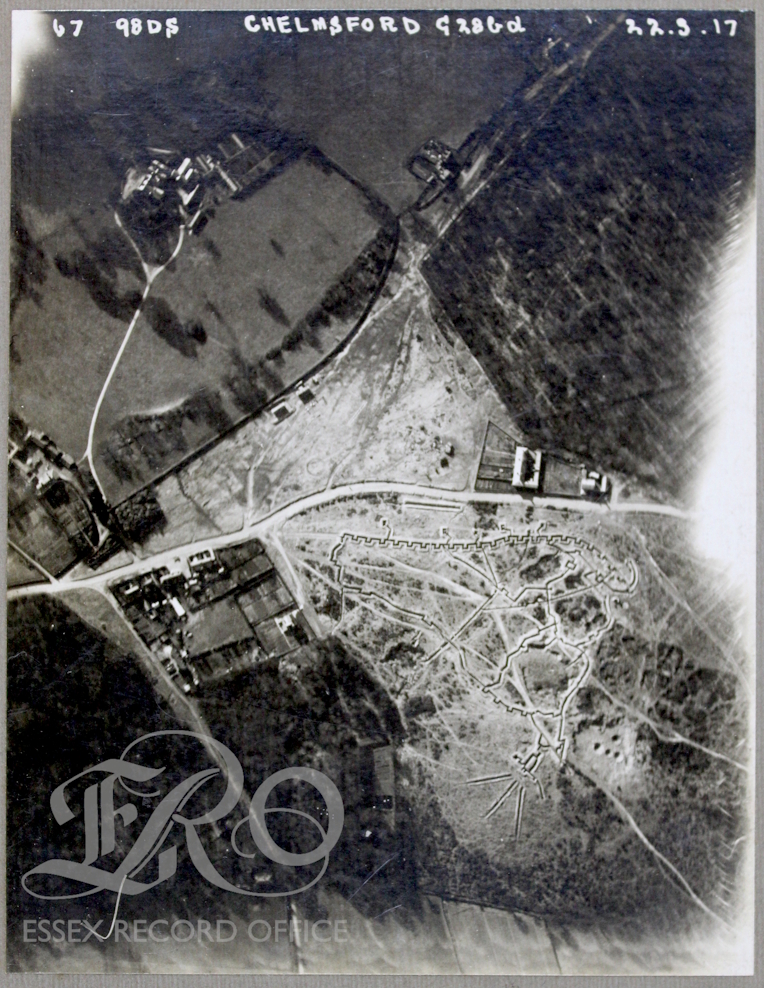
The first thing, looking at this photo, is that the landscape is distinctly ‘heathy’, with patches of scrub. This marginal land would have been actively sought out by the military for their exercises, as they always tried to use areas of poor soil, which was of little value to the locals apart from rough grazing or for cutting furze or heather from. So where in ‘Chelmsford’ was this practice trench system located? First thoughts turned to Little Baddow and Danbury, the latter the site of an important Napoleonic camp. Was it Galleywood Common, once the location of a major Napoleonic defensive line? Scouring Ordnance Survey maps drew a blank so we spread the net wider. It came when Edward Harris was looking at a combination of maps on the National Library of Scotland website (Ordnance Survey Maps – Map Images – National Library of Scotland) and our trusty A to Z from the early 2000s – it was Mill Green, Ingatestone – huzzah!
So, we now knew where it was, but what was it for? Reaching out to our archive community, ERO regular Robert Fletcher told us that it was the Southern Area Bombing School SABS) – he had undertaken some research on this in previous years. In fact, it had been mentioned by a Miss Christy of Ingatestone who had a sketch map of the site. Robert also gave us some other references, one of which was to a notebook kept by a member of the Durham Light Infantry, Charles Edward Shaw.
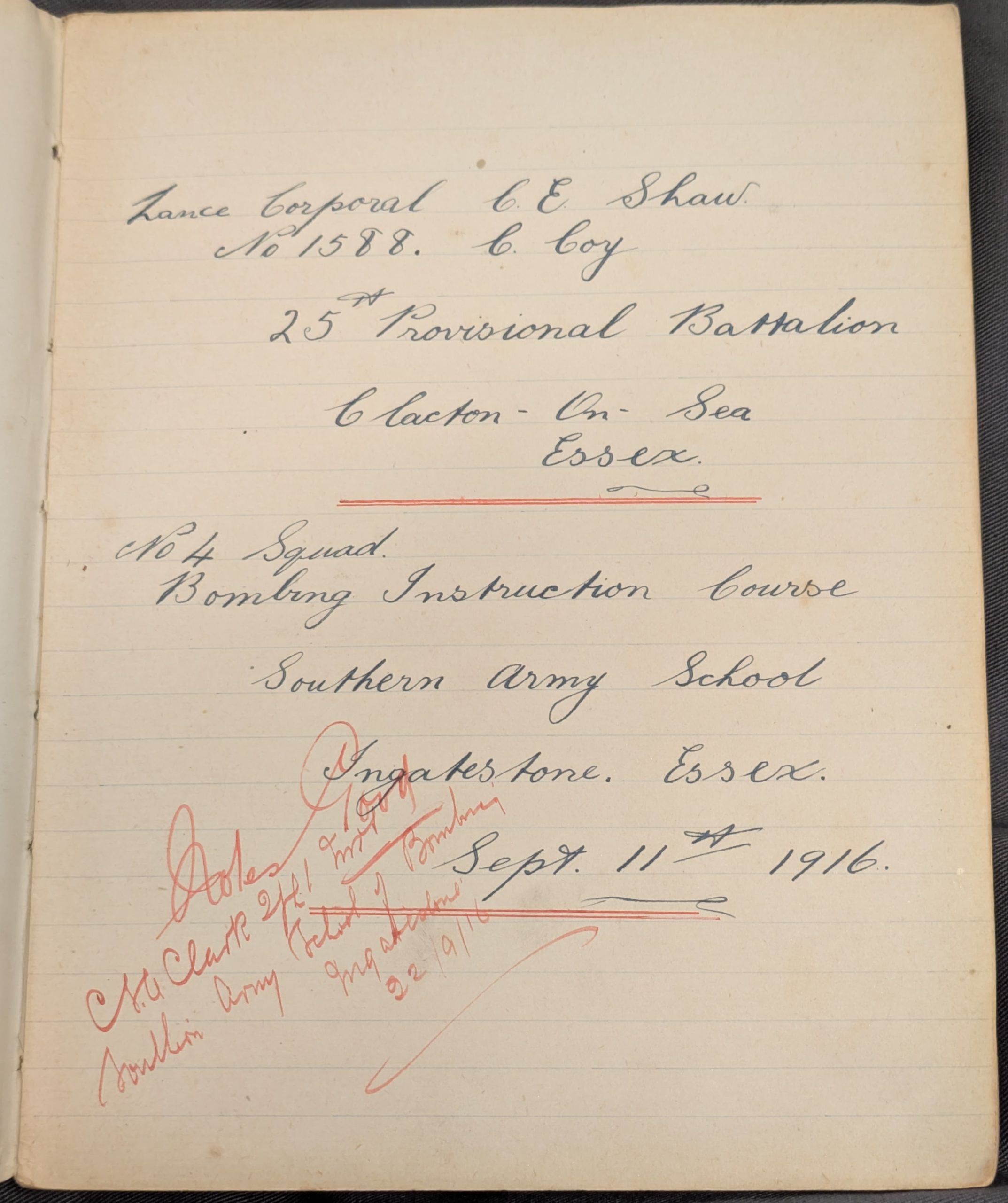
Our friends at The Story in Durham (The Story), took a look at Charles’s notebook for us, but, apart from the rather attractive title page, and although it does contain details about grenades, there is nothing on his time in Ingatestone. Do any of you know anything about SABS as it would be great to find out more.
And just when you think you’ll never need to think about bombs and bombing schools again, an interesting video comes along which explains all about them including some of the set-up which you can see in our aerial photo:
So, on this Armistice Day we can remember all those who had to undertake a course at the bombing school, be grateful that it does not exist now, but also thankful that on one day in 1917 a photograph was taken of this long-forgotten relic of World War One.