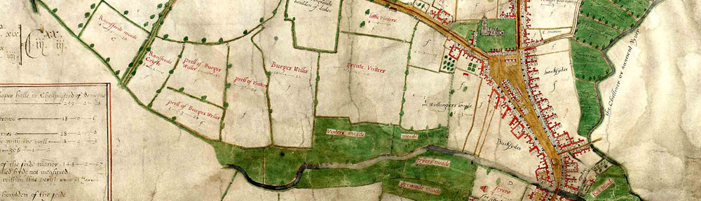
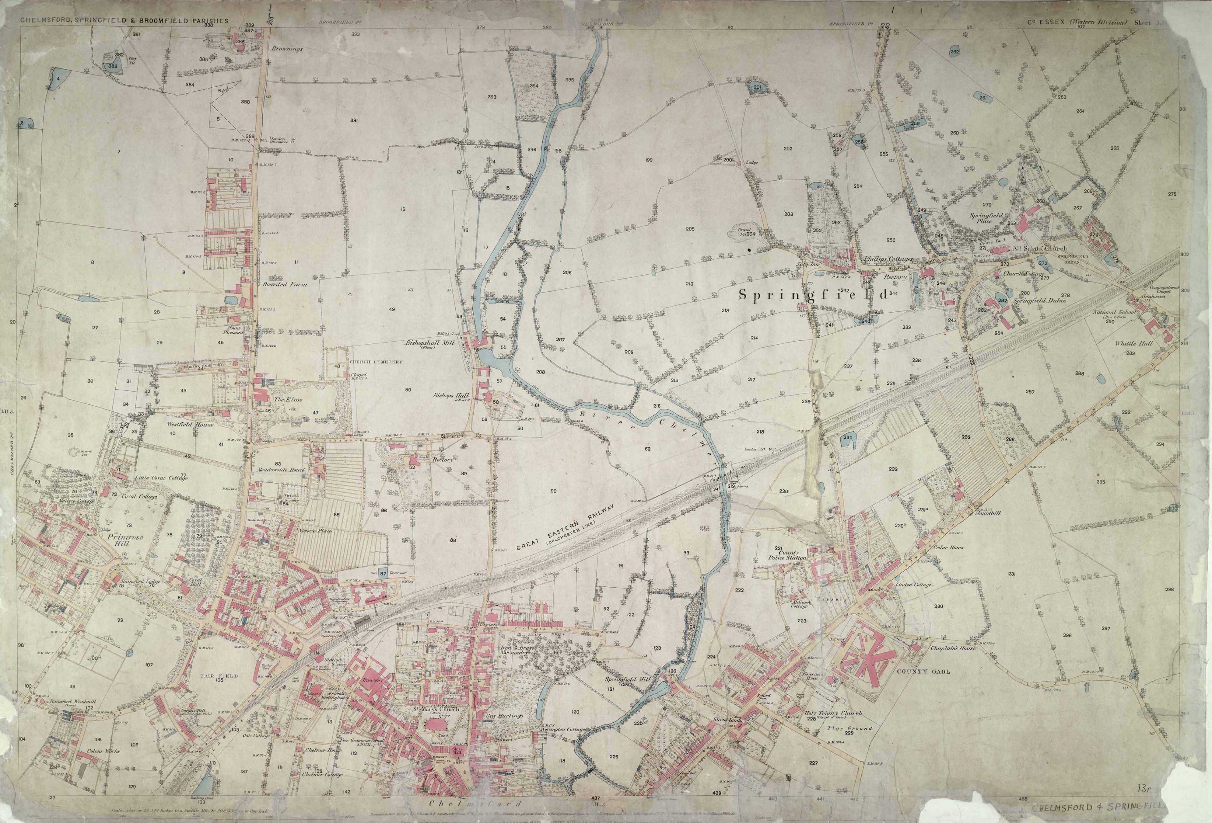
Ordnance Survey map of Chelmsford, 1874 Published March 16, 2012 at 3982 × 2706 in Ordnance Survey map of Chelmsford, 1874 Ordnance Survey map of Chelmsford, 1874. MAP/OS/25/1/52.4 Learn how to use historic ordnance survey maps and other types of map in our ‘Discover Maps’ tutorial.