New accessions arrive at ERO in a steady stream, and sometimes a very special survivor from the past comes into our care.
One such item that recently came into us is this map of Grays dating from 1631, made by a surveyor named Samuel Parsons (A14738 box 1).
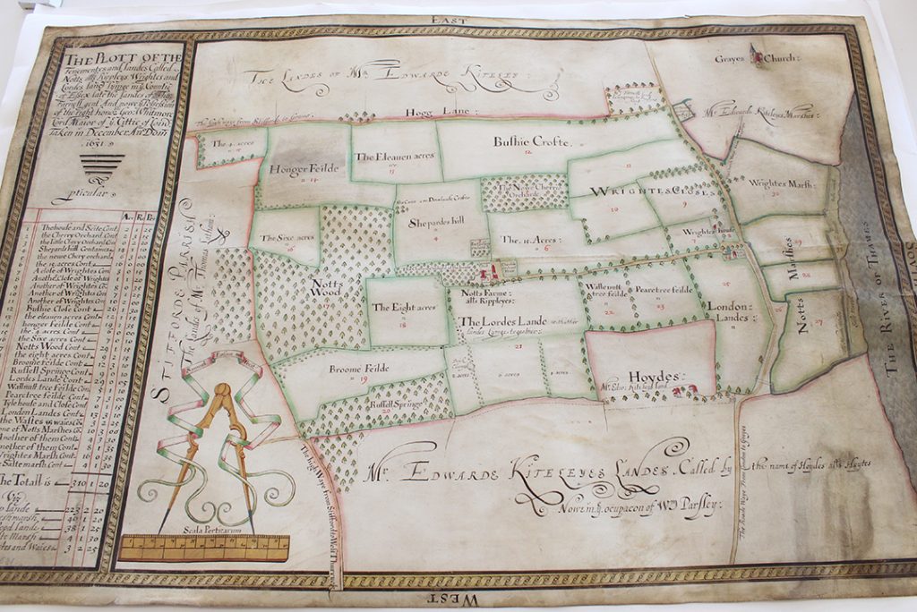
The map in our Conservation Studio after being cleaned. East is at the top of the map. The area shown is the west side of Grays. London Road, shown running along the south side of the map, is today’s A126, and Hogg Lane, shown running along the east side of the map, is today the A1012. The salt marshes shown along the banks of the Thames are today housing. Part of the area shown in the middle of the map is today Grays Chalk Quarry Nature Reserve, part of it is Badgers Dene housing estate, part of it is Askews Farm Industrial Estate, and part of it is a NuStar oil and gas terminal.
The map was made for George Whitmore, Lord Mayor of London, and shows land that he owned in Grays called Notts (alias Ripleys), Wrightes and Lords Land. Whitmore was a merchant and member of the Worshipful Company of Haberdashers. During the Civil War, not long after this map was made for him, he supported the king and was imprisoned by the Parliamentarians.
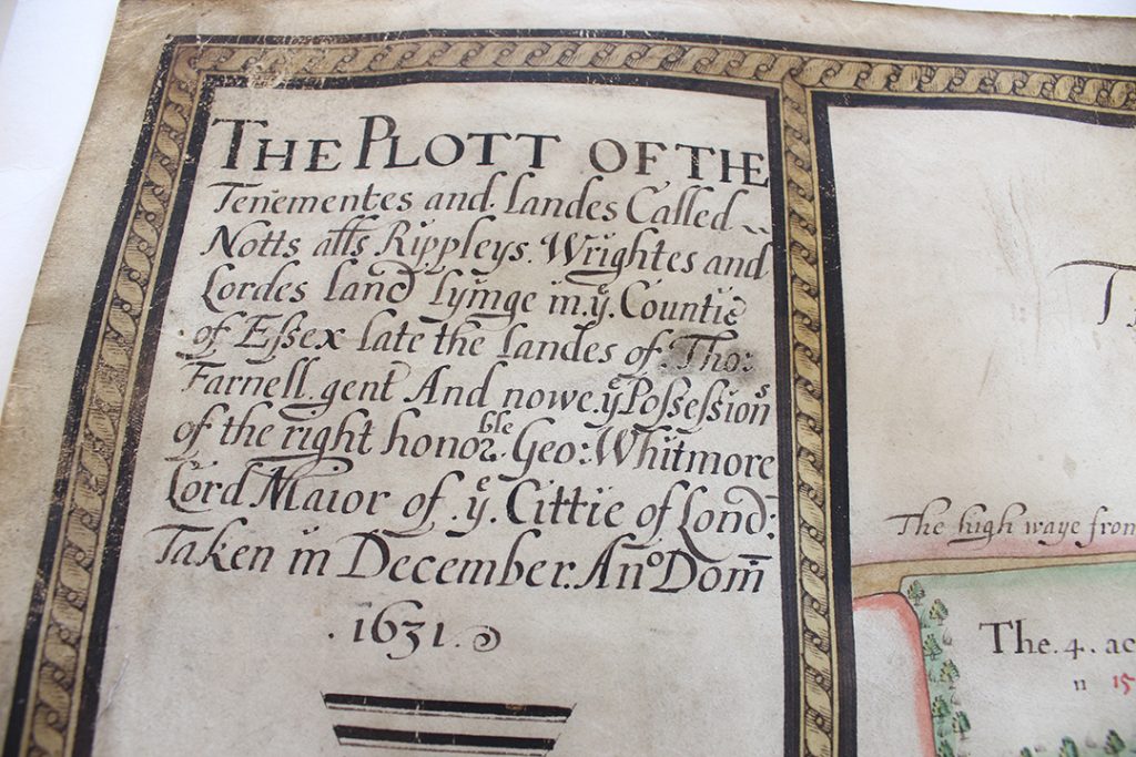
The map was made for George Whitmore, Lord Mayor of the City of London
Traditionally, surveys of estates were written documents, and the practice of making maps to either supplement or replace a written survey only started to take off in the 1570s. This type of map served two purposes: firstly, they were useful tools for ensuring efficient and profitable use of land; and secondly, they were status symbols for land owners.
At the centre of the map is Notts Farm, alias ‘Rippleyes’, surrounded by cherry orchards.
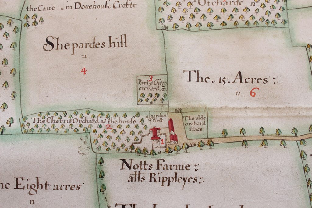
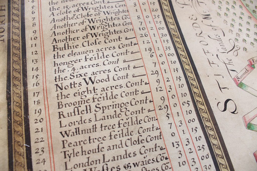
The names and acreages of the individual fields are listed along the left-hand side of the map, including ‘the eleauen [eleven] acres’, ‘Wallnutt tree feilde’ and ‘Pearetree feilde’.
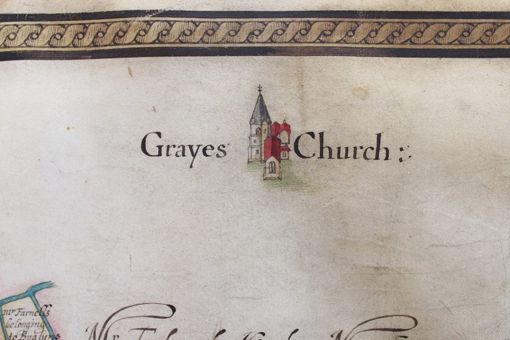
Grays church is shown in the top right corner of the map.
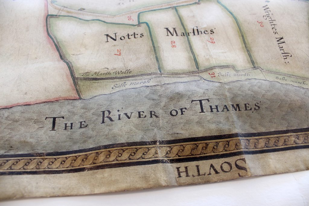
And ‘The River of Thames’ flows along the right hand side of the map, with salt marshes along its edge.
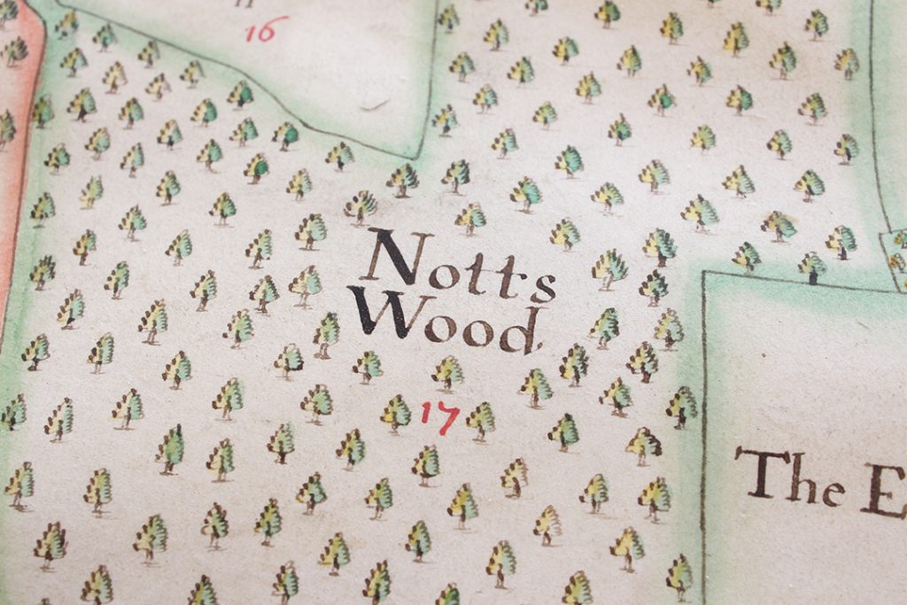
Parsons shows wooded areas using tiny, individually drawn trees. Each one is coloured in green and yellow, adding detail and dimension.
The map joins two other documents made by Samuel Parsons already looked after at ERO. One is a map of land around Coggeshall Grange made in 1639 (D/DOp P1 – view a digital image of it here), and the other is a written survey of land in Little Bentley (D/DQs 4).
The Coggeshall map shares several stylistic similarities with the newly arrived Grays one. Both share the same patterned border, and decorative scale giving Parsons’s name as the maker.
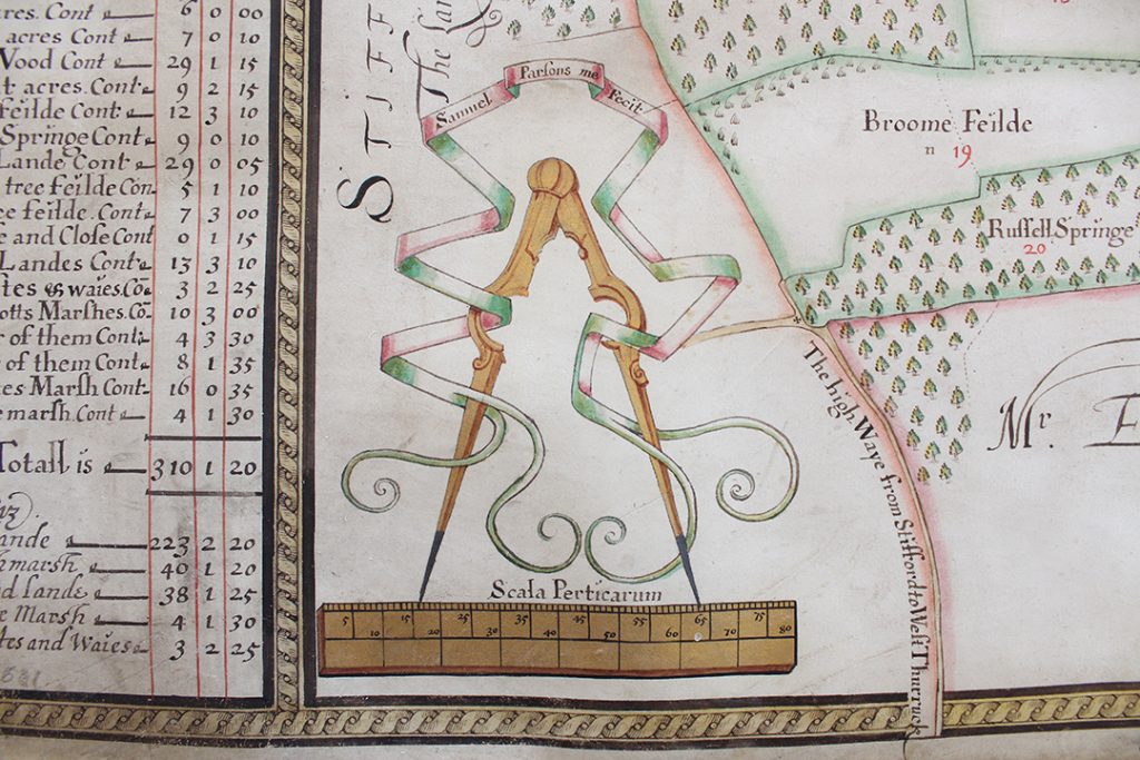
The scale on the Grays map, bearing Samuel Parsons’s name
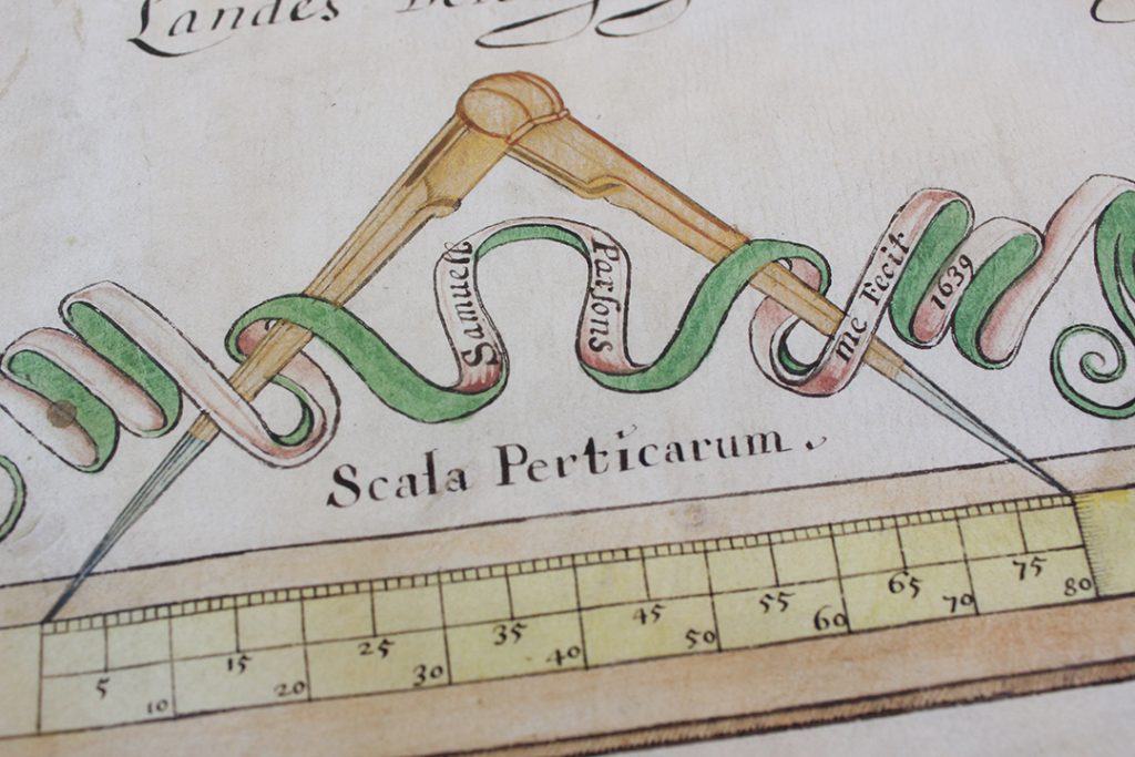
The scale from Parsons’s 1639 map of Coggesall, again decorated with compasses showing his name
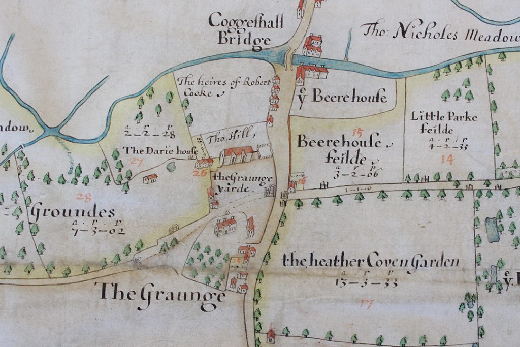
The Coggeshall map shows Coggeshall Grange, including the barn which is today a National Trust property, shown here in ‘the Graunge yarde’.
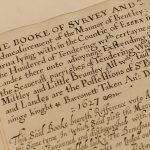
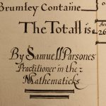
The first surviving work of Parsons’ in Essex is his survey of land in Little Bentley in Tendring (D/DQs 4), made for Sir Paul Bayning, who was from a family of wealthy London merchants. This written survey book refers to a map made by Parsons at the same time, but this sadly seems not to have survived. Parsons signed this survey as ‘Samuell Parsones Practitioner in the Mathematicks’.
Parsons also made maps and surveys in Middlesex, Berkshire, Shropshire and Yorkshire. His map of Dringhouses in York (1624-29) is the earliest surviving large-scale plan of any part of York and its neighbourhoods, and even shows the names of the local people who farmed the land. York archivist Victoria Hoyle says that Parsons’s map ‘is so accurate, it perfectly matches the 1853 Ordnance Survey map’. (You can read more about the Dringhouses map here.)
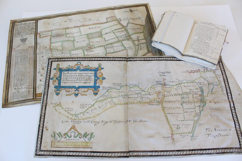
The three documents made by Samuel Parsons which are now all part of the collections at ERO
Most of Parsons’s surviving maps were made in Shropshire (you can view an image of his 1635 map of Rudge Heath on Shropshire Archives’ catalogue here). Indeed, there is a connection between some of Parsons’s Shropshire maps and his map of Grays; some of his Shropshire work was for the Whitmore family of Apley Hall, of which George Whitmore (the commissioner of the Grays map) was a member.
In his study of 17th century mapmakers in Essex ‘An upstart art. Early mapping in Essex’ (T/Z 438/2/1) A. Stuart Mason, an expert on early map making suggests that Parsons may have been based in London, meeting his wealthy clients there, and being despatched to the countryside to survey their estates. His signature as a ‘Practitioner in the Mathematicks’ could suggest, according to Mason, that Parsons may well have taught mathematics in London alongside his surveying work.
Parsons made maps of extraordinary quality for their time, and we are very happy to welcome this new addition into our collection.