Today we are used to being able to carry a map of the world on a smartphone in our pocket, being able to search for anywhere that takes our fancy, to zoom in on it and see not only maps but aerial photographs and streetviews.
This is all very easy to take for granted today, but for our ancestors making a map was an expensive and specialist process. Yet human beings have a long history of making maps to visualise and understand the world around them, and we are lucky to have maps of Essex dating back to the sixteenth century.
A new book, Printed Maps of Essex from 1576, by map expert Peter Walker, brings together all the printed county maps in our collection for the first time. Packed with full-colour illustrations it will be a wonderful companion for any historian of our county. The book is being officially launched at a special event in Saffron Walden on Saturday 21 May 2016; see our events page for details.
Since we like maps so much, we thought we would share a few of our more unusual county maps with you here in the run-up to the book launch, starting with the oldest map of Essex.
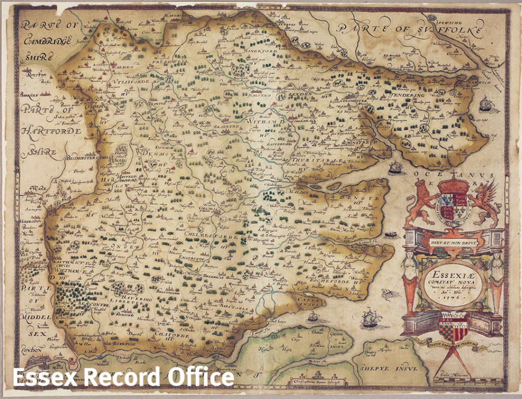
This map was made by Christopher Saxton (c.1540-c.1610) in 1576. It would have been printed on a printing press using an engraved copper plate, and then hand-coloured afterwards.
Saxton was the first person to produce an atlas of British counties, in 1579, based on his 7 year survey of the 52 counties of England and Wales. Some counties are combined on sheets, but Essex has its own page. The map was commissioned when fears of a Spanish invasion of England were rife. This may be why the map concentrates on river access to the county, and no roads are shown.
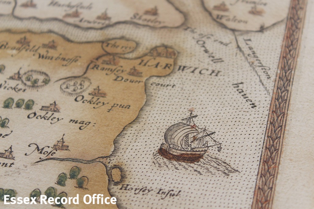
The map includes illustrations of sailing ships, such as this one off the north coast of the county
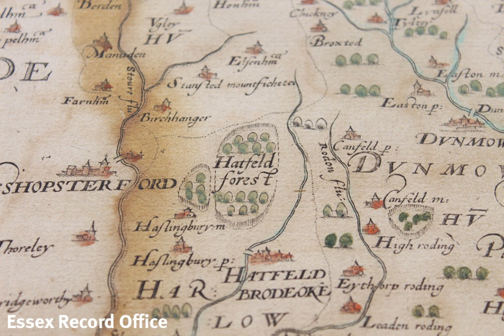
The map shows all the towns and villages and a few of the larger mansions with their names; only a small number of parks and bridges are named. Certain estates, such as Hatfield Forest, are shown as enclosed, or impaled, telling us that it was private land, belonging to somebody of significant wealth.
Few other topographical details are marked except rivers, woodland and Shell Haven, the blockhouse on Mersea Island, and the miniature but unnamed drawing of Stanway beacon.
The title is on an elaborate cartouche surmounted by the Royal Arms of Queen Elizabeth I, and below are the quartered arms of Thomas Seckford, Master of the Requests to the Queen, Saxton’s patron.
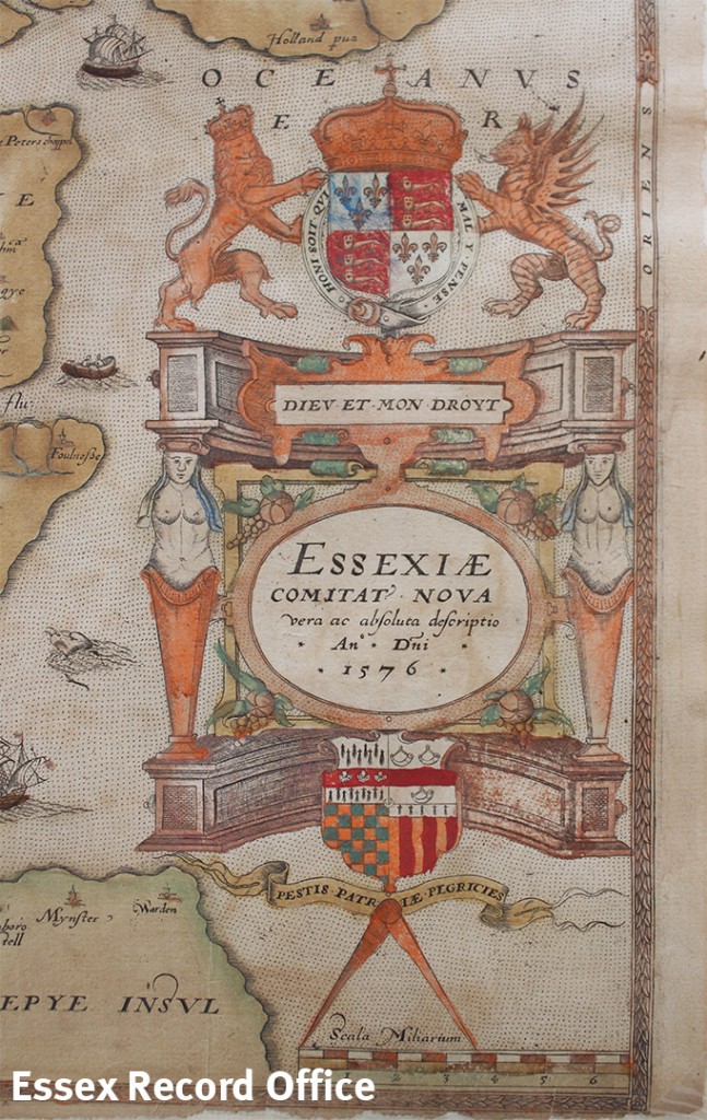
The cartouche gives the map’s title: Essexiae Comitat’ Nova vera ac absoluta descriptio Ano Dni 1576 [A new true and complete description of the County of Essex Anno Domini 1576]