Hopefully when using a map to navigate, you don’t end up going round in circles.
This unusual map, however, goes round in one big circle, showing the area 25 miles around London.
It is currently on display in the ERO Searchroom alongside the oldest map of Essex and these miniature maps of Essex that we have recently written about to celebrate the launch of a new book on the historic maps of our county. Printed Maps of Essex from 1576 is being launched on Saturday 21 May 2016 at Saffron Walden – you can find all the details of the event below.
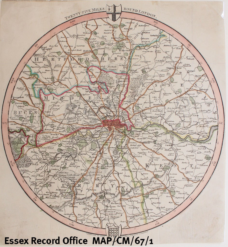
The map dates from 1819, and includes a portion of Essex which begins with Sheering in the north-west of the county, before the circular edge sweeps down past the Rodings and Willingale, down to Ingatestone, Billericay and Laindon, before finally passing Vange and Stanford-le-Hope and then reaching the Thames.
The map shows main roads and some secondary roads, parks and most villages. It also defines the extent of the ‘Penny Post’ by a faint dotted line. In Essex the Penny Post line is drawn through Chingford and Woodford, not quite reaching Romford.
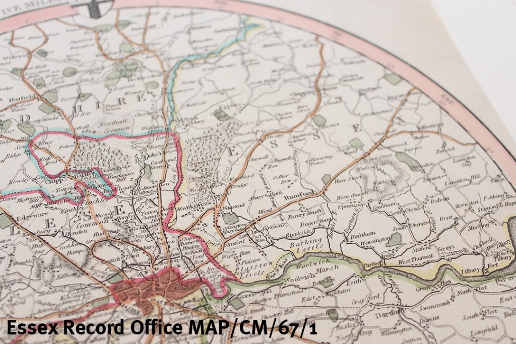
The map was made at a time when the county of Essex was much bigger than it is today, extending as far as the River Lea and including areas such as Stratford, West Ham, Walthamstow and Barking and Dagenham.
If you’re a fan of maps, join us for the launch of Printed Maps of Essex on Saturday 21 May 2016, which will include a talk from the author, map expert Peter Walker, and a display of maps included in the book.
_________________________________________________________________________
Book launch: Printed Maps of Essex from 1576
Human beings have a long history of making maps to visualise and understand the world around them. Our ancient county is represented in many maps from the sixteenth century onwards, both printed and manuscript, a large number of which can be found today at the Essex Record Office. This new well-illustrated volume by map expert Peter Walker, Printed Maps of Essex from 1576, comprehensively lists and evaluates the ERO’s printed map collection and will be an invaluable guide to all those interested in Essex history. Join us to launch the book with a talk from Peter on the maps and the people who made them, and a display of some of the maps themselves. Copies of the book will be available to purchase on the day at a discounted price.
Printed Maps of Essex from 1576 is being published by the Friends of Historic Essex, the charity which supports the Essex Record Office.
Saturday 21 May, 11.00am-2.00pm (talk at 11.30am, display and book sale the rest of the time)
Saffron Walden Town Hall, Market Street, Saffron Walden, CB10 1HZ
Free, no need to book