Document of the Month, February 2015: Grant of rights in the Forest of Essex, c.1135-1138

The earliest document we look after at ERO is over 1,000 years old – but it is nothing to do with Essex. February’s Document of the Month is our oldest Essex document, a deed dating to c.1135-1138 (D/DBa T2/4).

D-DBa T2-4 - 1

The deed is a grant of rights in the forest of Essex given by William de Monfichet and his wife Margaret to Humphrey, son of Eustace de Barentun.  His father had previously held the rights in this deed.  The grant is one of a series of this approximate date made to Eustace and Humphrey de Barentun by the Earl of Essex and William de Monfichet, which followed similar grants by the King.

The de Barentuns, later the Barrington family of Barrington Hall in Hatfield Broad Oak, were the hereditary woodwards or keepers of Hatfield Forest.  At this date the Barringtons were a minor family compared to the great barons who were descended from William the Conqueror’s most loyal supporters.

William de Monfichet and his wife Margaret were the grandchildren of two of the Conqueror’s supporters – Robert Gernon and Richard (de Clare) son of Gilbert, both of whom were well rewarded with extensive landholdings recorded in Domesday Book.  The Monfichets held lands in Essex, including at Stansted Mountfitchet and claimed the hereditary right to be Keeper or Forester of the Royal Forest of Essex.  William’s great-grandson Richard de Montfichet was one of the 25 Magna Carta barons chosen to ensure that King John abided by the terms of the charter.

Even if you do not read Latin, see how many recognisable words you can make out. Look out for ‘Will’ (short for William), Umfredo (Humphrey), filio (son), Estach (Eustace), forestie (forest), Exsexie (Essex), and Margarite…

The deed will be on display in the Searchroom throughout February 2015.

The experience of death and burial in Hatfield Broad Oak, 1827-1832

By archivist Lawrence Barker

Whenever we give talks to people about parish records and their use in family history research, we make the point that some burial registers can give extra information about the deceased in addition to the bare details of name, date and age, and sometimes record background historical information.

A case in point is the burial register for Hatfield Broad Oak, 1813-1859 (D/P 4/1/26), which was deposited with us in November 2011.  Most of the register confines itself to recording the bare minimum details of name, abode, when buried, age and by whom the ceremony was performed, as stipulated under the terms of ‘Rose’s Act’ of 1812, which stated that “amending the Manner and Form of keeping and of preserving Registers of Baptisms, Marriages, and Burials of His Majesty’s Subjects in the several Parishes and Places in England, will greatly facilitate the Proof of Pedigrees of Persons claiming to be entitled to Real or Personal Estates, and otherwise of great public Benefit and Advantage”.

Nevertheless, even though the information is basic, we can still build up a picture of the demography of death in Hatfield Broad Oak which tells us something about what life might have been like then.

Chart - deaths in Hatfield Broad Oak

Pie chart showing age at death in Hatfield Broad Oak, 1827-1832, taken from the parish register. A total of 200 deaths are recorded during this period, and over 80 of them were children under 10 years old.

For example, looking at the ages of those buried (above), one forgets just how high the infant mortality rate used to be before improvements were brought about by modern hygiene and medical practice, and how likely it was having survived birth you might not have survived much beyond early childhood.  The register shows that, out of the 200 or so burials which took place between 1827 and 1832 in Hatfield Broad Oak, 80 of them (40%) were of children aged 10 or under.  At the other end of the scale, it shows also that only 20% of those buried reached what we would now consider as old age, i.e. over 60.

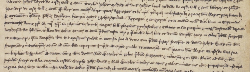
A lot depended upon the individual incumbent as to whether he was disposed to record additional information.  From May 1827, the new curate at Hatfield Broad Oak, John Robert Hopper, took it upon himself to start recording in the margin the cause of death of those he was burying and other information besides.  So, we find that a serious epidemic of typhoid carried off 25 children between September 1828 and June 1829, reaching a peak in January and February 1829 (below).

D-P 4-1-26 a

In 1830, it was measles that took 6 children in March and April and in 1831, 4 children died of whooping cough.  Throughout the period, 4 infants died of convulsions.

Typhoid, an indicator of impoverished and unhygienic living conditions, seems to have been a major cause of death during the period, with 37 cases, followed by a condition described rather vaguely as ‘decline’ which accounted for 23 deaths.  A few died of consumption or of ‘inflammation of the bowels’ or of dropsy.  One 52 year old died of cancer in 1832.  Two were simply found dead in their beds and one woman aged 27 was found dead in a field on Sunday 30th March 1831 – the verdict that she died of apoplexy.

Occasionally, a fatal accident is recorded as the cause of death.  In November 1828, a 64 year old Edward Bird ‘fell thro’ 2 floors of Mr P Sullivan’s malting, Heath and died a day or 2 after’.  Another died in July 1832 of ‘old age arrested by a fall down stairs’.  In May 1830, one Patterson Parker ‘accidentally shot himself’.

Later that same year in July, a Royal Naval Lieutenant, George Berkley Love, visiting from Yarmouth on the Isle of Wight, was working in the Park of Barrington Hall when he ‘accidentally cut himself thro’ the lower third of the thigh with a scythe’ and bled to death in 5 minutes.  J. R. Hopper records that an oak tree was planted soon afterwards to mark the spot where the accident occurred.

Earlier that year in February, poor little 5 year old Betsy Rogers burnt to death, and two extraordinary marginal notes on that page give a clue as to how (below):

Feb.y 7.  A frost of 7 weeks broke up today.  Temperature 12° below freezing point! Many persons frozen to death. One at Gt Canfield, one at Sawbridgeworth.

The seat of Lord Rendlesham (Rendlesham Hall, Suffolk) burnt to the ground, damage = 100,000£; The seat of Lord Sandwich (Hinchinbroke, Huntingdonshire) also destroyed by fire with title deeds, fine pictures, etc.; The Argyle Rooms, Regent St, London also destroyed by fire. Lyceam also…All in Jan.y in Feb.y arising from the unusual heating of flues etc. in consequence of the uncommon severity of the season.

D-P 4-1-26 b crop

If you would like to find out more about parish registers and how they can help you with your research, come along to our next Discover: Parish Registers workshop on Thursday 12 March 2015, 2.30pm-4.30pmTickets are £10.00, please book in advance on 033301 32500. Full details can be found on our events page.

If you are interested in booking a talk with one of our Archivists, on parish registers or another subject, please get in touch with us on ero.enquiry[@]essex.gov.uk

Essex Book Festival: interview with Jonathan Swan, author of Chelmsford in the Great War

Ahead of his talk at ERO as part of the Essex Book Festival, we caught up with author Jonathan Swan, whose new book Chelmsford in the Great War is just about to be published. Join us for Jonathan’s talk on his book Chelmsford in the Great War on Saturday 14 March, 11.00am-12.30pm. Tickets £6, please book in advance on 033301 32500.


How did you come to write Chelmsford in the Great War?

Not quite sure! I have been researching First World War military medicine for a number of years and during negotiations with Pen & Sword Publishing my editor happened to mention a major series they were commissioning, “[Your Town] in the Great War”. This sounded interesting, so I spent a weekend in the library to see if there was enough material and sent in a proposal. And eighteen months later we have a book!

Chelmsford in the Great War


What sort of sources did you use to piece together your history of First World War Chelmsford, and where did you find them?

The library was my starting point, but Essex Record Office proved a great resource for maps, photographs and the wartime council minutes and other papers and records. Online resources such as the British Newspaper archive were invaluable.


What was the most surprising thing you found during your research?

Great War Chelmsford was so much smaller than it is today, and roads like the Parkway have completely altered the urban landscape. Not a huge surprise, but it made it difficult to understand how people moved around the town; the High Street was central to everything. The railway formed the western and northern boundary of the town and, as Basil Harrison put it in his “Duke Street Childhood”, the corner of Duke Street and Broomfield Road was the start of the countryside!

Ordnance Survey 6":1 mile map of Chelmsford, 1919 with 1938 revisions

Ordnance Survey 6″:1 mile map of Chelmsford, 1919 with 1938 revisions. The approximate outline of the modern city is shown in purple. Click for a larger version.


Are there any stories that you found during your research that have particularly stuck with you?

I’ve always been interested in local politics and democracy. In 1914 the council was made up of a number of unelected aldermen and a handful of councillors and they seemed to be incapable of civic leadership in the crisis – they didn’t believe in public air raid shelters, they didn’t want insurance for council property against bomb damage, they didn’t want public food kitchens, and there was a housing crisis because of all the additional munitions workers residing in the town and they did nothing about it. The high profile War Relief Fund did next to nothing because they didn’t think anyone merited assistance. The answer to any problem was to form yet another committee or subcommittee. And the idea of a conflict of interest appeared to have no meaning to them!


Chelmsford Brenda, the St Bernard dog who collected money for the Red Cross in Chelmsford during the First World War - one of the stories that Jonathan came across in his research (photo from scrapbook of Sir Richard Colvin, D/DU 787/4)

Chelmsford Brenda, the St Bernard dog who collected money for the Red Cross in Chelmsford during the First World War – one of the stories that Jonathan came across in his research (photo from scrapbook of Sir Richard Colvin, D/DU 787/4)

Do you have any family connections with the First World War?

My grandfather served in the Royal Army Medical Corps as a stretcher bearer. I followed in his footsteps by serving in the RAMC as a laboratory technician.


Is this your first book?

My first book was actually a text book on financial modelling, which is my day job. I’m currently working on the third edition. I’ve also written articles on corporate governance, local history, and military medicine.


Are you a full-time author?

I wish!


What is your connection with Chelmsford? We moved here from Newham in 2007. Both of my sons attended Boswells School. I spend some of my spare time interfering with the affairs of Essex County Council, Essex Police, Chelmsford College, and Anglia Ruskin University.


Where is your favourite place in Essex?

Anywhere I can go fishing!


What advice would you give to someone thinking of writing a history book?

A common mistake is to assume history is simply about dates and events. Good history books have a story to tell – it isn’t just what happened, it’s also why. And you must be selective: you will find fascinating little snippets about this or that, which may only amount to a sentence or two. I’ve left out a lot of material that didn’t really add any value – Corporal Rutland was tragically shot dead by his own pistol when showing it to a comrade in the Cherry Tree pub – interesting, but it doesn’t link to anything else. Conversely I’ve left out stories which merit a whole chapter or even a book of their own – Chelmsford teachers at war is a good example. A final point is that there are some very clever people out there, so make sure you can support any statements you make!

The passing of the plotlands

Archivist Lawrence Barker takes a look at the rise and fall of the Basildon plotlands…

Anyone exploring the history of the development of Basildon New Town is quite likely to encounter the curious phenomenon of the ‘plotlands’.  These developed throughout the first half of the 20th century but were to more-or-less disappear with the development of Basildon New Town for which much of the land was purchased, compulsorily if necessary, during the 1970s.  The history of this process has recently generated quite a lot of interest (a talk given at ERO in April 2014 in April by Ken Porter proved to be the best-attended of the year).

In searching for original records for another project on the same subject, we uncovered many more previously hidden in the large collection associated with Basildon Development Corporation which was responsible for the creation of the New Town. The development of the plotlands had is origin in the decline of agriculture in this country during the second half 19th century.  In particular, cheaper grain imported from America in the mid 1870s knocked the bottom out of the grain market resulting in many farms switching to pasture.

Great Gubbins sale poster watermarkedSouth Essex, with its heavy clay soils which were more difficult and therefore more costly to work, was particularly hard hit.  On top of that, an extended period of bad weather finally finished off arable farming in south Essex.  Many farms collapsed and were sold off as cheap building land; farms such as Great Gubbins near Laindon.  The sales catalogue (left) and map (below) dating from 1885 (D/DS 4/20) shows the extent of the original farm land which was put up for sale.  Towards the bottom, one can see the proposed route for the new extension of the railway to Southend and the location of the new station to be built for Laindon. Great Gubbins sale map watermarked

It is interesting to compare how the same area looked 50 years later on an OS map in 1939 showing the plotlands landscape fully established (below, with Great Gubbins Farm outlined in red).

OS map new series 1939 81-9 watermarked Yet, little seems to have happened at first.  Another sales catalogue with map for the same land dated 1893 (D/DS 15/2) shows the vacant land this time split into 5 lots.

Laindon Station estate sale cat 1 watermarkedIt was the coming of the railway that seems to have boosted sales but not perhaps in the direction the vendors had originally hoped.  Records dating from the 1890s for the development of the neighbouring estate surrounding the new Laindon station (D/DS 4/35), called the Laindon Station Estate, include posters and catalogue (left) advertising cheap building land and show the aspiration held by the vendors Protheroe and Morris that the area would ‘shortly become an important residential neighbourhood’ served by shops and even featuring a new Essex racecourse.  This time the land was parcelled up into hundreds of smaller 20-by-140 foot plots (hence plotlands) which buyers could combine to create larger plots if they wished as shown on the accompanying map (below).

Laindon Station estate 1892 watermarked

Instead, although a new hotel and some shops were built near the station, most of the plots were bought up by hoards of ordinary folk as individuals who erected all kinds of chalets and shacks which they used as weekend retreats.  The pictures below were found among many such photographs in the first box of Basildon Development Corporation records (A9238) and demonstrate the variety of buildings erected by the plotlanders, in this case in Victoria Road on the former Great Gubbins farmland.

Victoria Road Photos watermarked Deanna Walker provides a fine first-hand account of the process in her book Basildon Plotlands published in 2001, where she describes her childhood memories as a resident of Dagenham spending weekends in the plotlands at Langdon Hills. Later still, many people replaced their shacks with more substantial bungalows and came to take up permanent residence. When the time came for the land to be designated for development for Basildon New Town, the Development Corporation commissioned surveys of the land which include maps of the various plots based on copies of large scale OS maps with each plot numbered, linked to a description, name, no. of rooms, condition, life, architectural quality, services (e.g water, sewerage, gas, electricity), rate value, condition of plot, and remarks (see below).  These have been catalogued as A/TB 1/8/10/1-14. Laindon Station estate 1949 watermarked Material uncovered Box no.1 of A9238 includes aerial photographs of the Basildon area prior to development of the New Town showing the plotlands, and later photographs showing the transformation from plotlands to new town.  For example, the photograph below shows how the streets planned for residential estates were created first with building following on after, and one can just detect a few remaining plotlands before they were obliterated. Baslidon Aerial Photo 1 watermarked Typically, people whose properties were affected were encouraged to accept the inevitable and take the initiative in coming to an agreement with the Development Corporation to sell their plot to them and so avoid compulsory purchase. A typical letter is one received by a plotland owner on 30 January 1962 which begins by outlining the Corporation’s intention to develop the area and that their property will be affected.  It then goes on to say that the Corporation has authority from the Minister of Housing and Local Government to:

…buy by agreement the land and property required for this redevelopment and it is hoped that you will be prepared to consider opening negotiations for the sale of your property by agreement to the Corporation.

The Corporation also offered to pay for legal costs, surveyors’ fees and ‘reasonable removal expenses’ if an agreement is reached and, in addition, to offer alternative accommodation. Not everyone was affected though.  Another box (no.33) includes individual case files of plotland properties which were not to be affected by the creation of the New Town and which possibly still exist today.

If you would like to find out more about plotlands for yourself, there is plenty of material to explore in the ERO archive and library.

New Accession: a little book of surveys

We have recently acquired a little leather-bound book incorporating coloured plans on parchment dating from 1767 of three estates in north west Essex (now catalogued as D/DU 2963/1). Each plan is accompanied by a reference table on paper listing all the fields and their acreages. The surveys seem to have been commissioned by a Mr Collins and carried out by a Mr Hollingworth.  They are of Scot’s Farm in Debden, Bishop’s Farm in Widdington and Sibleys in Chickney.

The book is of diminutive size but exquisitely executed and detailed. The map of Bishop’s Farm in Widdington struck is in particular, as it shows a farm made up of strips of land.

We are very pleased to have acquired this little book for our collection as it can now be made available to researchers for the first time.

IMG_5026


IMG_5028


IMG_5030


IMG_5032


IMG_5036

Document of the Month, November 2014: ‘Poping’ in Purfleet, 1897

Archivist Allyson Lewis takes a look at a battle of wills between a headmaster and his pupils in late-Victorian Purfleet.

E/E 88/7/3

‘Remember, remember the 5th of November, Gunpowder, treason and plot’ begins the rhyme.  It commemorates the attempt in 1605 to blow up the Houses of Parliament by a group of conspirators led by Robert Catesby.  The aim of the plot was to kill James I and replace him with a Catholic monarch.  The group included Guy Fawkes who hid in the cellars of the Parliament building to guard the gunpowder and light the fuse as the King entered the building for the opening of the parliamentary session.  He was arrested, tortured into giving up the names of his co-conspirators and duly hanged.

The celebration of the preservation of the Protestant monarchy began almost immediately with the passing of the Observance of 5th November Act in January 1606.  Although this was intended as a day of thanksgiving for the safety of the king, it became an excuse for anti-Catholic feeling, particularly after the future Charles I married Henrietta Maria of France, a Catholic princess, in 1625.  Effigies of the pope and the devil were burned for the first time that year.  5th November Day was re-established as a celebration of Protestant monarchy after the restoration of Charles II.  The landing at Weymouth of William of Orange on 5 November 1688 added another layer of Protestant significance to the day.  During the 18th century it became more usual to burn effigies of Guy Fawkes rather than the pope.  The Observance of 5th November Act was repealed in 1859 but the tradition of Bonfire Night still continues.

In the 19th century children began a custom of ‘poping’, going from house to house begging ‘a penny for the Guy’ and gathering wood for a large bonfire.  In this log book entry, the headmaster of Purfleet School comments on his attempts to prevent boys going ‘poping’ in school hours by encouraging residents to only give to children going round after school.  He allowed the boys to bring their costumes into school and change in the school cloakrooms before going out begging for wood, food, drink and pennies, and singing traditional rhymes.

The school log book will be on display in the Searchroom throughout November 2014.

IMG_4523 watermarked

Saffron Walden: 1758

This coming Saturday, 8 November 2014, come and join us at Saffron Walden Town Hall for a look at one of the most spectacular maps in our collection.

IMG_4469 edit

The map shows the town of Saffron Walden and the surrounding area, and is so large we’ve had to give serious thought to how we will transport it!

IMG_4451 edit

The map was made in 1758 by Edward John Eyre, along with a survey book, recording all the individual pieces of land, and how they were being used. The day will include a talk from an ERO Archivist about how the map and survey book work together.

IMG_4512

The map shows the town of Saffron Walden, and lots of other local details.

IMG_4489-1 IMG_4487 IMG_4485 IMG_4465 editIf you would like to join us on Saturday to see the map, here are all the details:

Saffron Walden 1758 At Saffron Walden Town Hall

In 1758 an extensive survey was carried out covering lands surrounding Saffron Walden, and several maps were made to accompany the survey books. This is a unique opportunity to see these maps and the survey books displayed together, to explore what the town and surrounding countryside looked like in the mid-eighteenth century.

The day will include a talk by Paul Marden of the Essex Place Names Project at 11.30am explaining the origins of some of the field names on the map. Allyson Lewis, archivist at the ERO will then give a talk at 12.00noon about the survey which accompanies the map.

Saturday 8 November, 10.30am-3.00pm

Free entry, suggested £2.00 donation

Saffron Walden Town Hall, Market Square, Saffron Walden, CB10 1HR

In association with the Saffron Walden Archive Access Point

Supported by Saffron Walden Town Council

Great Totham in 1821 (or thereabouts)

In this guest blog post, Dr James Bettley tells us about fascinating discoveries in Great Totham.

In January 2013, the parishioners of Great Totham were clearing out the vestry at St Peter’s Church following a major reroofing project.  From behind a large wardrobe emerged a painting of the church, not seen for as long as anyone could remember, although the view of the building was familiar from an engraving that had been used as the frontispiece to The History of Great Totham, published in 1831. The painting was dirty, torn, and stained, but it is now being cleaned and repaired (thanks to grants from the Heritage Lottery Fund, Essex Heritage Trust, and the Church Buildings Council), and on Saturday 1 November it will take centre stage at a symposium being organised to celebrate the cultural life of Great Totham in the 1820s, ’30s and ’40s.

P1080788

Roger Allen (churchwarden) and Sally Woodcock (conservator) discussing the next stage in a delicate process

The church, hall and vicarage were the heart of the village in those days.  The vicar himself, G. S. Townley, spent most of his time in London (he was also rector of St Stephen Walbrook), so from 1810 the parish was looked after by a curate, Thomas Foote Gower; in 1829 Townley was declared of unsound mind, but did not die until 1835, when Gower succeeded him as vicar (and remained until his death in 1849).

Gower was well connected. His father, also a clergyman as well as being a physician and antiquary, lived in Chelmsford and had married the sister of John Strutt M.P., the builder of Terling Place.  Gower moved in good circles, and it is not surprising that when the famous painter of portrait miniatures, Charles Hayter, was living for a few months in Witham in 1821, Hayter and Gower got together.  The painting of Great Totham church is known to be by ‘Miss Hayter’, and there can be little doubt that this was Ann, Charles’s daughter, herself an accomplished and well-known miniature painter who exhibited at the Royal Academy between 1814 and 1830.

Charles Hayter

Members of the Gower family sketching at Layer Marney, 31 May 1821, drawn by Charles Hayter (courtesy of Cheffins, Cambridge)

Gower’s Totham friends included the two Johnson brothers, George William and Cuthbert William, and Charles Clark.  Both the brothers were barristers, but both also achieved fame as writers, G. W. on gardening and C. W. on agriculture.  G. W. also wrote The History of Great Totham, which was printed by Charles Clark – without doubt the most eccentric of the circle.  Nominally a farmer (his father was the tenant of Great Totham Hall), he spent most of his time writing doggerel poetry, printing, and collecting books (his extraordinary letters to a London bookseller, John Russell Smith, are in the Essex Record Office: D/DU 668/1-20).

The symposium on Saturday 1 November will explore the world of Clark, Gower, the Hayters, and the Johnsons, and will include talks, poetry readings, and a demonstration of printing on something like the press that Clark used.  The event runs from 2.30 to about 6.00.  Admission is free, although there will be a charge for tea.  For further information, please go to http://totham1821.wordpress.com/, or email jamesbettley@btinternet.com.

Essex at War on film

We were lucky enough to have Chris Church of Wire Frame Media film at Essex at War, 1914-1918 at Hylands House on Sunday 14 September, who has produced this fabulous short film capturing a flavour of the day. Have a watch for a snapshot of what went on, and if you came along see if you can spot yourself!

If you came along and would like to tell us what you thought of the day, do please fill in our short survey here.

Essex at War, 1914-1918

I can’t believe it has finally come and gone – after 15 months in the planning, today was Essex at War at Hylands House. This was a big collaboration between ERO, Hylands House, Now the Last Poppy has Fallen, the Essex Regiment Museum, and many others. It’s always great to take the ERO out on the road to new locations, and we had a wonderful day meeting so many people. We hope that if you visited you enjoyed your day!