A Mappa Monday

Customer Service Team Lead, Edward Harris, looks at the highs and lows of research using our manuscript map collection.

We may have said before that we love maps here at ERO. But some of our manuscript maps can leave you scratching your head.

We have often ordered up something titled “Map of the Parish of…”, hopeful that it will give us an extensive view of the parish in question, only to get something like D/DWe P5 below. A map of Bagg Wood belonging to Thomas White Esq surveyed in 1703.

Map of Bagg Wood in Aldham

Map of Bagg Wood in Aldham (D/DWe P5)

These maps may show one or more field with very little context and no real clue of where it is. We do at least know that it is in Aldham and which part of the ditch it was measured to!

Examining a Google maps satellite images leaves us with scant help. While many of the woodlands do reveal a name when clicked on, none of them are named Bagg Wood. A perusal of the National Library of Scotland’s excellent Geo-referenced map resource (https://maps.nls.uk/) reveals only one candidate that is roughly the right shape, but called Hoe Wood on the 2nd Edition 25” to the mile Ordnance Survey. I suppress a little frustration that the surveyors in the late 1880s didn’t include an acreage as they had done in the 1870’s.

The perfect next step was our collection of copy Tithe Maps. Listing the owner, occupier, acreage and cultivation of every plot of land in the parish, but often also the names of houses, fields and woodland.

The Tithe Map of Aldham, surveyed in around 1839 (D/CT 2B) and it’s accompanying Award (D/CT 2A) is wonderfully clear and easy to consult, but it is also clear that there is no Bagg Wood. What is however, is a vast array of land owned by a Thomas Western, the major landowner in Aldham. One plot of land is the aforementioned Hoe Wood with an Acreage of 21 Acres 2 Roods and 21 Perches. Close enough?

Tithe map of Aldham 1843 (D/CT 2B)

Then I realised that I had fallen for yet another pitfall of a manuscript map, North is not always at the top of the page. A quick 90 degree counter-clockwise rotation of the parchment revealed the North is actually to the right hand edge of the map, and Bagg Wood and Hoe Wood are one and the same.

To add to the clues, the “DWe” part of the maps reference, tells me that it is part of the papers of the Western family.

Manuscript maps are often less clear even than this one, half the fun is in trying to locate their features on a modern map. Manuscript maps can be beautiful. Having a set of maps beautifully crafted for your estate was the status symbol of its day.

By way of example, here is another estate map for the estate of Thomas Western. D/DCm P29 dating to 1809 and surveyed by Robert Baker meticulously records all of the estate over several membranes and is beautifully decorated.

The value of this volume of estate maps can be seen in the gold leaf and beautiful colours used. It has also been separated from the other family papers at some point which can be seen by the different reference. Was this because it was sold off at some point to raise some vital funds? Can you spot Bagg Wood? Also, bonus points if you spotted the route of the railway marked across the estate.

D-DCm P29 Plan

Plan of the Estate of Thomas Western (D/DCm P29)

Document of the Month, September 2018: survey of Rivenhall

New fragments which tell us about Essex’s past come in to us all the time, in all shapes and sizes. Here, Archivist Ruth Costello tells us about one of our new additions – a beautiful survey of the Rivenhall estate. The volume bears no date, so Ruth has been sleuthing to see if she could find out when it was made.

This month’s document is one of two volumes of maps which we received earlier this year as part of accession A14956. This, the smaller of the two, shows Rivenhall Place and its lands, which were owned by the Western family.
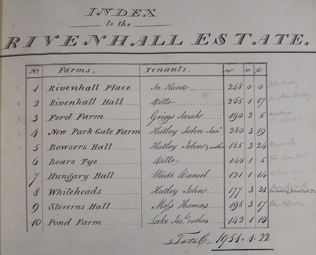
The index at the beginning of the volume lists the parts of the Rivenhall estate which are included in the survey
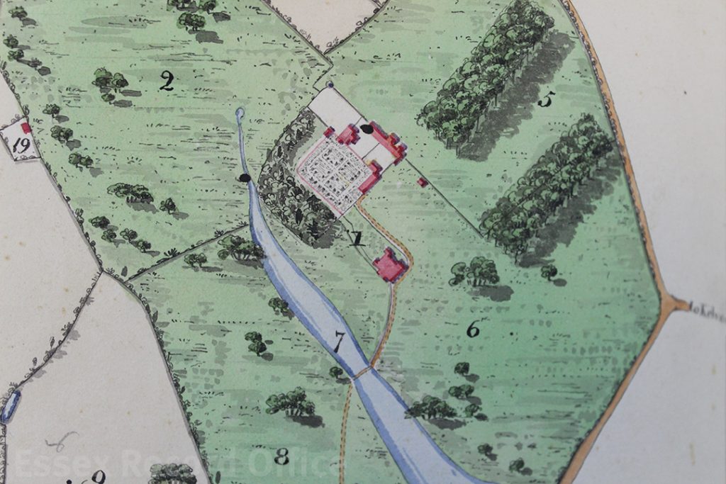
For each part of the estate, there is a carefully drawn map, and a list of how each parcel of land was being used. This map shows Rivenhall Place and the lands immediately around the grand house.

Despite its undoubted beauty, it seems to have been treated as a working document, with annotations in pencil, some of which seem to have been rubbed out at a later date.

Unfortunately, the survey does not include a title page, where we might expect to find the name of the surveyor.  Nor does it include a date.

We knew the volume must predate 1839 as the Rivenhall tithe map produced in that year clearly shows the newly built Eastern Counties Railway running through the parish.  In the volume, it has been pencilled in at a later date (it’s the line crossing through the meadow land numbered ‘23’, north of Rivenhall End in the page on display).
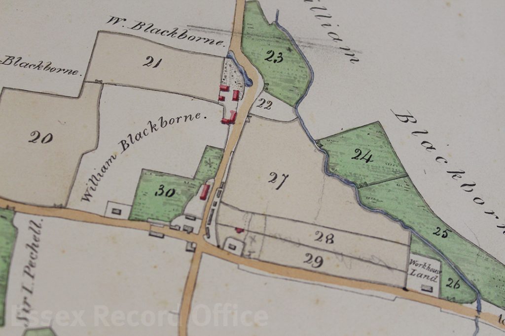
The two lines marked in pencil through field no. 23 on this map show where a railway line was later built, helping us to date the volume

We already held two maps of Rivenhall Place among the Western family estate records drawn in 1828 and 1839 (this latter one didn’t show the railway, so must have been produced earlier that year).  It’s unlikely that the land would have been surveyed and mapped on another occasion, so we thought that the volume must tie in with the date of one of these maps.

On display in the ERO Searchroom, the volume is opened to display the map of Pond Farm, which at the time was leased (somewhat appropriately) by Joseph Lake.  Both the volume and the 1828 map (D/DWe P12) show a property described as ‘workhouse land’ (it’s surrounded on two sides by the field numbered ‘26’).  The later map of 1839 (D/DWe P16) has the name ‘Bilney’ against this property.  It would seem that Mr Bilney bought the property after the Poor Law Amendment Act of 1834 led to the sale of former, smaller parish workhouses and the creation in this case of the new Witham Poor Law Union workhouse.
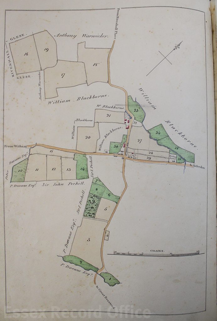
Map of lands that made up Pond Farm
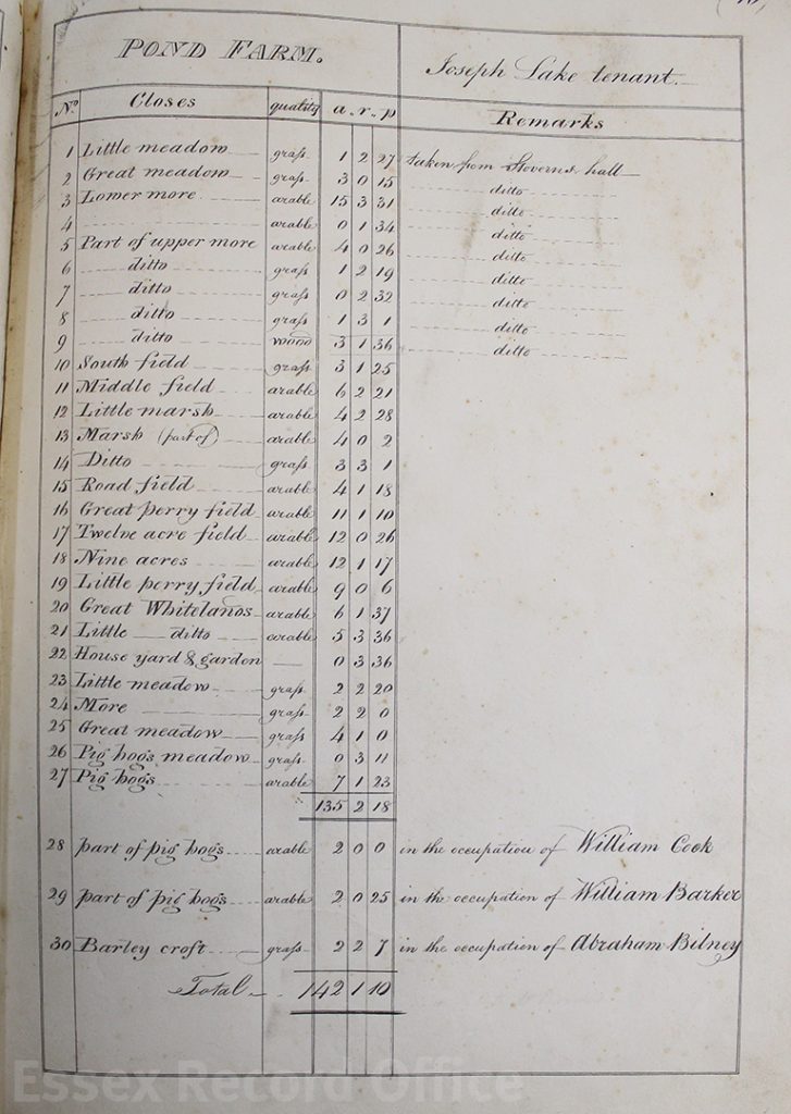
List of lands making up Pond Farm

Some of the surrounding area is described as ‘William Blackborne’s land’.  We found a burial for a William Blackborne in the Rivenhall parish register in 1825.  Initially this made us think that the volume must predate his death and must be earlier than 1825.  However, both the 1828 and 1839 estate maps also included his name, which showed that out of date information was being copied forwards.

We think, therefore, that the volume and the 1828 map we already held were drawn at the same time.  Sadly, we still don’t know who drew them; the map also has no author.  The map shows the whole of the estate and its individual farms together, but it has only a very little colouring, by comparison with the volume.  This volume and its companion (a series of maps of the Felix Hall estate) are thus a welcome addition to our holdings.

The volume will be in display in the Searchroom throughout September 2018.

You Are Hear: What does it sound like?

Sarah-Joy Maddeaux of our You Are Hear: sound and a sense of place project muses on how sounds can transport us to difference times and places.

Smells and tastes are evocative senses; this is well-known. A whiff of a particular aroma instantly transports me to the place where I once encountered that scent. The smell of an extinguished match smells like birthdays, that moment at the party when you blow out the candles on the cake. The smell of chlorine takes me back to swimming lessons. The warm smell you encounter of an upstairs room on a hot day reminds me of summer; the dusty smell when you first put the heating on for the year reminds me of winter. As for the smell of a library book, well, that is a heavenly odour that evokes happy days spent discovering new texts and re-reading well-loved ones. A taste of a familiar food, too, can bring me back to childhood. A baked apple is associated with Bonfire Night; the first clementine of the season tastes like Christmas.

But sound? Certain songs remind me of a period in my life, or people I enjoyed the tunes with. But can ordinary, everyday sounds have the same effect? Working on the You Are Hear project has made me realise that, yes, sounds too can provoke memories of places encountered. After growing up in a port town, the horn of a ship reminds me of watching the slow progress of ocean-going vessels travelling through the locks. An oar quietly slipping through the water on a still morning brings back family canoeing trips. The honking of geese brings to mind autumn, and the start of a new academic year, with all the mingled expectation, fear, hope, and regret this entailed. The relentless clipping of hundreds of heels on hard floors, rhythmic but not quite in unison, will always remind me of my morning commute through the maze of underground tunnels during a brief period when I worked in London.

Thinking more about this, there are certain sounds that were distinctive to my childhood in the late twentieth century, sounds that only a comparative few (out of the course of human history) would identify with. The exquisitely sharp sound of a phonograph needle dropping into place, though this is enduring thanks to djs and music purists.

Record on record player

The drone of a dot matrix printer. The call of a dial-up modem (static at one pitch, static at a lower pitch, then wee-oh, wee-oh, all the while hoping, desperately hoping that it will connect).

For how much longer will these sounds be remembered? What sounds in human history have disappeared and been forgotten? In fifty years, will people know why the words ‘Unexpected item in baggage area’ spoken in an automated female voice provoke me to a frustrated rage because I HAVEN’T STARTED CHECKING OUT MY PURCHASES YET! Will an annoyingly chirpy whistle still prompt half of a bus-load of passengers to start rummaging in their bags looking for their phones?

Sound artists have realised the power of sound to evoke associations, and the danger of losing certain noises as our world changes. Aiming to record the present for future generations, they seek out those noises that compose everyday soundscapes, difficult to identify, but instantly recognisable to those who dwell in such soundscapes.

As part of the Heritage Lottery Funded project, You Are Hear: sound and a sense of place, we want to capture the sounds of twenty-first century Essex by making new recordings of what you can hear today. We will then pin these recordings to an online map, together with recordings made in similar locations or of similar activities decades ago, from recordings already in the Essex Sound and Video Archive. Will this show change, or continuity? I expect both.

We need your help. What sounds matter to you? What can you hear on a daily basis? What sounds do you think will disappear in ten, twenty, fifty, one hundred years? We are holding public consultations to ask you, the residents of Essex, what sounds mean Essex to you, or what Essex sounds like. Come along to one of the following events and tell us about your soundscape, and why you are hearing what you are, where you are.

1-3 October: George Yard Shopping Centre, Braintree
29-31 October: Grays Shopping Centre, Grays
12 November: ecdp offices, Chelmsford
19-21 November: High Chelmer Shopping Centre, Chelmsford

You will also have the opportunity to test our prototype audio comparison map; take a beginner’s workshop on making your own sound recordings; and learn more about the project. If you cannot make it to these events, please do pass on your suggestions of Essex sounds to: Sarah-Joy Maddeaux, You Are Hear Project Officer.

HLF Logo

New Accession: a little book of surveys

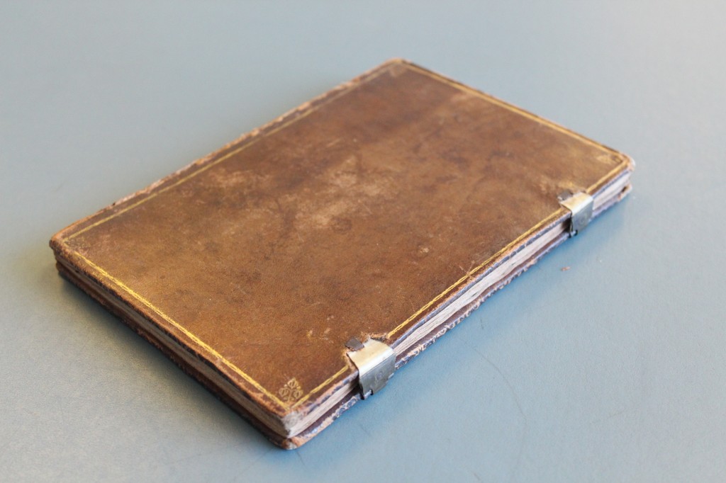
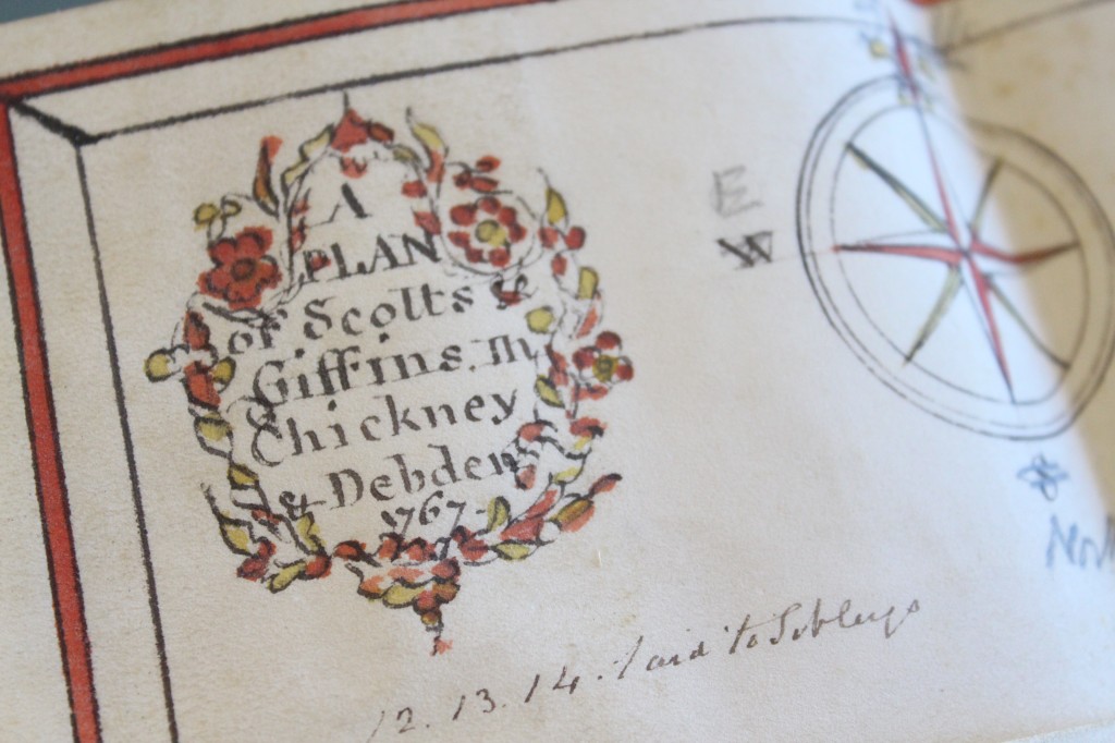
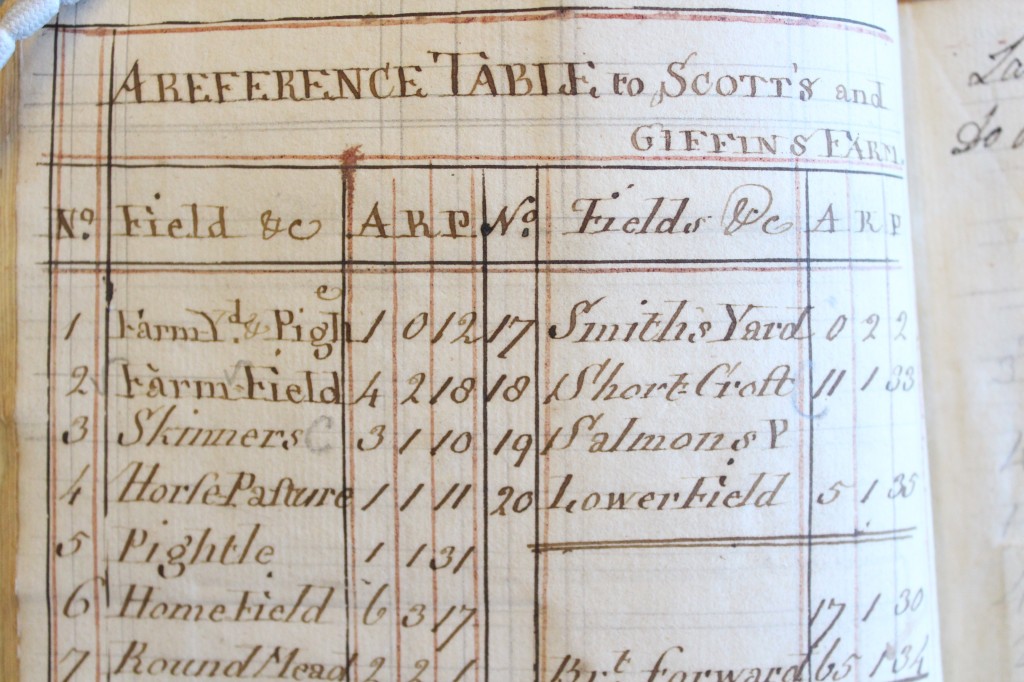
We have recently acquired a little leather-bound book incorporating coloured plans on parchment dating from 1767 of three estates in north west Essex (now catalogued as D/DU 2963/1). Each plan is accompanied by a reference table on paper listing all the fields and their acreages. The surveys seem to have been commissioned by a Mr Collins and carried out by a Mr Hollingworth.  They are of Scot’s Farm in Debden, Bishop’s Farm in Widdington and Sibleys in Chickney.

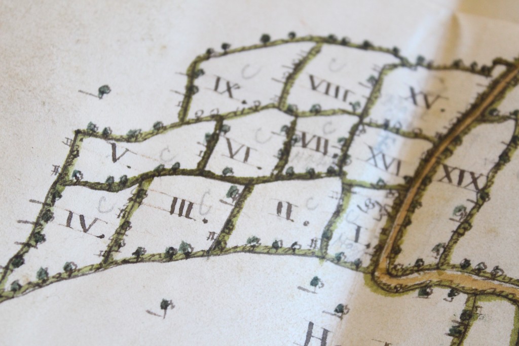
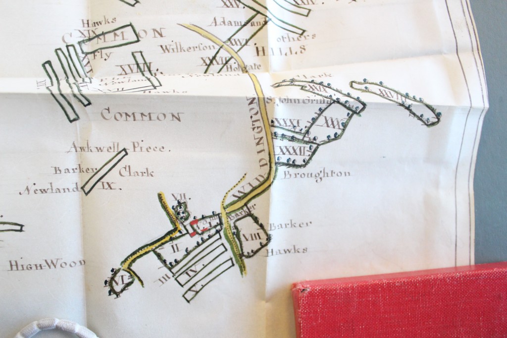
The book is of diminutive size but exquisitely executed and detailed. The map of Bishop’s Farm in Widdington struck is in particular, as it shows a farm made up of strips of land.

We are very pleased to have acquired this little book for our collection as it can now be made available to researchers for the first time.

IMG_5026


IMG_5028


IMG_5030


IMG_5032


IMG_5036

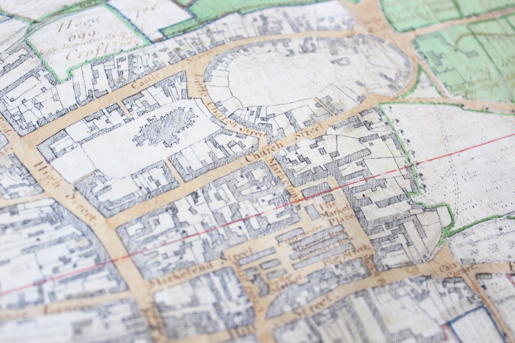
Saffron Walden: 1758

This coming Saturday, 8 November 2014, come and join us at Saffron Walden Town Hall for a look at one of the most spectacular maps in our collection.

IMG_4469 edit

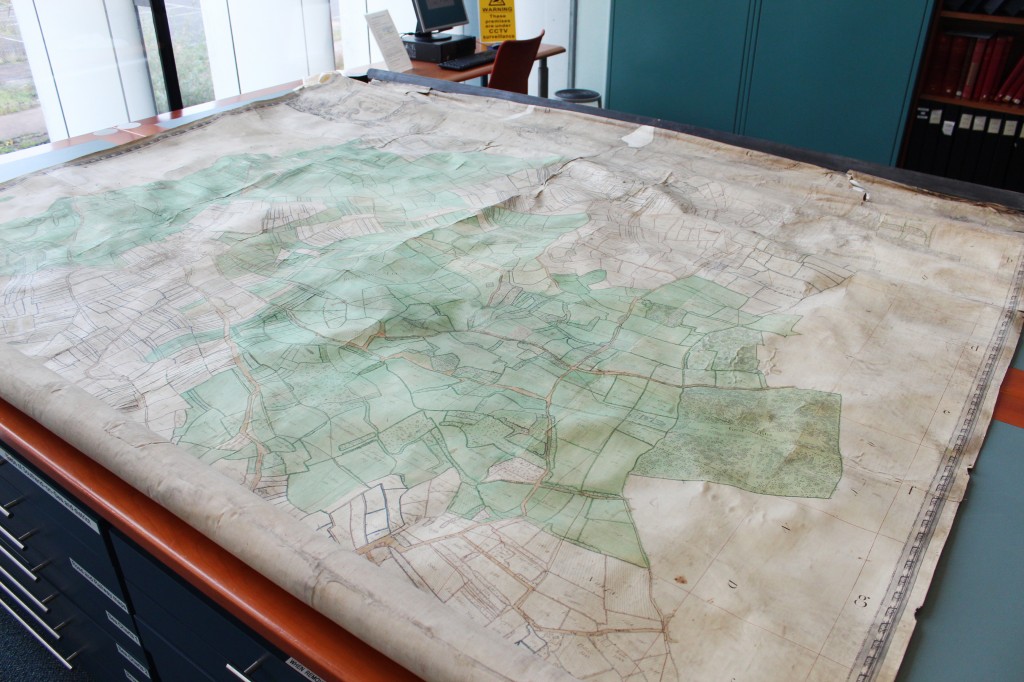
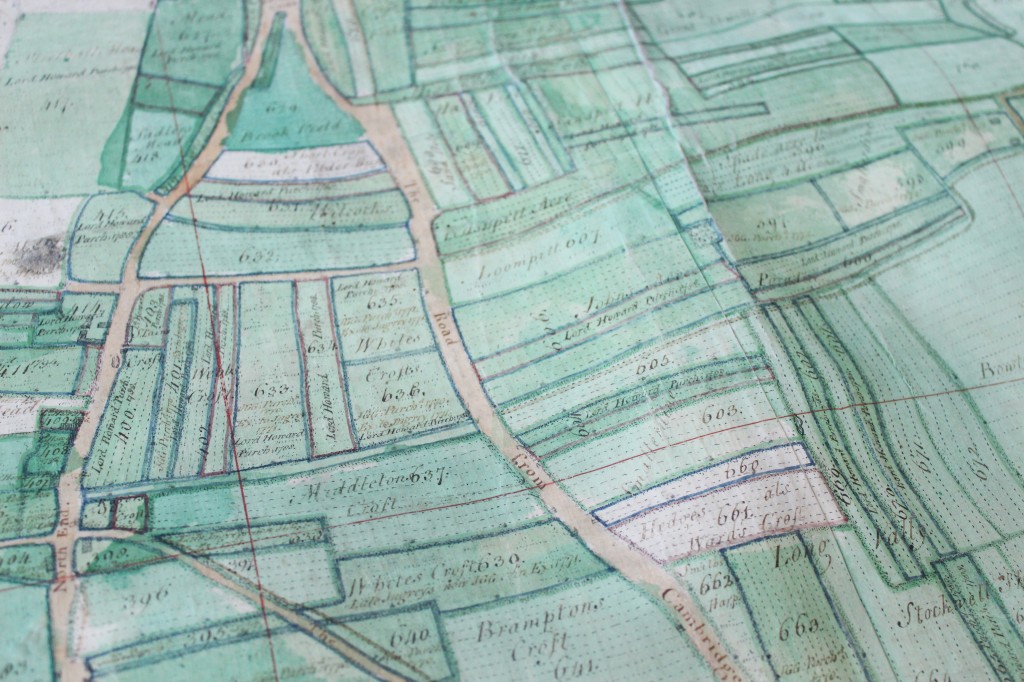
The map shows the town of Saffron Walden and the surrounding area, and is so large we’ve had to give serious thought to how we will transport it!

IMG_4451 edit

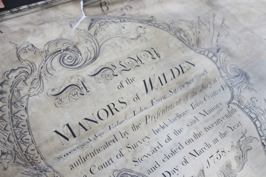
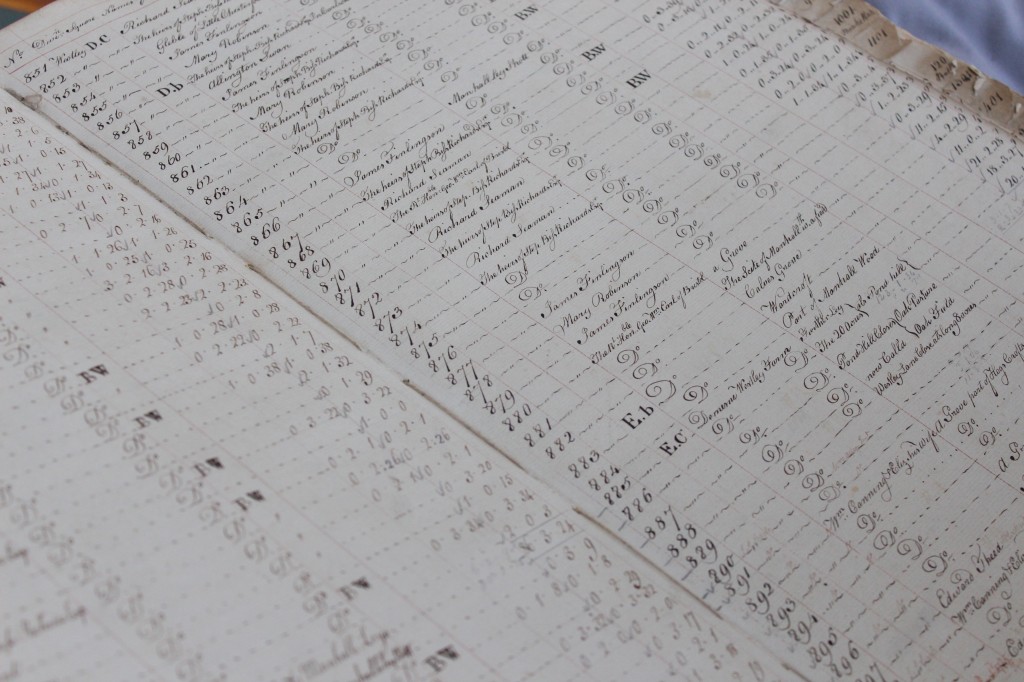
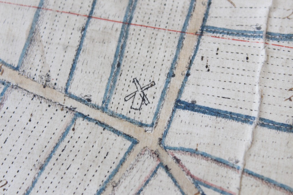
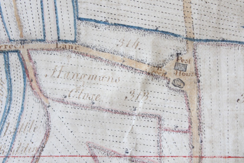
The map was made in 1758 by Edward John Eyre, along with a survey book, recording all the individual pieces of land, and how they were being used. The day will include a talk from an ERO Archivist about how the map and survey book work together.

IMG_4512

The map shows the town of Saffron Walden, and lots of other local details.

IMG_4489-1 IMG_4487 IMG_4485 IMG_4465 editIf you would like to join us on Saturday to see the map, here are all the details:

Saffron Walden 1758 At Saffron Walden Town Hall

In 1758 an extensive survey was carried out covering lands surrounding Saffron Walden, and several maps were made to accompany the survey books. This is a unique opportunity to see these maps and the survey books displayed together, to explore what the town and surrounding countryside looked like in the mid-eighteenth century.

The day will include a talk by Paul Marden of the Essex Place Names Project at 11.30am explaining the origins of some of the field names on the map. Allyson Lewis, archivist at the ERO will then give a talk at 12.00noon about the survey which accompanies the map.

Saturday 8 November, 10.30am-3.00pm

Free entry, suggested £2.00 donation

Saffron Walden Town Hall, Market Square, Saffron Walden, CB10 1HR

In association with the Saffron Walden Archive Access Point

Supported by Saffron Walden Town Council

What is a manor and what are manorial records?

Ahead of Essex through the ages: tracing the past using manorial records on Saturday 12 July, we begin a manorial mini-series exploring what these fascinating documents can tell us about Essex in the past. In this first post Archivist Katharine Schofield writes for us about what a manor actually was…

A manor was essentially a unit of land.  Manors were at the heart of the post-Norman Conquest feudal system whereby all land was owned by the King.  He rewarded his followers (or tenants-in-chief) by giving them land which they held in return for military service to the King.  They in turn rewarded their followers (or tenants) on the same basis.  At the bottom of the structure was the knight’s fee, the amount of land considered sufficient to finance the service of one knight.  Domesday Book, produced in 1086, shows the beginnings of this system and is arranged by manors rather than towns or villages.  It is for this reason that a number of places appear in it more than once.

Manors and parishes rarely coincided.  Domesday Book, for example, records three manors in the parish of Takeley, owned by Eudo Dapifer [the steward], Robert Gernon and the Priory of St. Valéry in Picardy.  By the time that the Revd. Philip Morant wrote The History and Antiquities of the County of Essex in 1768 there were four manors in the parish – Waltham Hall, Colchester Hall, St. Valerys or Warish Hall and Bassingborns which could trace their ownership back to the three Domesday manors.  Manors could also have land in a number of different parishes; for example, records of the manor of Berechurch or West Donyland in Colchester included property in Old Heath and on East Hill and St. John’s Green, all in other parishes.

The lord of the manor owned everything in and of the manor – the crops, animals, mineral, hunting and fishing rights and also the tenants, who could be bought and sold and who owed days of labour and items of produce to the lord.  The lord would either keep the land and farm it using the labour of his tenants or he would rent the land, retaining jurisdiction over it.

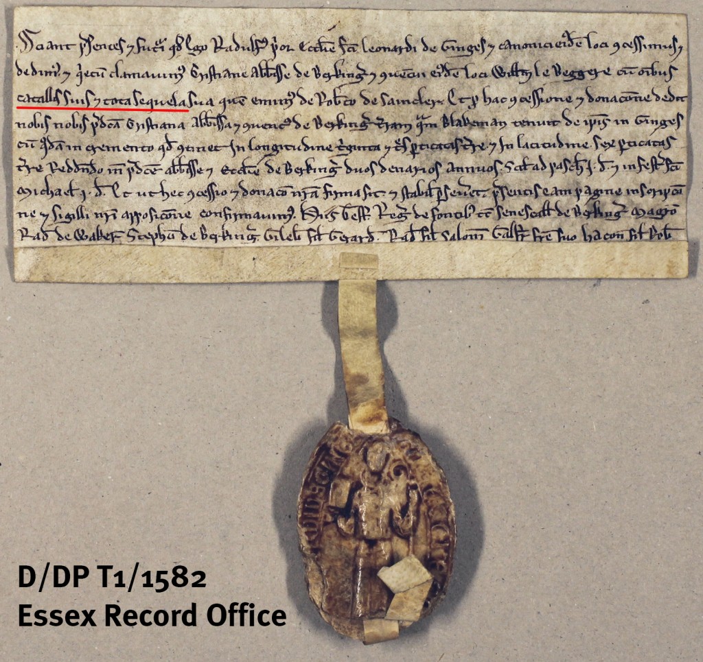
Among the earliest deeds in the Essex Record Office are a small number of early 13th century grants where named individuals, with their belongings and descendants, or chattels and issue [catallis et sequela – underlined in red below]), are sold or exchanged for land.

Grant by Thoby Priory of William le Beggere to Barking Abbey, c.1202-1201 (D/DP T1/1582). William had originally been purchased by the Priory from Robert de Saincler. In return for this grant, the abbey gave the priory land in Mountnessing.


As tenants were considered part of the property, the lord was also entitled to customary dues which would be paid as compensation for the loss of income that the tenant or members of his family would bring.  These included payments which were required when a son was sent to school or entered holy orders, as well as ‘merchet’ which was paid when a daughter married and ‘chevage’ paid to live the outside the manor.

The territorial rights of the lord over the tenants and their lands were enforced in the manorial court – the court baron.  Some, but not all, manorial lords also had jurisdiction over minor criminal matters in the court leet.

The rights of manorial lords did not change significantly over the centuries, but the nature of the manor did.  Some rights ceased to be exercised and others became more important.  It is estimated that the Black Death of 1348-1349 killed around a third of the national population and possibly as much as half of the population of East Anglia.  This ultimately led to lords being unable to find tenants willing to work the land as they had done previously, and the labour dues of tenants being commuted to rents or quit rents.  This, in turn, meant that records which commonly appeared in the early Middle Ages disappeared to be replaced with rentals.  Similarly by the 18th century the business of the manorial courts was mostly taken up with the admission and surrender of land by copyhold tenants.

IMG_2893 watermarked

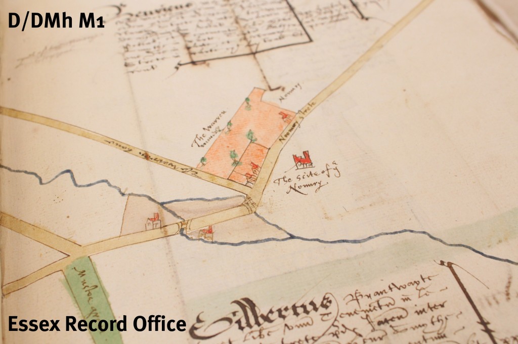
Manorial survey of Castle Hedingham by Israel Amyce, 1592. This survey book includes written descriptions of pieces of land illustrated with maps. (D/DMh M1)

The Manorial Documents Register (MDR) was established in 1926, the year after manorial landholding (copyhold) was abolished, to record the location of documents and ensure that they could be traced if they were required for legal purposes.  The two main types of manorial records listed by the MDR are:

  • Court records – court rolls, later books, estreat and suit rolls, stewards’ papers, admissions and surrenders
  • Assessment of land and financial records – surveys, extents, custumals, accounts (or compoti), rentals, and quit rents

As well as the records listed by the MDR, the Essex Record Office holds many deeds of copyhold properties and of the manors themselves.  Manorial titles remain and still retain some rights, including the extraction of minerals and fishing and any remaining rights must have been registered with the Land Registry before October 2013 if a lord intends to continue enforcing them.

Over the last few years, the ERO has been contributing to a major update to the Manorial Documents Register, improving the catalogue and getting information online to make these useful and fascinating documents more available to researchers. Even if you don’t want to attempt reading the earlier Latin documents, from 1733 they were kept in English, so there may well be information contained within them of interest to your research in family history, house history, or local history. Essex through the ages on 12 July marks the completion of our contribution to the project, and celebrates the improved accessibility of these records for researchers.

Whether you are interested in using manorial records in your own research, or just want to enjoy hearing experts talk about them, join us for Essex through the ages: tracing the past using manorial records on Saturday 12 July 2014 to find out how you can discover centuries of Essex life using these fascinating documents. There are more details, including how to book, here.