Regular readers will probably have noticed our Chelmsford Then and Now series of blog posts, written by Ashleigh Hudson, who worked with us on a research placement last year as part of her MA degree with the University of Essex. We have been fortunate this year to have hosted another student placement, and this year Louise Rodwell has been investigating the history of the High Street of Britain’s oldest recorded town, Colchester. We will be sharing the results of her research here over the coming months. You can also join us at Colchester on the Map on Tuesday 15 November 2016 at Colchester Town Hall to see some of our historic maps and photographs from the town.
In his 1825 History of Colchester, the antiquarian Thomas Cromwell wrote that ‘To every lover of history and antiquarian research, there can exist few more interesting towns than that of Colchester’.
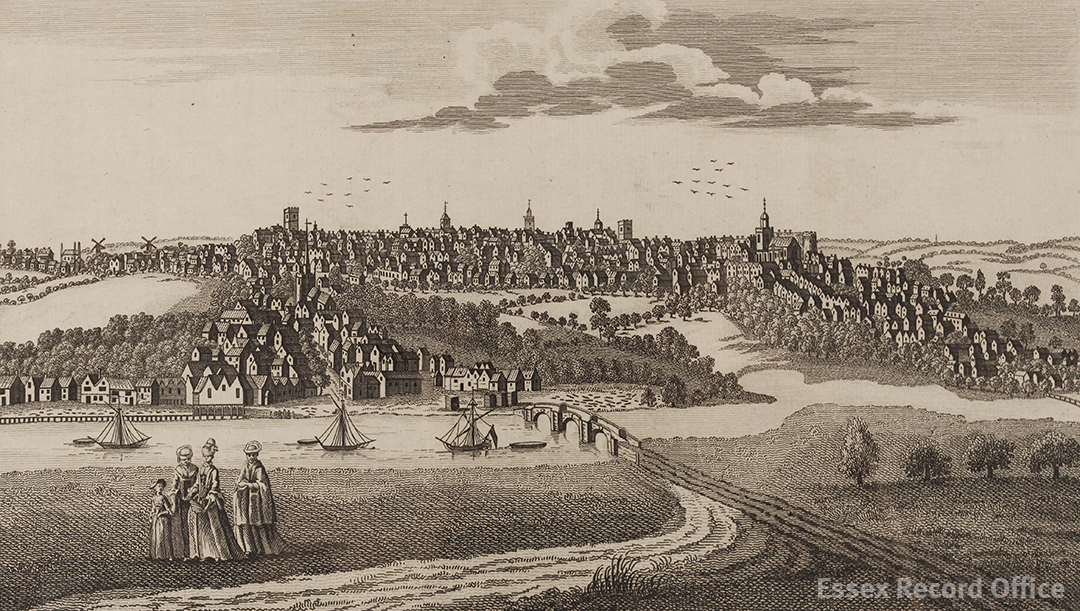
‘Perspective view of Colchester in the County of Essex’, engraved for The Complete English Traveller (I/Mb 90/1/)
Colchester is well known as a Roman town, but much less is popularly known about the other phases of its history, despite its involvement with events such as the Dutch Revolt, which resulted in an influx of Dutch and Flemish migrants to the town, the English Civil War, when Colchester was besieged, and the witch trials of East Anglia, led by the notorious Matthew Hopkins.
This project sets out to explore the histories of selected sites on Colchester High Street, and to imagine the lives of some of the people who have lived, worked, shopped and walked along this historic road. Using maps, documents and photographs from the Essex Record Office, this research will investigate continuity and change in the high street, and reflect on how Colchester’s past shapes our experience of the high street today.
To get us started, we thought we would take a look at one of our favourite maps of the town, which provides a fabulous window into the past.
This survey, grandly headed ‘The Ichnography of Colchester’ (MAP/CM/25/1), dates from about 1748. It is unsigned, but is believed to be by a man named James Deane, a local architect from whom we also have other records and drawings. The unusual word ‘ichnography’ is an architectural term with Greek origins, usually used to mean a ground plan of a building, but here used to mean a plan of a whole town. The layout of the town seen here is easily recognisable today, and is based on the streets set out by the Romans.
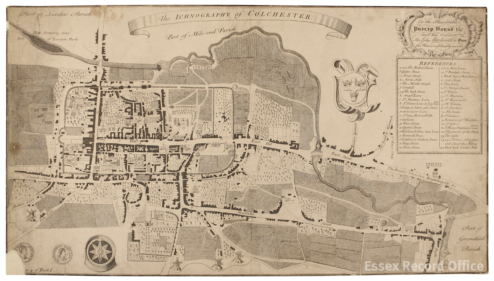
James Deane’s plan of Colchester, c.1748 (MAP/CM/25/1) (Click for a larger version)
No scale is given, but it is approximately 1:2,800. The map is dedicated to the Hon. Philip Yorke and his Consort The Lady Marchioness of Grey; Yorke was Earl of Hardwicke, a local landowner and MP for Reigate and later Cambridgeshire.
Some streets are named on the map, while others are included in a key which lists 41 places indicated on the map by letters and numbers. These include places still familiar to us today, such as the castle, St John’s Abbey Gate, the high street and Head Street, and other names which have fallen out of use, such as Grub Street, Hog Street and Cat Lane. Grub Street, labelled ‘a’, was the short bit of road connecting St Botolph’s Street with Magdalen Street.* Hog Street is in the south east of the map, and possibly is what today is known as Military Road, while Cat Lane has been upgraded to become Lion Walk.
This is a map that rewards detailed study, with a number of charming details to spot. A few of our favourites are middle row, a narrow row of shops and a church in the middle of the High Street, none of which still exist today, ships sailing on the River Colne at the Hythe in the south east corner of the map, and the three windmills shown on the southernmost edge of the map.
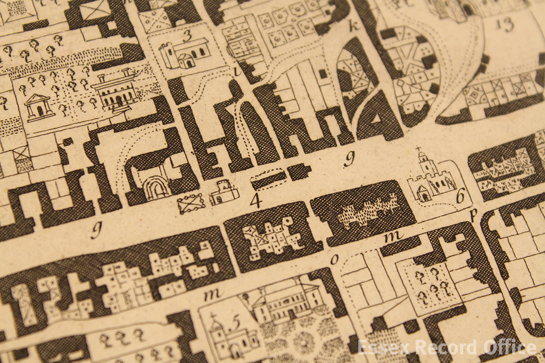
Middle row, including St Runwald’s church (MAP/CM/25/1)

Ships on the Hythe (MAP/CM/25/1)

Three windmills on the southernmost edge of Deane’s map (MAP/CM/25/1)
In our future blog posts in this series we will be looking at a series of properties along the high street which reflect different aspects of town life and how it has changed through the centuries, including pubs, inns, churches and shops.
In the meantime, do join us on Tuesday 15 November at Colchester Town Hall to see James Deane’s map alongside several others of the town, along with historic photographs and sound recordings, at Colchester on the Map.
*This part of the blog post was corrected on 17/11/16 after a reader flagged up that we had made an error in our original identification of Grub Street as Balkerne Hill.