As well as asking our users about their favourite documents from our collections, we have also been asking ourselves. Here Public Service Team Manager Neil Wiffen tells us about his favourite document, John Walker’s 1591 map of Chelmsford.
My favourite document at the ERO has to be one of the best known and most widely reproduced – the 1591 Walker map of Chelmsford. This might be an obvious choice (and could it be said boring?) but for me it works on so many levels.
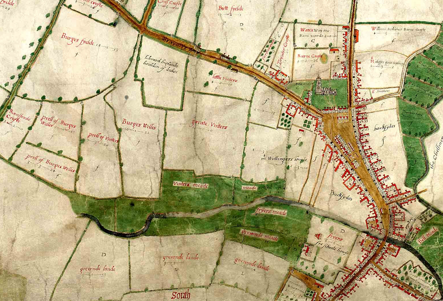
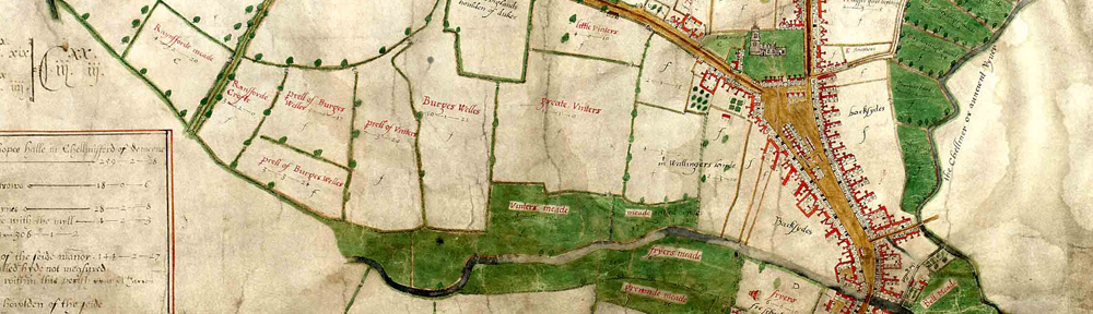
Extract from the Walker map of Chelmsford, 1591 (D/DM P1)
First of all it is a map and I think everyone likes a map because we can all get something from a map so very easily. We don’t need to read Latin or funnily written handwriting to be able to enjoy an historic map. As maps go it is a sumptuous and artistic map. The colours are still so very vivid even after 422 years and the wonderful portrayal of the buildings by John Walker is exquisite.
Being Chelmsford born and bred it works for me on a local level, a source of civic pride. I can’t help when I walk down the High Street but try and imagine what it would have been like when Walker surveyed the town. Indeed walking down the High Street is to walk in our predecessors footsteps so little has the basic layout of the town changed over the centuries. In a way the map is the nearest we can ever get to late Tudor Chelmsford, so it allows us to travel in time. It is a map that continues to keep me thinking about town development. If ever you’ve been shopping on a Friday or Saturday when they have the market stalls in the High Street you can just imagine what it was like when the Middle Row was developed over centuries. Stall holders didn’t bother to take down their stalls overnight but slept under the counter or added another level and before you knew there was a row of permanent shops which Walker depicts.
It can also be a dangerous map as well. Looking at the layout of Chelmsford in 1591 we can be lulled in to thinking how much nicer it would be to live in a small Chelmsford. Urban development and awful planning decisions of the 1950s-70s have deprived the town of much interest which is there in the Walker map. However, we must not forget the appalling inequality, insanitary conditions and harsh punishments of those earlier centuries.
Last of all it is a map of wonder. How did John Walker survey the town and produce the map? Whenever I look at the map I always think – ‘John Walker, what a clever bloke!’
If you would like to nominate your own favourite ERO document, we would love to hear from you. Simply download this form, and return it to the Searchroom desk or by e-mail to hannahjane.salisbury[at]essex.gov.uk. There are also paper copies available at the Searchroom desk. Nominated documents may be featured on this blog or in displays at our open day on Saturday 14 September 2013.