Filling the holes in history

History sometimes gets a bit tatty around the edges. Most of the documents we look after were originally created as working items, things to be used, referred to, added to, amended, and carried around.

Wear and tear is inevitable, but fortunately modern conservation techniques can make once fragile documents much stronger again and allow us to make them accessible to researchers.

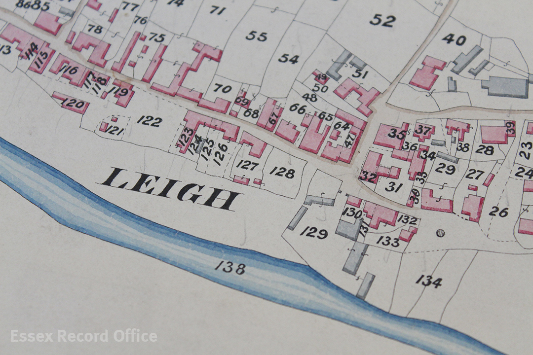
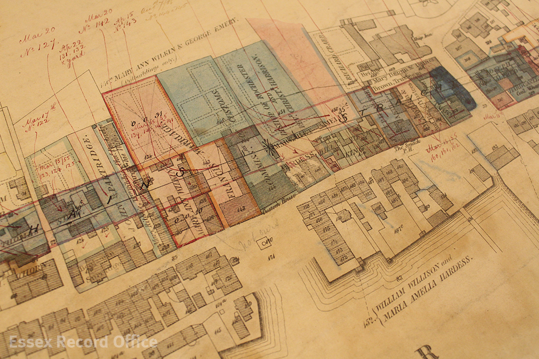
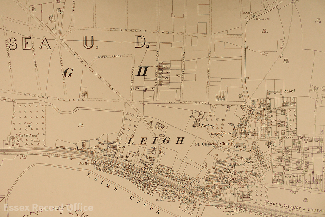
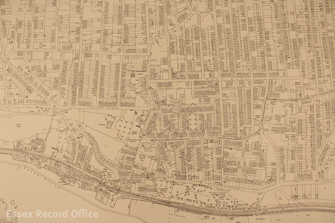
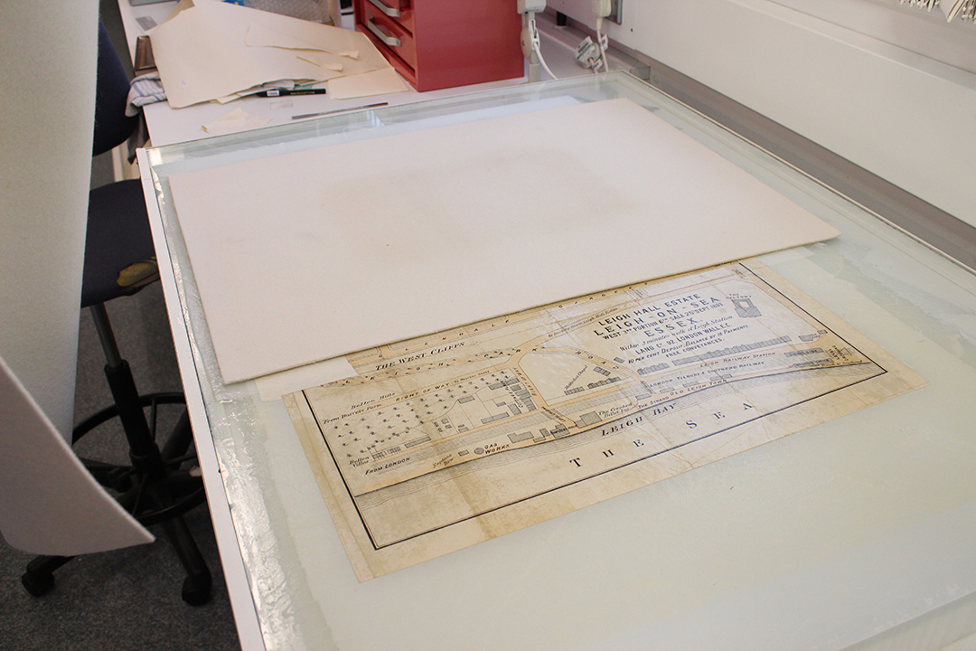
This map shows a plan of a late Victorian development in Leigh-on-Sea that will be on display at Leigh-on-Sea on the Map on Saturday 18 February 2017. It dates from 1893, and had several small splits in it and a rather large hole on one edge. To make it ready for display we took it to our expert conservator Diane Taylor. This short photo story will take you through the process of how the biggest hole in the map was repaired.

IMG_2581 1080x720

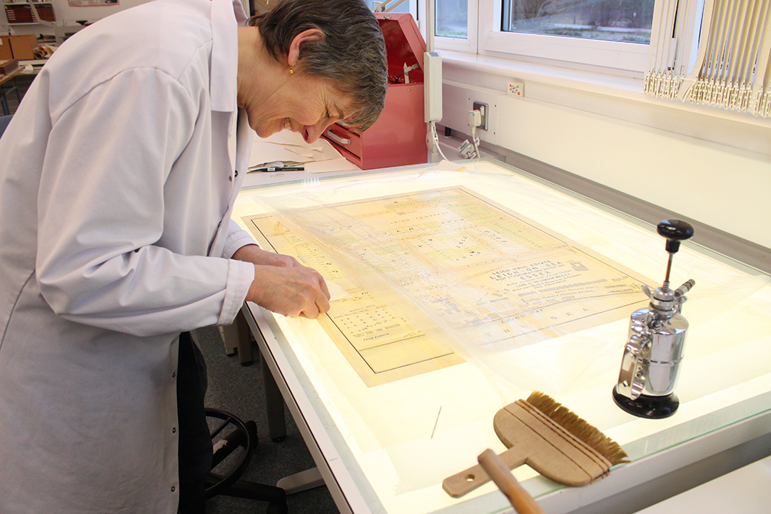
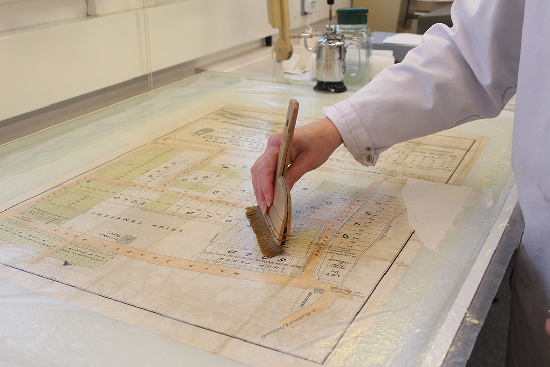
Senior Conservator Diane Taylor working on a plan of the Victorian development of the Leigh Hall Estate, dating from 1893 (D/DS 365/2/1). The map shows part of an important stage in the development of the town, when open land was sold off in plots for new houses to be built.

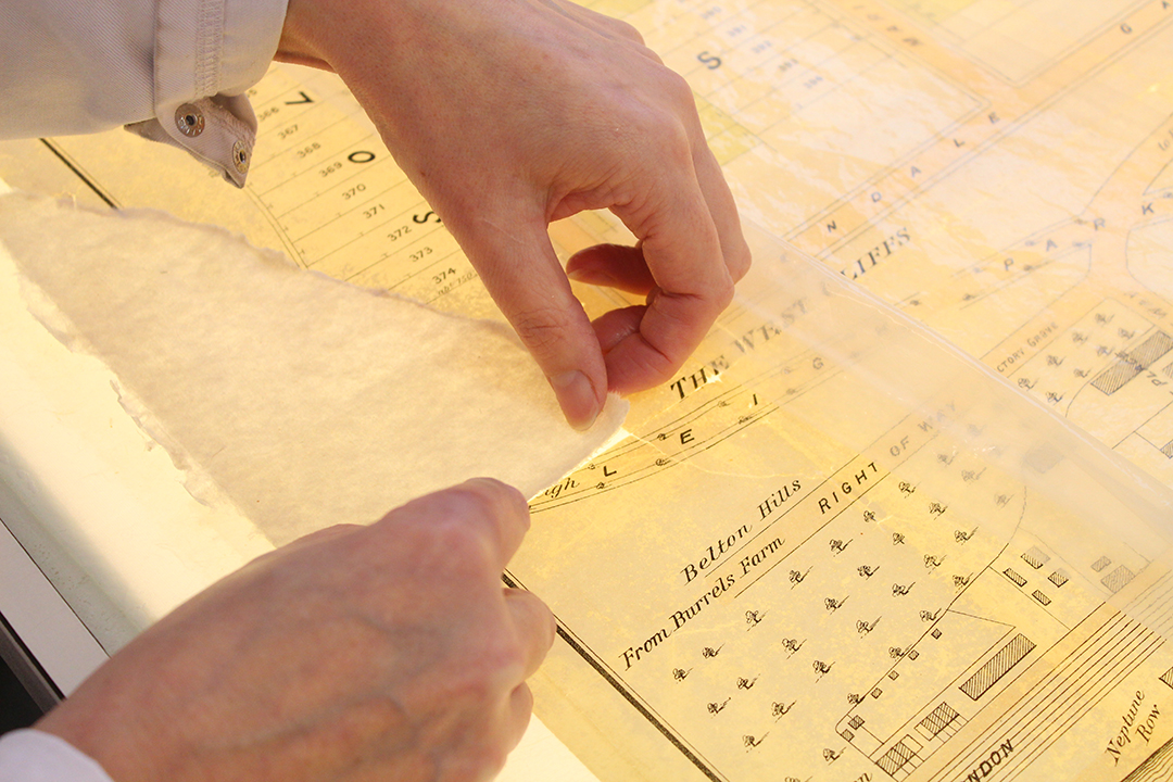
The process begins with preparing a sheet of Japanese tissue paper, a very fine but strong tissue paper which will be used as a backing for the map to give it strength. The tissue is laid onto the glass surface of a large light box, and sprayed with a fine mist of distilled water, then covered with an even layer of wheat starch paste, which will act as an adhesive. The map itself is then also sprayed with distilled water and laid on top of the tissue (the idea of getting documents wet sounds alarming, but many kinds of older paper and ink can get wet without disintegrating). The map is then covered in a sheet of transparent polythene and smoothed down with a wide flat brush.

IMG_2579 1080x720

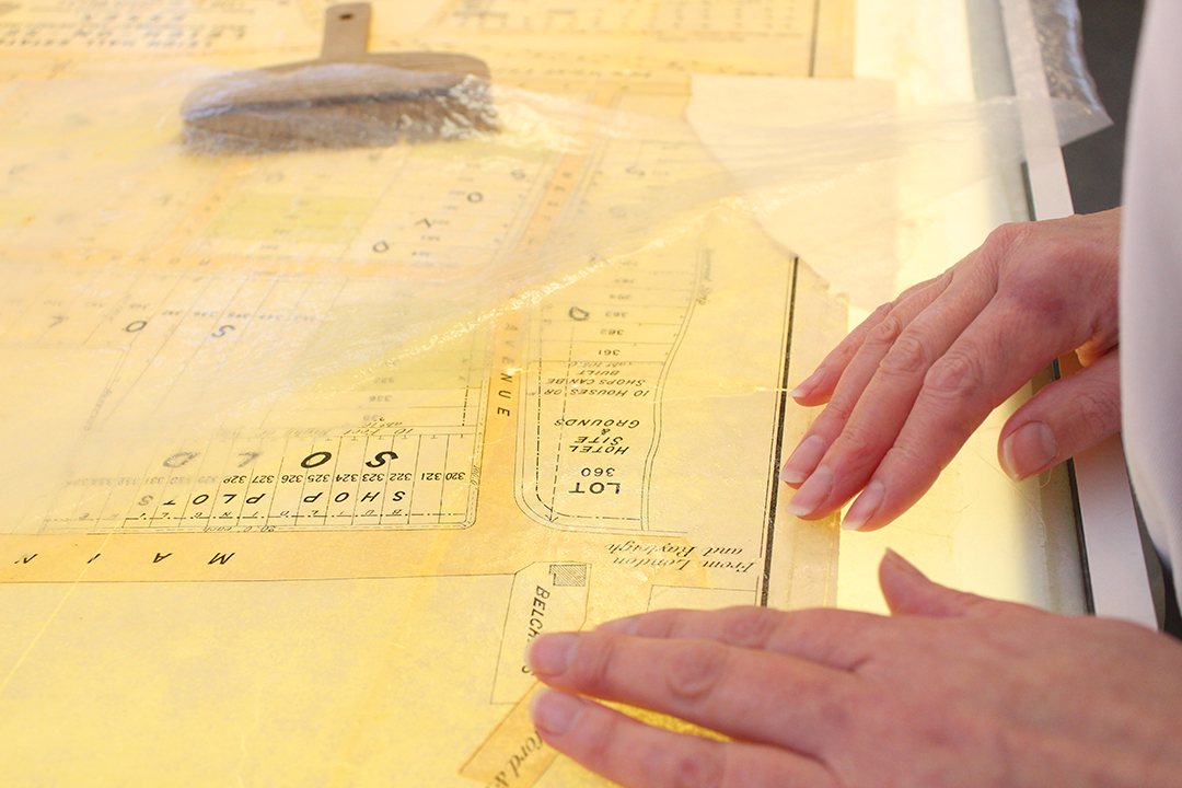
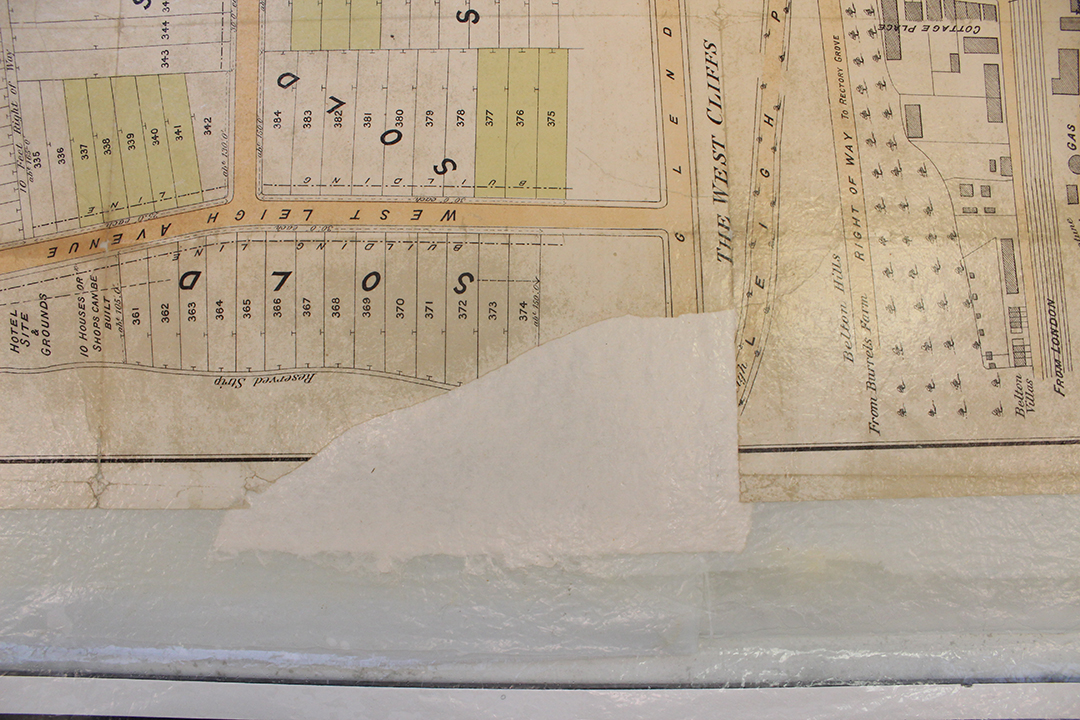
Diane carefully shapes a piece of new, traditionally-made paper to fit the hole as precisely as possible, with just a small overlap. Wheat starch paste adhesive is used to adhere the infill to the map and the tissue backing.

IMG_2585 1080x720

Using the light box, Diane closely examines the other smaller splits in the map and makes sure they are all closed up and securely adhered to the tissue backing.

IMG_2588 1080x720

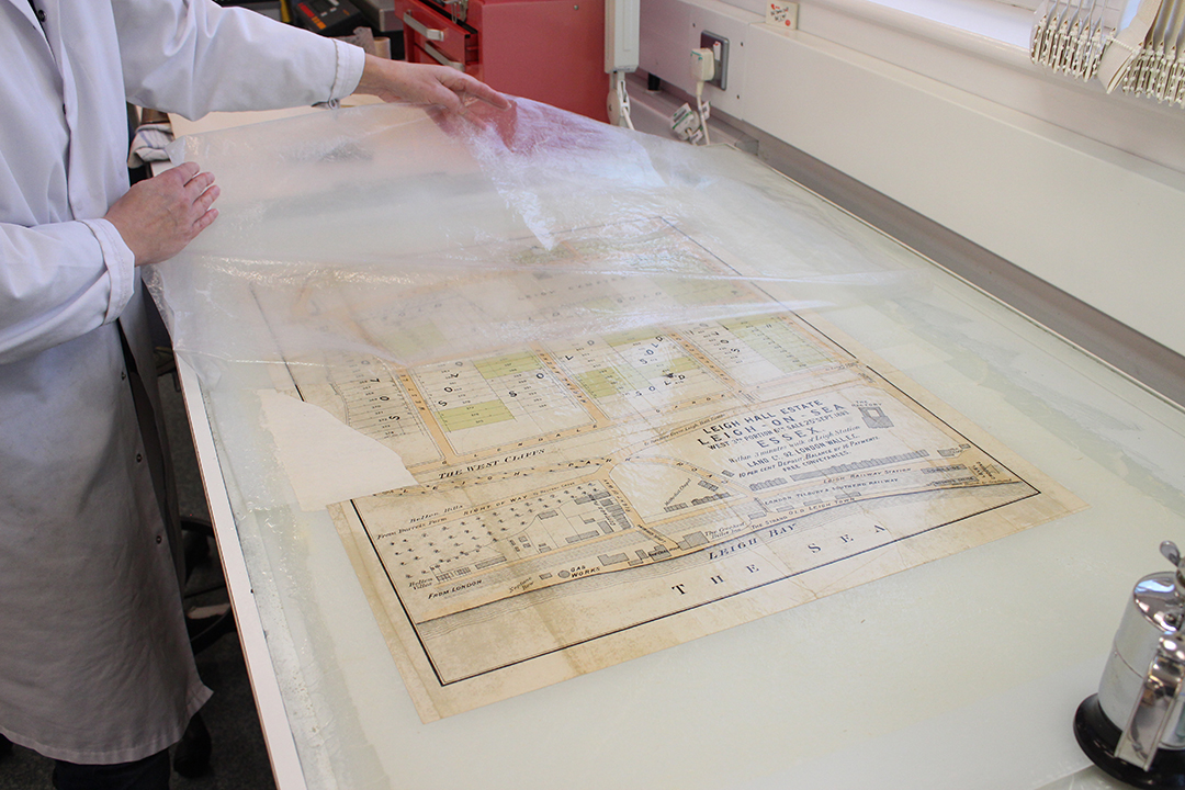
Once the infill is in place and the splits carefully realigned, the map is again covered with the polythene sheet and a wide brush is used to smooth everything down.

IMG_2589 1080x720

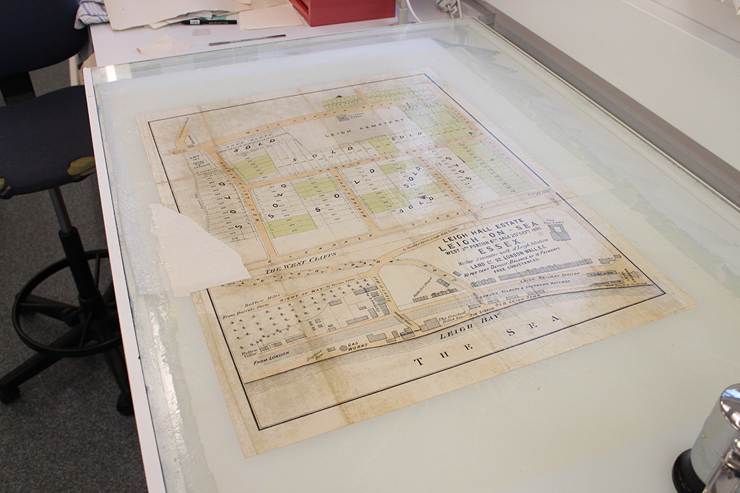
The main repair will now need to be left to dry, and the edge of the piece of infill will then be trimmed to be flush with the edge of the map.

IMG_2594 1080x720

The polythene is peeled back to reveal a repaired but wet map.

IMG_2595 1080x720 IMG_2597 1080x720

The map is covered with thick felts to absorb the water and begin the drying process.

IMG_2602 1080x720

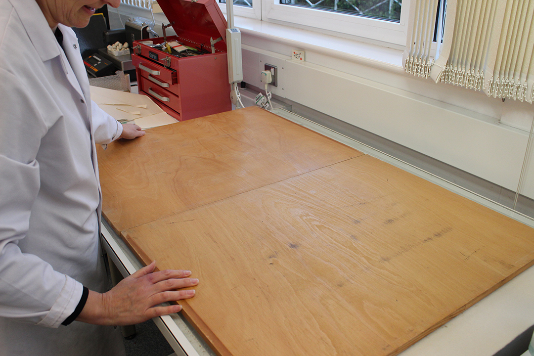
Wooden boards are placed over the felts to press them and draw water out of the map.

After drying, the edges of the tissue backing and the infill repair will be trimmed, and the map will be clean and strong and ready for researchers to use.

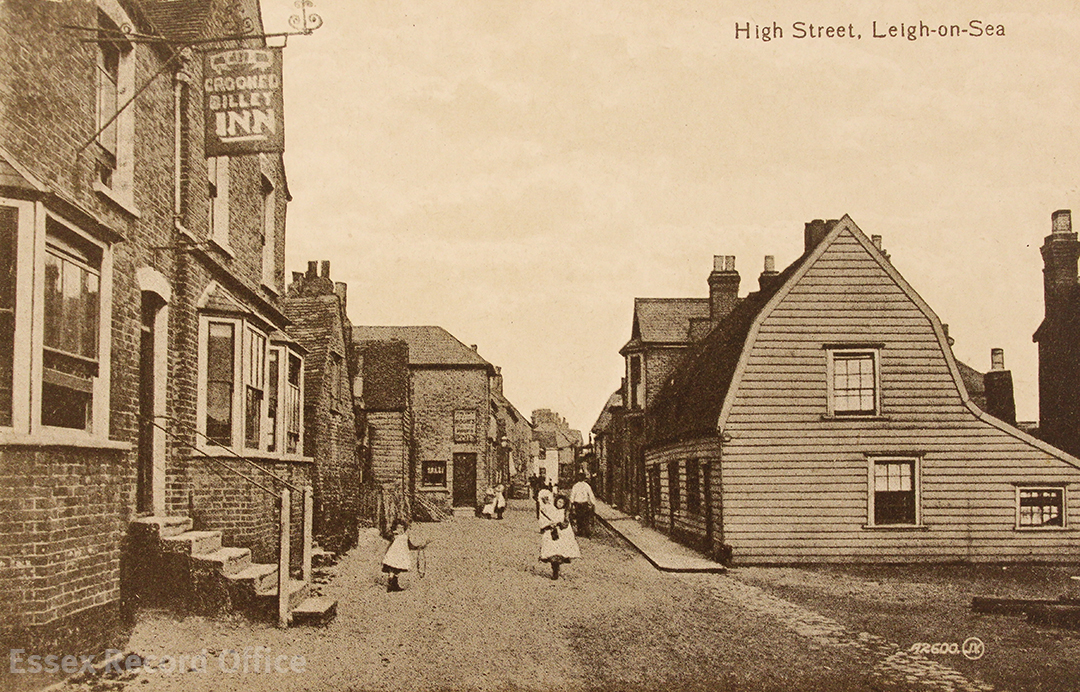
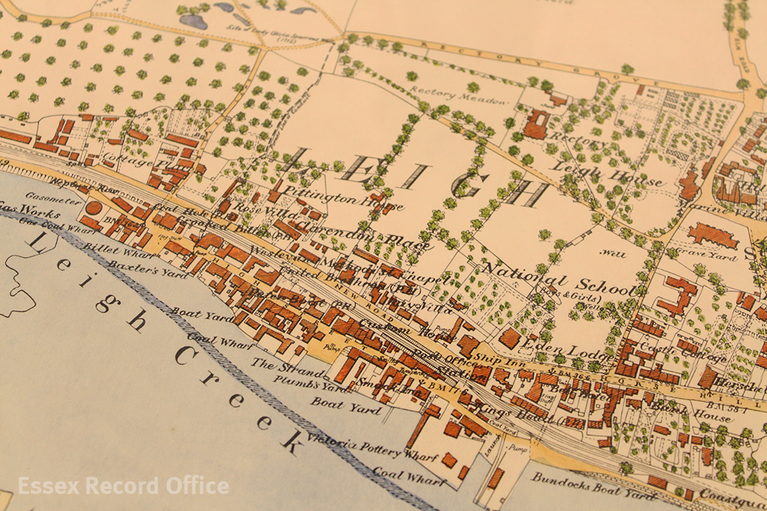
Join us at Leigh-on-Sea on the Map on Saturday 18 February 2017 at The Forum in Southend to see this map alongside several others tracing the development of Leigh from a small fishing village to the town we see today. Find full details here.

Leigh-on-Sea on the Map

“a pretty little town, well stock’d with lusty seamen”

This vivid description of Leigh-on-Sea comes from William Camden’s Britannia, a survey of Great Britain and Ireland published in 1586.

We are diving in to Leigh’s history at the moment ahead of Leigh-on-Sea on the Map on Saturday 18 February 2017, when we will be displaying a selection of our historical maps and images of Leigh at The Forum in Southend, showing its transformation as development spread ever further out from the small old town area that hugs the Thames shoreline.

Here we share some sneak peaks at some of the maps and postcards we will be bringing with us to display.

Leigh tithe map, 1847 (D/CT 217B)

IMG_8898 1080 watermarked

Extract from the Leigh tithe map, 1847 (D/CT 217B)

The centrepiece of our display will be Leigh’s tithe map, which dates from 1847. The map shows Leigh just before the coming of the railway, when it was still a small fishing town or village.

Tithe maps are brilliant sources for researchers interested in the history of their family or a particular property or place, as each plot on the map is numbered. This is because the maps are accompanied by a list of who owned and occupied each property, as they were used to work out how much tax people should pay based on the value of their property. The system of taxing people according to the value of their property replaced a much more cumbersome medieval system of people rendering a tenth of their agricultural produce to the church.

Railway map, c.1854 (D/DS 177/1)

IMG_2624 1080 watermarked

This 1854 map shows the route the London, Tilbury and Southend Railway was to take through Leigh, cutting through a swathe of existing buildings (D/DS 177/1)

Soon after the tithe map was prepared in 1847, another map of Leigh was produced which shows us the dramatic transformation the old town was about to undergo. This map was prepared in connection with the building of the London, Tilbury and Southend Railway, and shows the somewhat brutal course the track was to take through the town.

Although each building is numbered and presumably linked to a schedule giving names of owners of the properties through which the railway would pass, the whereabouts of the schedule is unknown. The map shows all the familiar Leigh landmarks, including the Bell and Ship inns, the Billet and Smack public houses, the Coast Guard House, the Custom House and individual wharfs and quays.

The building of the railway sliced the old town in two, marooning the High Street on a thin strip of land along the edge of the Thames. Victorian progress was rarely halted by the presence of old buildings that today we would consider precious, and in Leigh the presence of steep cliffs meant there was no alternative but to drive the railway through the town.

Leigh postcard 38 front 1080 watermarked

Leigh-on-Sea High Street in the late nineteenth century, in the part of the old town which was sandwiched between the new railway line (behind the buildings on the left) and the Thames (behind the buildings on the right). The Crooked Billet Inn still survives, as do several of the buildings shown in this picture. (ERO postcard collection, Leigh-on-Sea no. 38)

Ordnance Survey maps

The best maps which show the development of Leigh from 1890 to 1939 are the large scale ordnance survey maps of the “County Series”.

These were made in three waves – the first edition, made in the 1870s, the second edition, from the 1890s, and the New Series, made between the 1920s and 1940s. The county was entirely mapped in two different scales, 6” to the mile and the fabulously detailed 25” to the mile.

IMG_2654 1080 watermarked

Later copy (1964) of the first edition Ordnance Survey map of Leigh which was made in 1873 (MAP/CM/142/1)

Unfortunately we do not have an original 25” to the mile first edition OS map showing Leigh, but we will be bringing a well-known copy of it that was made later. The original map dated from 1873, and we can see that by this time Leigh remained a fairly small place, although now with a railway running through its centre. We can see that adjustments had been made to existing buildings to accommodate the railway, and that a ‘New Road’ had been built alongside it.

Amongst the new buildings shown are the Smack pub in a new building across the street from its original site (which by this time was underneath the railway line) and, on the hill below the church, a new National School which was built in 1852.

IMG_2636 1080 watermarked

Ordnance Survey map of Leigh, 1897

Leigh was resurveyed in 1897 for the second edition of the County Series. By this time, much of the open land around the old town had been divided up to be sold as plots, and new streets had been planned out, with pockets of building underway. This sort of development is seen frequently in our maps of Victorian Essex. Plots were either bought by individuals who then built their own houses, or purchased by developers who built who rows or streets of houses. Some plots were reserved for shops or hotels.

IMG_2644 1080 watermarked

Ordnance Survey map of Leigh, 1922

The next major survey of Leigh took place in 1922, and the map which resulted shows a fairly spectacular explosion of new housing that had been built since the 1890s. The town we see in this map resembles much more closely the town we can see today. Beside the railway, a tramline had been built running along The Broadway from St Clement’s church, past the Grand Hotel, and then along Leigh Road into Southend.


Southend bomb map, 1945 (D/BC 1/4/3/3)

The most recent map which will be on display was made soon after the end of the Second World War, and shows where bombs and other missiles were dropped on Southend, including Leigh, during air raids. If you live in Leigh, was your house near one of these bomb sites?

IMG_2615 edit 1080 watermarked

Map showing where bombs fell on the Southend district during the Second World War, 1945 (D/BC 1/4/3/3)

For more historic maps and images of Leigh, join us at Leigh-on-Sea on the Map on Saturday 18 February 2017, 10.00am-3.00pm, at The Forum, Elmer Square, Southend-on-Sea, SS1 1NE. Entry is free, but if you could make a donation to support our work we would really appreciate it.

Document of the Month, February 2017: Photograph of Frederick Park and Ernest Boulton, aka Fanny and Stella

As February is LGBT history month, we have chosen this photograph from the Frederick Spalding Collection (D/F 269/1/3696), dating from c.1869.  Frederick Park (left) and Ernest Boulton (right) were presumably photographed by Spalding in his Chelmsford studio while they toured Essex as part of a small theatrical company.  They often dressed in women’s clothing when not on stage, calling themselves Fanny Graham and Stella Boulton.

D-F-269-1-3696 1080 watermarked

Park (the son of one the Masters of the Court of Common Pleas) was articled to Gepps, the Chelmsford solicitors; Boulton was the son of a London stockbroker.  They were arrested by the Metropolitan Police in April 1870 while wearing women’s clothing at a London theatre and charged with six others with “conspiring and inciting persons to commit an unnatural offence”.  Their arrest and subsequent trial the following year was reported in detail in newspapers throughout the British Isles.  After the ‘not guilty’ verdict, Frederick Park emigrated to the US, dying there in 1881 at the age of 34. Ernest Boulton continued performing, touring in small theatre productions with his brother Gerard until his death in 1904.

A print of the photograph will be on display in the ERO Searchroom throughout February 2017.