Document of the Month, September 2018: survey of Rivenhall

New fragments which tell us about Essex’s past come in to us all the time, in all shapes and sizes. Here, Archivist Ruth Costello tells us about one of our new additions – a beautiful survey of the Rivenhall estate. The volume bears no date, so Ruth has been sleuthing to see if she could find out when it was made.

This month’s document is one of two volumes of maps which we received earlier this year as part of accession A14956. This, the smaller of the two, shows Rivenhall Place and its lands, which were owned by the Western family.

The index at the beginning of the volume lists the parts of the Rivenhall estate which are included in the survey

For each part of the estate, there is a carefully drawn map, and a list of how each parcel of land was being used. This map shows Rivenhall Place and the lands immediately around the grand house.

Despite its undoubted beauty, it seems to have been treated as a working document, with annotations in pencil, some of which seem to have been rubbed out at a later date.

Unfortunately, the survey does not include a title page, where we might expect to find the name of the surveyor.  Nor does it include a date.

We knew the volume must predate 1839 as the Rivenhall tithe map produced in that year clearly shows the newly built Eastern Counties Railway running through the parish.  In the volume, it has been pencilled in at a later date (it’s the line crossing through the meadow land numbered ‘23’, north of Rivenhall End in the page on display).

The two lines marked in pencil through field no. 23 on this map show where a railway line was later built, helping us to date the volume

We already held two maps of Rivenhall Place among the Western family estate records drawn in 1828 and 1839 (this latter one didn’t show the railway, so must have been produced earlier that year).  It’s unlikely that the land would have been surveyed and mapped on another occasion, so we thought that the volume must tie in with the date of one of these maps.

On display in the ERO Searchroom, the volume is opened to display the map of Pond Farm, which at the time was leased (somewhat appropriately) by Joseph Lake.  Both the volume and the 1828 map (D/DWe P12) show a property described as ‘workhouse land’ (it’s surrounded on two sides by the field numbered ‘26’).  The later map of 1839 (D/DWe P16) has the name ‘Bilney’ against this property.  It would seem that Mr Bilney bought the property after the Poor Law Amendment Act of 1834 led to the sale of former, smaller parish workhouses and the creation in this case of the new Witham Poor Law Union workhouse.

Map of lands that made up Pond Farm

List of lands making up Pond Farm

Some of the surrounding area is described as ‘William Blackborne’s land’.  We found a burial for a William Blackborne in the Rivenhall parish register in 1825.  Initially this made us think that the volume must predate his death and must be earlier than 1825.  However, both the 1828 and 1839 estate maps also included his name, which showed that out of date information was being copied forwards.

We think, therefore, that the volume and the 1828 map we already held were drawn at the same time.  Sadly, we still don’t know who drew them; the map also has no author.  The map shows the whole of the estate and its individual farms together, but it has only a very little colouring, by comparison with the volume.  This volume and its companion (a series of maps of the Felix Hall estate) are thus a welcome addition to our holdings.

The volume will be in display in the Searchroom throughout September 2018.

Filling the holes in history

History sometimes gets a bit tatty around the edges. Most of the documents we look after were originally created as working items, things to be used, referred to, added to, amended, and carried around.

Wear and tear is inevitable, but fortunately modern conservation techniques can make once fragile documents much stronger again and allow us to make them accessible to researchers.

This map shows a plan of a late Victorian development in Leigh-on-Sea that will be on display at Leigh-on-Sea on the Map on Saturday 18 February 2017. It dates from 1893, and had several small splits in it and a rather large hole on one edge. To make it ready for display we took it to our expert conservator Diane Taylor. This short photo story will take you through the process of how the biggest hole in the map was repaired.

IMG_2581 1080x720

Senior Conservator Diane Taylor working on a plan of the Victorian development of the Leigh Hall Estate, dating from 1893 (D/DS 365/2/1). The map shows part of an important stage in the development of the town, when open land was sold off in plots for new houses to be built.

The process begins with preparing a sheet of Japanese tissue paper, a very fine but strong tissue paper which will be used as a backing for the map to give it strength. The tissue is laid onto the glass surface of a large light box, and sprayed with a fine mist of distilled water, then covered with an even layer of wheat starch paste, which will act as an adhesive. The map itself is then also sprayed with distilled water and laid on top of the tissue (the idea of getting documents wet sounds alarming, but many kinds of older paper and ink can get wet without disintegrating). The map is then covered in a sheet of transparent polythene and smoothed down with a wide flat brush.

IMG_2579 1080x720

Diane carefully shapes a piece of new, traditionally-made paper to fit the hole as precisely as possible, with just a small overlap. Wheat starch paste adhesive is used to adhere the infill to the map and the tissue backing.

IMG_2585 1080x720

Using the light box, Diane closely examines the other smaller splits in the map and makes sure they are all closed up and securely adhered to the tissue backing.

IMG_2588 1080x720

Once the infill is in place and the splits carefully realigned, the map is again covered with the polythene sheet and a wide brush is used to smooth everything down.

IMG_2589 1080x720

The main repair will now need to be left to dry, and the edge of the piece of infill will then be trimmed to be flush with the edge of the map.

IMG_2594 1080x720

The polythene is peeled back to reveal a repaired but wet map.

IMG_2595 1080x720 IMG_2597 1080x720

The map is covered with thick felts to absorb the water and begin the drying process.

IMG_2602 1080x720

Wooden boards are placed over the felts to press them and draw water out of the map.

After drying, the edges of the tissue backing and the infill repair will be trimmed, and the map will be clean and strong and ready for researchers to use.

Join us at Leigh-on-Sea on the Map on Saturday 18 February 2017 at The Forum in Southend to see this map alongside several others tracing the development of Leigh from a small fishing village to the town we see today. Find full details here.

Colchester then and now: The Ichnography of Colchester

Regular readers will probably have noticed our Chelmsford Then and Now series of blog posts, written by Ashleigh Hudson, who worked with us on a research placement last year as part of her MA degree with the University of Essex. We have been fortunate this year to have hosted another student placement, and this year Louise Rodwell has been investigating the history of the High Street of Britain’s oldest recorded town, Colchester. We will be sharing the results of her research here over the coming months. You can also join us at Colchester on the Map on Tuesday 15 November 2016 at Colchester Town Hall to see some of our historic maps and photographs from the town.

In his 1825 History of Colchester, the antiquarian Thomas Cromwell wrote that ‘To every lover of history and antiquarian research, there can exist few more interesting towns than that of Colchester’.

‘Perspective view of Colchester in the County of Essex’, engraved for The Complete English Traveller (I/Mb 90/1/)

‘Perspective view of Colchester in the County of Essex’, engraved for The Complete English Traveller (I/Mb 90/1/)

Colchester is well known as a Roman town, but much less is popularly known about the other phases of its history, despite its involvement with events such as the Dutch Revolt, which resulted in an influx of Dutch and Flemish migrants to the town, the English Civil War, when Colchester was besieged, and the witch trials of East Anglia, led by the notorious Matthew Hopkins.

This project sets out to explore the histories of selected sites on Colchester High Street, and to imagine the lives of some of the people who have lived, worked, shopped and walked along this historic road. Using maps, documents and photographs from the Essex Record Office, this research will investigate continuity and change in the high street, and reflect on how Colchester’s past shapes our experience of the high street today.

To get us started, we thought we would take a look at one of our favourite maps of the town, which provides a fabulous window into the past.

This survey, grandly headed ‘The Ichnography of Colchester’ (MAP/CM/25/1), dates from about 1748. It is unsigned, but is believed to be by a man named James Deane, a local architect from whom we also have other records and drawings. The unusual word ‘ichnography’ is an architectural term with Greek origins, usually used to mean a ground plan of a building, but here used to mean a plan of a whole town. The layout of the town seen here is easily recognisable today, and is based on the streets set out by the Romans.

James Deane’s plan of Colchester, c.1748 (MAP/CM/25/1)

James Deane’s plan of Colchester, c.1748 (MAP/CM/25/1) (Click for a larger version)

No scale is given, but it is approximately 1:2,800. The map is dedicated to the Hon. Philip Yorke and his Consort The Lady Marchioness of Grey; Yorke was Earl of Hardwicke, a local landowner and MP for Reigate and later Cambridgeshire.

Some streets are named on the map, while others are included in a key which lists 41 places indicated on the map by letters and numbers. These include places still familiar to us today, such as the castle, St John’s Abbey Gate, the high street and Head Street, and other names which have fallen out of use, such as Grub Street, Hog Street and Cat Lane. Grub Street, labelled ‘a’, was the short bit of road connecting St Botolph’s Street with Magdalen Street.* Hog Street is in the south east of the map, and possibly is what today is known as Military Road, while Cat Lane has been upgraded to become Lion Walk.

This is a map that rewards detailed study, with a number of charming details to spot. A few of our favourites are middle row, a narrow row of shops and a church in the middle of the High Street, none of which still exist today, ships sailing on the River Colne at the Hythe in the south east corner of the map, and the three windmills shown on the southernmost edge of the map.

Middle row, including St Runwald's church (MAP/CM/25/1)

Middle row, including St Runwald’s church (MAP/CM/25/1)

Ships on the Hythe (MAP/CM/25/1)

Ships on the Hythe (MAP/CM/25/1)

Three windmills on the southernmost edge of Deane's map (MAP/CM/25/1)

Three windmills on the southernmost edge of Deane’s map (MAP/CM/25/1)

In our future blog posts in this series we will be looking at a series of properties along the high street which reflect different aspects of town life and how it has changed through the centuries, including pubs, inns, churches and shops.

In the meantime, do join us on Tuesday 15 November at Colchester Town Hall to see James Deane’s map alongside several others of the town, along with historic photographs and sound recordings, at Colchester on the Map.

*This part of the blog post was corrected on 17/11/16 after a reader flagged up that we had made an error in our original identification of Grub Street as Balkerne Hill.

Five favourite Chelmsford documents

Hannah Salisbury, Engagement and Events Manager

We have two great events coming up in late October looking at the history of Chelmsford. On Wednesday 26 October we have a guided walk of the city centre based on John Walker’s fabulous 1591 map (see below if you have never seen this before), and on Saturday 29 October we are hosting Chelmsford Through Time, a pop-up display of historic maps and photographs, with a talk by Dr James Bettley on the post-war development of Chelmsford. You can find details of both of these on our events webpages.

In preparation for these events we have been sifting through some of the masses of material we have on Chelmsford history, and I thought I would share here five of my favourite Chelmsford items from our collections, that provide fascination snapshots into the past of our county town.

  1. John Walker’s map, 1591

Any round-up of significant documents of Chelmsford’s history must surely start with John Walker’s spectacular map, dating from 1591 (long-time readers of this blog will most like have come across this in some of our previous posts). It shows the town in exquisite detail, with each building individually drawn with its own doors, windows and chimneys. What’s more, a written survey that goes with the map tells us who was living in each of these properties at the time. It’s a very special window into the past that I never get tired of looking through.

Walker map Chelmsford

Extract from John Walker’s map of Chelmsford, 1591, showing the town (D/DM P1)

  1. James Maylett execution

A grimmer choice, but I have always been interested in Tudor history and this snippet from the Chelmsford burial registers serves as a reminder of how brutal life could be. This burial entry dates from December 1542, and reads:

Jamys Maylette clerke Bachelor of Dyvinyti and p[ar]son of moche Lyes was drawen hanged and quarteryd on the market hyll for high treason on fryday the firste daye of December ao 1542.

That is to say, James Mallett, the parson of Great Lees, was hung, drawn and quartered in the market square at Chelmsford for high treason. 1 December that year was a Friday, market day, to ensure maximum witnesses for the gruesome spectacle.

Mallett had been a chaplain to Katherine of Aragon, Henry VIII’s first wife whom he divorced in order to marry Anne Boleyn. Mallett had also been rector of Great Leighs for 28 years. His treasonous offence was to comment unfavourably on Henry’s policy of dissolving religious houses. His public execution must surely have been intended as a warning to other clergy not to pass comment on the king’s decisions.

james-maylett-watermarked

Extract from the Chelmsford parish registers showing the burial of James Mallett, December 1542 (D/P 94/1/4 image 26)


  1. Spalding photo of High Street, c.1869

This is one of the earliest surviving photographs of Chelmsford High Street, dating to about 1869. It shows a view looking north up the High Street towards Shire Hall. It was taken by Fred Spalding, Chelmsford’s first commercial photographer. Spalding’s son and grandson both became photographers too, and we have about 7,000 of their photographs at the ERO today. This one, like all of Spalding’s early photographs, was taken on a glass plate coated with chemicals; a challenging process to get right, especially in the open air.

d-f-269-1-3715-watermarked

Photograph of Chelmsford High Street by Fred Spalding, c.1869 (D/F 269/1/3715)

  1. Photograph of Chelmsford Corn Exchange

If I could wave a magic wand over Chelmsford I would love to be able to bring back the Corn Exchange. This neo-Renaissance building was designed by Fred Chancellor in 1857, and sat on Tindal Square (Shire Hall is just out of frame on the right of this photo). It was demolished, along with the whole of the west side of Tindal Street, to make way for the High Chelmer redevelopment in 1969.

corn-exchange-1080-watermarked

Photograph by Fred Spalding of Chelmsford Corn Exchange

  1. Women at work in Marconi’s

This photograph is one of a series of images taken of Marconi’s Hall Street works, sometime between 1898 and 1912. At the start of the twentieth century, women were mostly expected to marry, have children, and stay at home. As an archetypal `new’ industry, the wireless industry involved complex assembly operations and `high-tech’ components requiring manual dexterity. The Marconi Hall Street works pioneered the early recruitment of a trained female workforce. Women are so often invisible or difficult to find in historical sources, so to find such striking photographs giving an insight into what their lives were like is always exciting. (You can see some more photos from this set on our Historypin page.)

Women at work in Marconi's Hall Street Factory, c.1902 (A11449)

Women at work in Marconi’s Hall Street Factory, c.1902 (A11449)

 Join us for Walking with Walker (Wednesday 26 October 2016) or Chelmsford Through Time (Saturday 29 October 2016) to delve deeper into Chelmsford’s history.

Chelmsford Then and Now: 61 High Street – from pubs to Paperchase

Today, no. 61 Chelmsford High Street is occupied by Paperchase. In the eighth post in our series looking at the history of Chelmsford High Street, Ashleigh Hudson looks at what else has stood on the site through the centuries. Find out more about the Chelmsford Then and Now project here.

In the 16th century, the site of 61 High Street formed part of two tenements known as Cocksayes and Patchings. By 1618, the site was divided into three distinct properties. The central property (61) was occupied by the Ship Inn, later known as the Waggon and Horse. The inn was ideally situated opposite Springfield road, in the heart of the High Street.

Extract from John Walker’s map of Chelmsford, revealing two tenements on part of the site that would later comprise of 61 High Street. (D/DM P1)

Extract from John Walker’s map of Chelmsford, revealing two tenements on part of the site that would later comprise of 61 High Street. (D/DM P1)

From 1798 the inn was known as the Queen’s Head which was described as a ‘good accustomed public house now in full trade’ in 1807. The Sales Particulars reveal a large property, with considerable facilities for entertaining including a bar, a large parlour and a market room.

One of Spalding’s earliest photographs of the High Street c.1869. The Queen’s Head can be seen on the left.

One of Spalding’s earliest photographs of the High Street c.1869. The Queen’s Head can be seen on the left.

The Queen’s Head continued to provide visitors with modest accommodation throughout the 18th and 19th century and the inn benefited from a steady flow of trade.

The Queen's Head can be spotted on the far left of this image (I/Mb 74/1/55)

The Queen’s Head can be spotted on the far left of this image (I/Mb 74/1/55)

A later view of the Queen's Head

A later view of the Queen’s Head

Watercolour of the Queen’s Head Yard by A.B. Bamford in 1906.

Watercolour of the Queen’s Head Yard by A.B. Bamford in 1906.

The watercolour above, by A.B Bamford, depicts the Queen’s Head Yard in 1906. The romanticised image of the yard is perhaps at odds with reality. Most inn yards were a hub of activity, with horses passing through at all hours of the day and night. The yard certainly would not have appeared so inviting a century earlier. In the 18th century the Queen’s Head yard adjoined the prison yard belonging to the House of Correction which occupied the site of 63-64 High Street. Prison reformer James Neild visited the House of Correction in 1803 and reported the building to be ‘filthy and out of repair’ concluding:

‘What renders this wretched prison more unbearable [is] the offensiveness of the hog-stye of an adjoining public house.’

Neild was unfortunately referring to the Queen’s Head. One can imagine the visitors staying at the Queen’s Head did not enjoy a room with a view, thanks to the ‘hog-stye’ and prison yard located to the rear of the property.

By the 20th century, inns and public houses were slowly disappearing from the high street as the demand for retail increased. The Queen’s Head managed to survive until the 1970s when it was demolished. A quick comparison of the Ordance Survey (OS) map of 1963 and the OS map of 1974 reveals that a substantial section of the west side of the high street was completely redeveloped.

The Queen’s Head is identifiable on the 1963 map by the ‘PH’ initials, which stands for public house. The property has quite a distinctive, backwards ‘L’ shape and a narrow passageway is visible, sandwiched between the Queen’s Head and the site of 62 High Street.

The OS map from 1974 reveals a very different property on the site of 61 High Street. The shape of the building has completely changed and the narrow passageway has been consolidated to form part of the new building. Entry to the yard can only be obtained via the rear of the property.

OS maps of Chelmsford 1963 and 1974

OS maps showing dramatic change on the west side of Chelmsford High Street between 1963 and 1974

These maps illustrate how the town was transforming in the 20th century; based on these maps, one would imagine that the west side of the high street is virtually unrecognisable to those who remember the high street as it looked in the 1960s.

(7) Current Image

Current image of Paperchase, occupying the former site of the Queen’s Head.

Today nothing remains of the original Queen’s Head building and the site of 61 High Street is currently occupied by Paperchase.

If you would like to find out more about the Queen’s Head see Hilda Grieve’s detailed history of Chelmsford The Sleepers and The Shadows.  Alternatively, try searching the Queen’s Head in Essex Archives Online. The Essex Record Office possess a fantastic range of OS maps which are available for viewing in the Searchroom.

Boston trip: another document is coming with us!

Following yesterday’s post we are pleased to be able to share the news that we have got further permission to be able to bring an original parish register with us on our trip to Boston in August 2015.

D/P 192/1/1 is the first parish register of Saffron Walden, with baptism, marriage and burial entries dating from 1558-1630, and therefore contains entries for a number of early American settlers and their families.

Map of Saffron Walden, 1758, by Edward John Eyre (D/B2 MAN7/3

Map of Saffron Walden, 1758, by Edward John Eyre (D/B2 MAN7/3

Several early settlers have been traced to Saffron Walden, such as Samuel Bass who moved to Roxbury, Massachusetts, in 1633, Thomas Cornell who went to Boston, Massachusetts in 1638, and Nicholas Desborough, who by 1637 was in Hartford, Connecticut.

The register is a beautiful early-modern book, long and thin, constructed of wooden boards with a soft leather cover.

The register will be on display with two original wills at our events in Boston, details of which are here.

IMG_7310

The first parish register of Saffron Walden – you can see its wooden covers just poking through the leather in the top left corner

IMG_7313

Soft leather wraps around the wooden covers of the book

IMG_7318

A glimpse inside the register

Guest post: ‘an adventure beyond words’

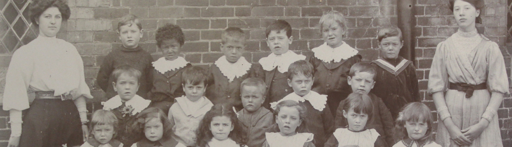
This guest post is written by Ben, Grace, Evie, Akmal, Toby, Ben, Grace, Lucas and Bella who are all in year 5 at Broomfield Primary School. They were shown around the ERO by Neil Wiffen, Public Service Team Manager, and Hannah Salisbury, Access and Participation Officer. If you would like to arrange a visit for an educational group, please get in touch with us on ero.events@essex.gov.uk 

My teacher and a small group of pupils were invited to The Essex Record Office. Not the CD, track kind of record: the letter, diary, document kind of record. We were not just fascinated to find out some amazing facts, we were amazed to see some facts that gave us a link to things from hundreds of years ago. On our journey through time we filled our brains with lots of information and fun facts.

Why does the Essex Record Office (ERO) exist? Some people have interesting artefacts in their home but it’s no good having it all there! The ERO provide the capability of looking at all the information you need in one place.  You do not have to make appointments in different buildings, the ERO has everything you need, but they have certain rules. These include not taking any bags (at all!) into the Searchroom.  This is because some naughty people try and steal the information. The other rule was to use pencil only, as they don’t want to ruin any documents or information. The ERO is for people of all ages – there is no limit. You cannot only just have fun and find out information, you can understand and communicate with the past.

When the ERO was opened in 2000, there was a model made of a flower designed by pupils [ed.: the sculpture which runs alongside the public stairs up to the Searchroom]. The roots were to represent that History is in the past, the stem shows that were are the present.  The flower and the seeds (which were binary 1 and 0s) represented the information travelling out in the future.

When we walked into the Searchroom Mr Wiffen explained about the organization of the documents. We thought it sounded quite complicated but actually it turned out to be a lot easier than we thought. IMG_5792 
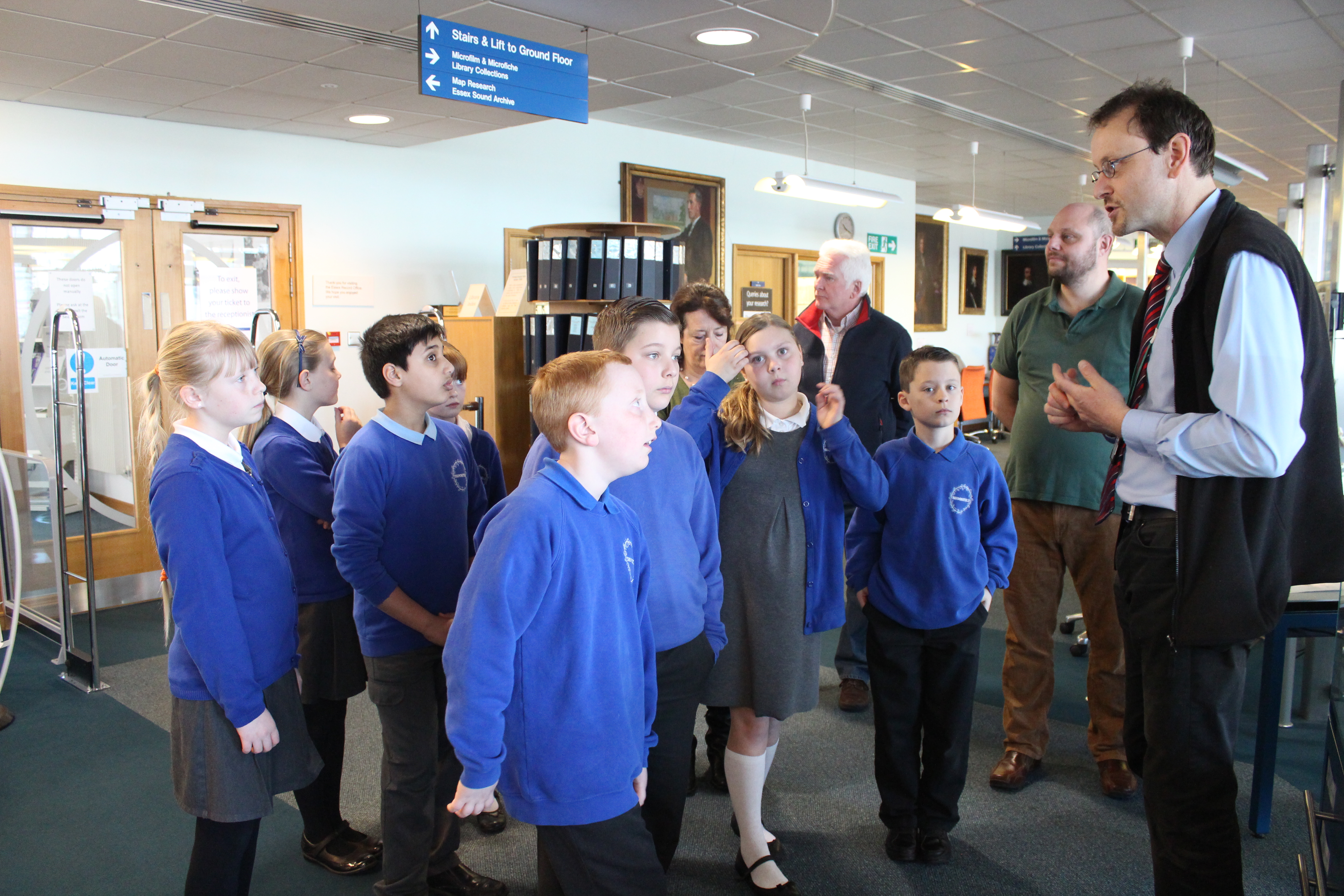
They have this website called Seax (a Seax is an Anglo Saxon stabbing sword and on the Essex County Council logo, the swords are Seaxes).  The website called Seax helps you to find documents VERY quickly and efficiently.  We searched for ‘Maps of Broomfield’ and it came up with 113 results.  The earliest was made in 1591 and the latest was made in 2007. To search, you type in the key words, and then it shows you all the search results with the key words in date order.

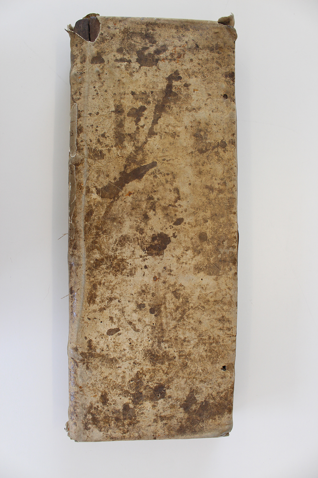
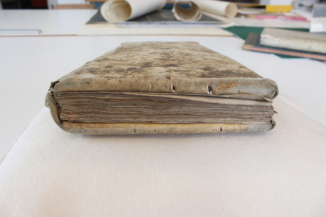
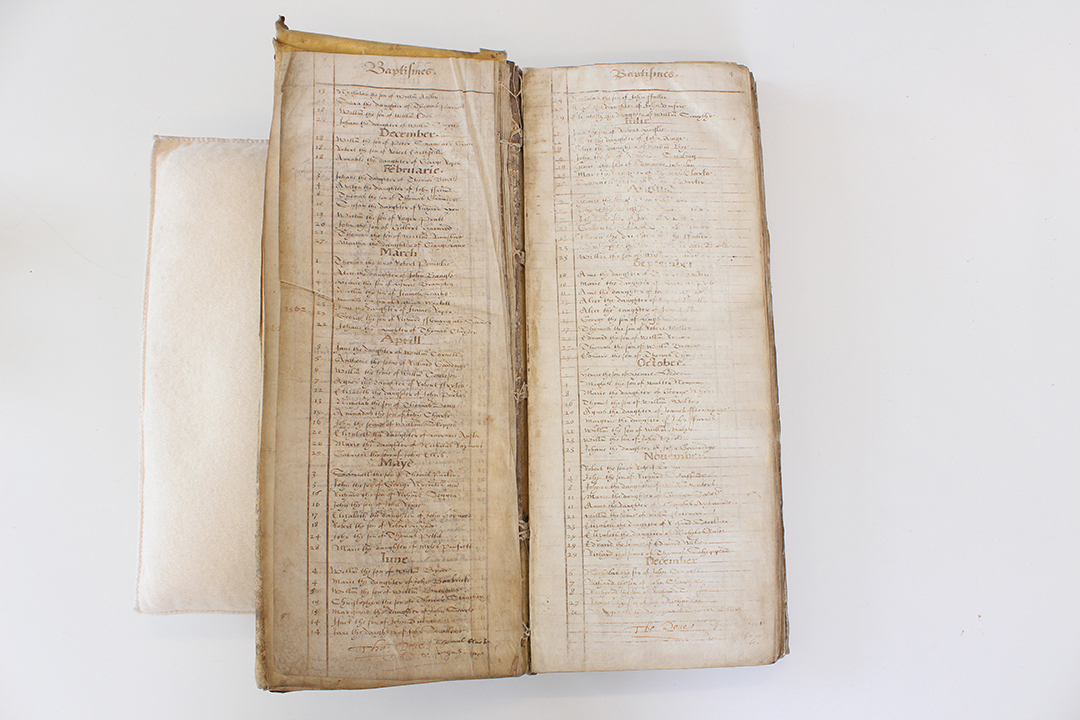
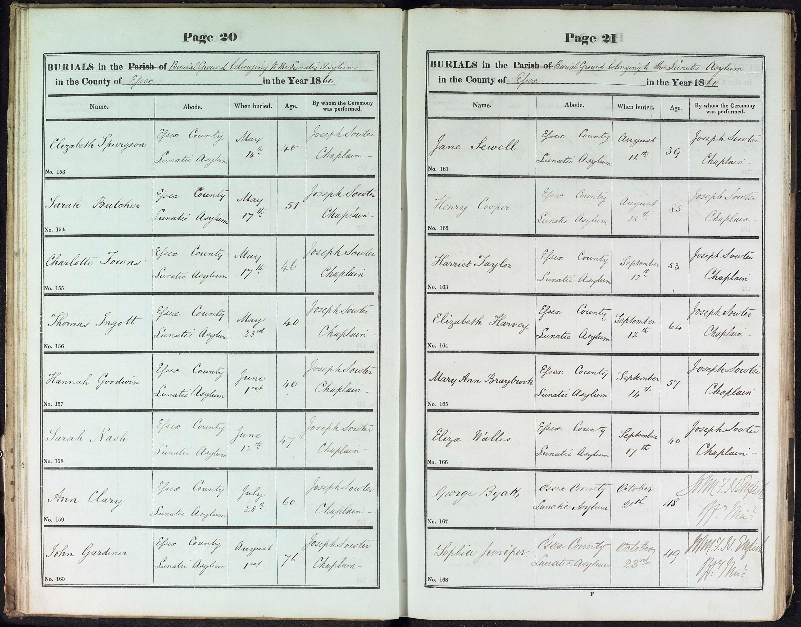
Hannah then informed us about a pie chart that someone made from the information in a book called a Parish Register which had a list of Births, Deaths or Marriages.  Somebody looked at details telling us about deaths in the 1830s.  We were shocked to hear that over half the people died under the age of 10!!

We definitely realised that Seax was helpful, especially for people who live overseas and love historical documents, because anyone around the world can ask for things to be put on there.  It is much cheaper than travelling to the ERO, but it was more fun to go there for our visit.

After we observed the picture-perfect painting of James I [ed.: on display in the Searchroom], Hannah told us that when monarchs wanted portraits of themselves, they would have chosen props that represented them. For example, Elizabeth I chose a globe to show she has invaded different nations. We should look for clues in paintings, not just at the person who has been painted. IMG_5800 
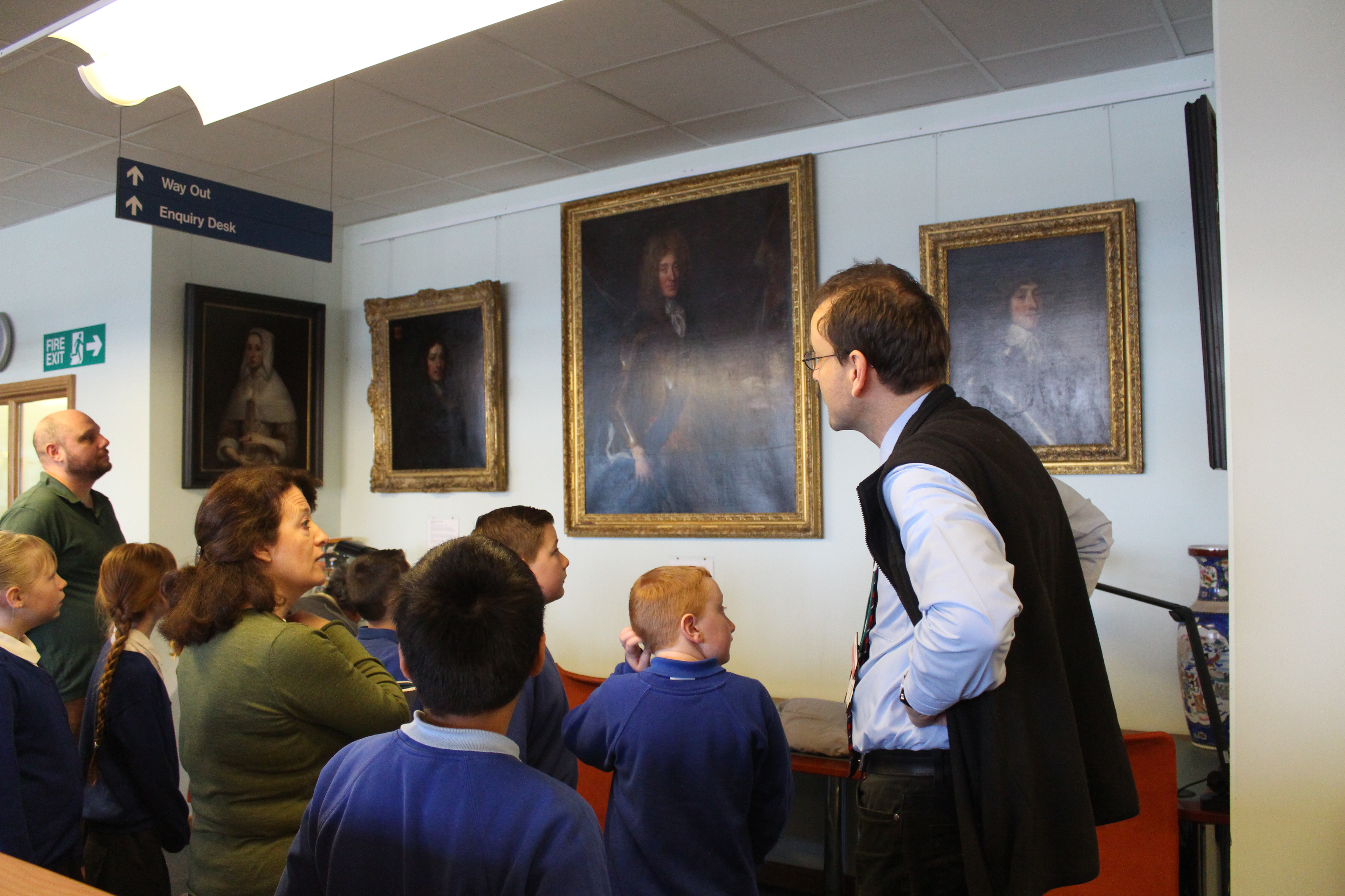
Next Mr Wiffen pulled a draw out full of envelopes and picked up a microfiche, which is miniscule pictures of wills and newspapers.  The reason why the newspapers are made smaller is because you can keep lots of information on a small sheet of film and the big news paper takes up a lot of room, is very thin and will disintegrate. You have to place the microfiche in a machine, so that when you look through, it will magnify and illuminate it big enough for people to read it. IMG_5807 
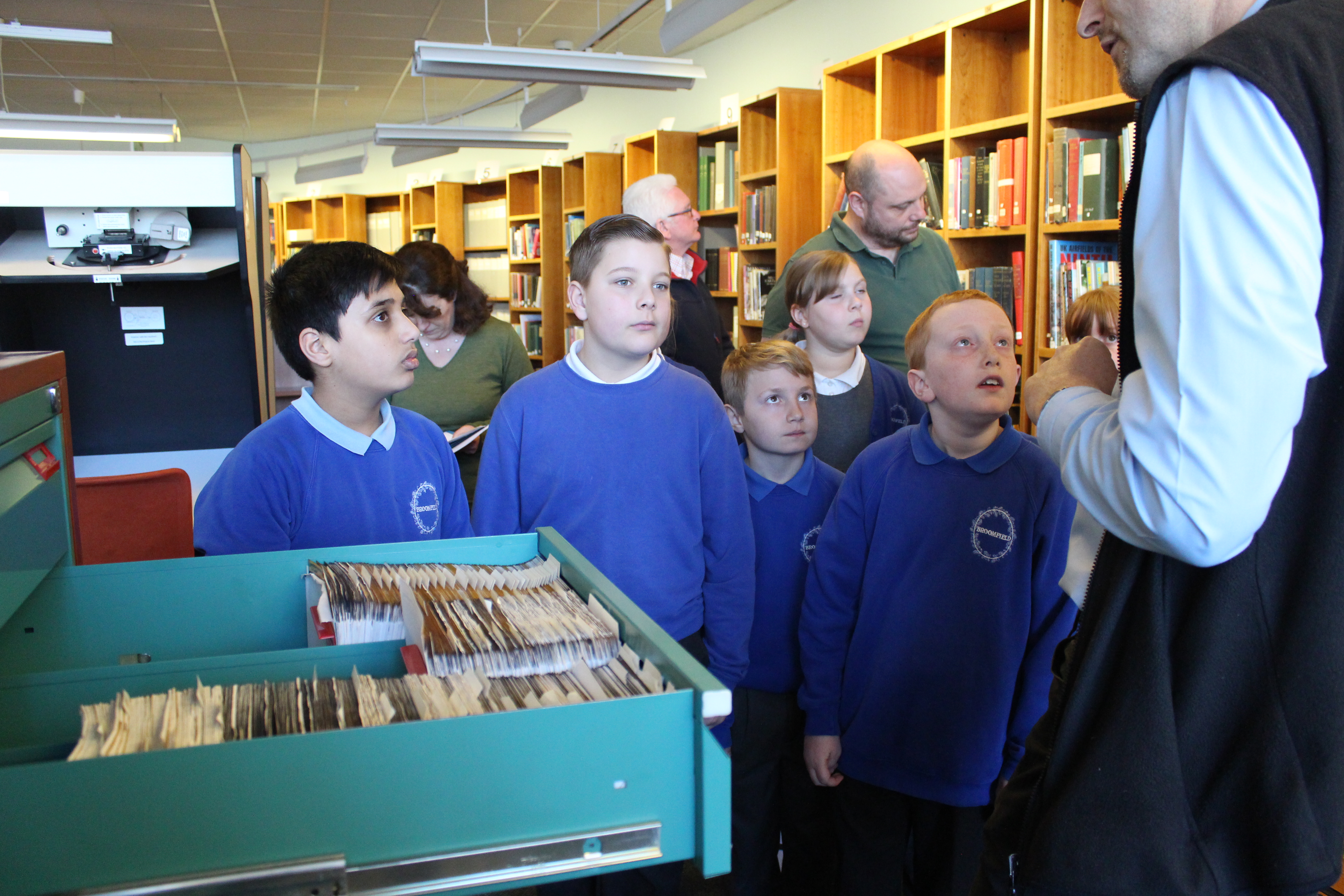
Mr Wiffen showed us a couple of unique maps of Broomfield in the past. The first one we looked at was from 1846. It was an enormous map and Broomfield looked empty and lonely, with fewer houses and more greenery.  We found that our school and houses had not been built yet. We put our fingers on our invisible houses. Bromfield Hospital was not there yet either, but the area where it would be built was called Puddings Wood. IMG_5832 
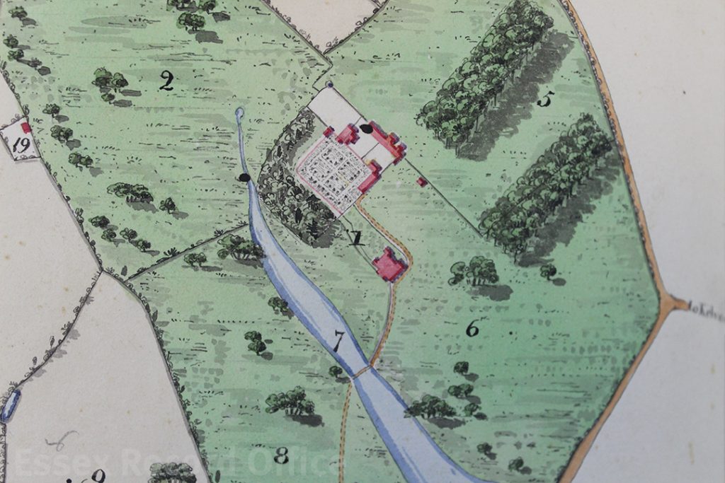
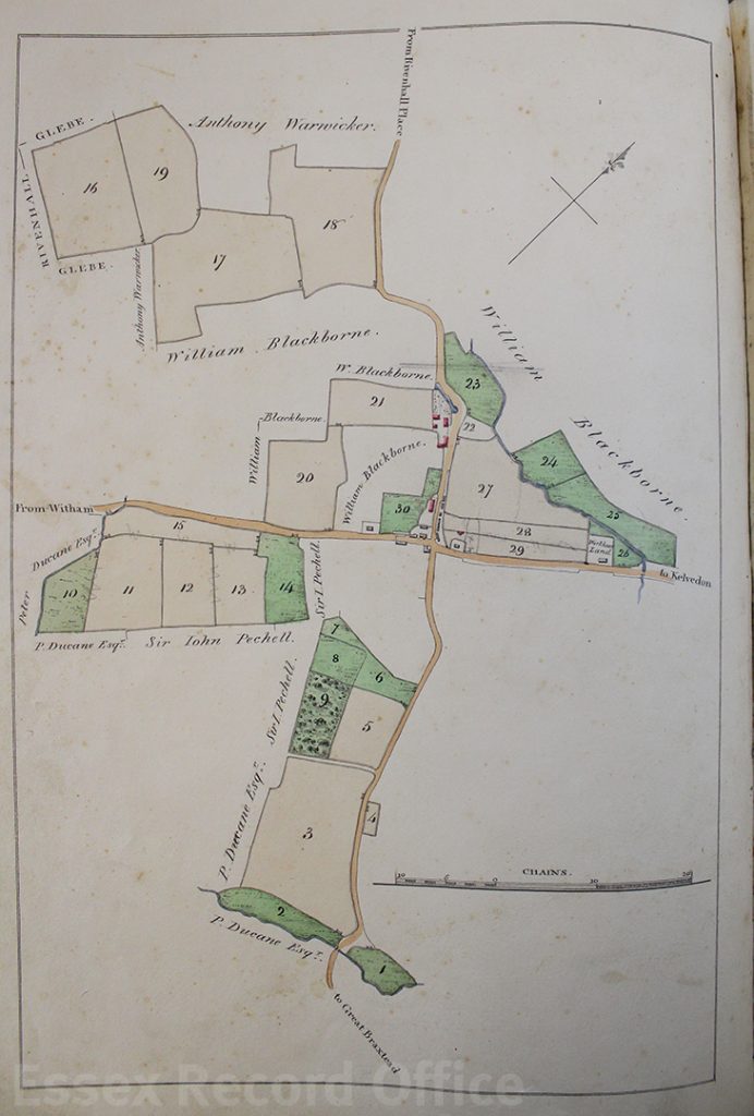
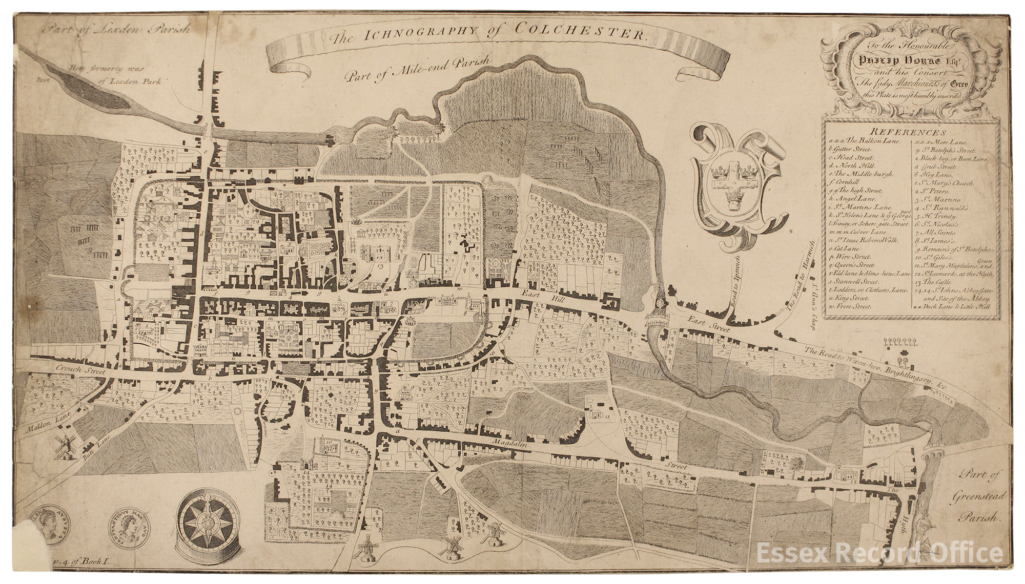
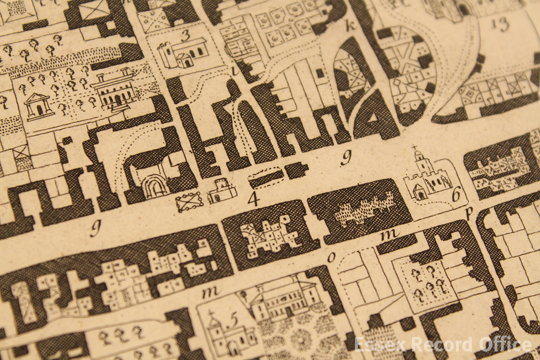
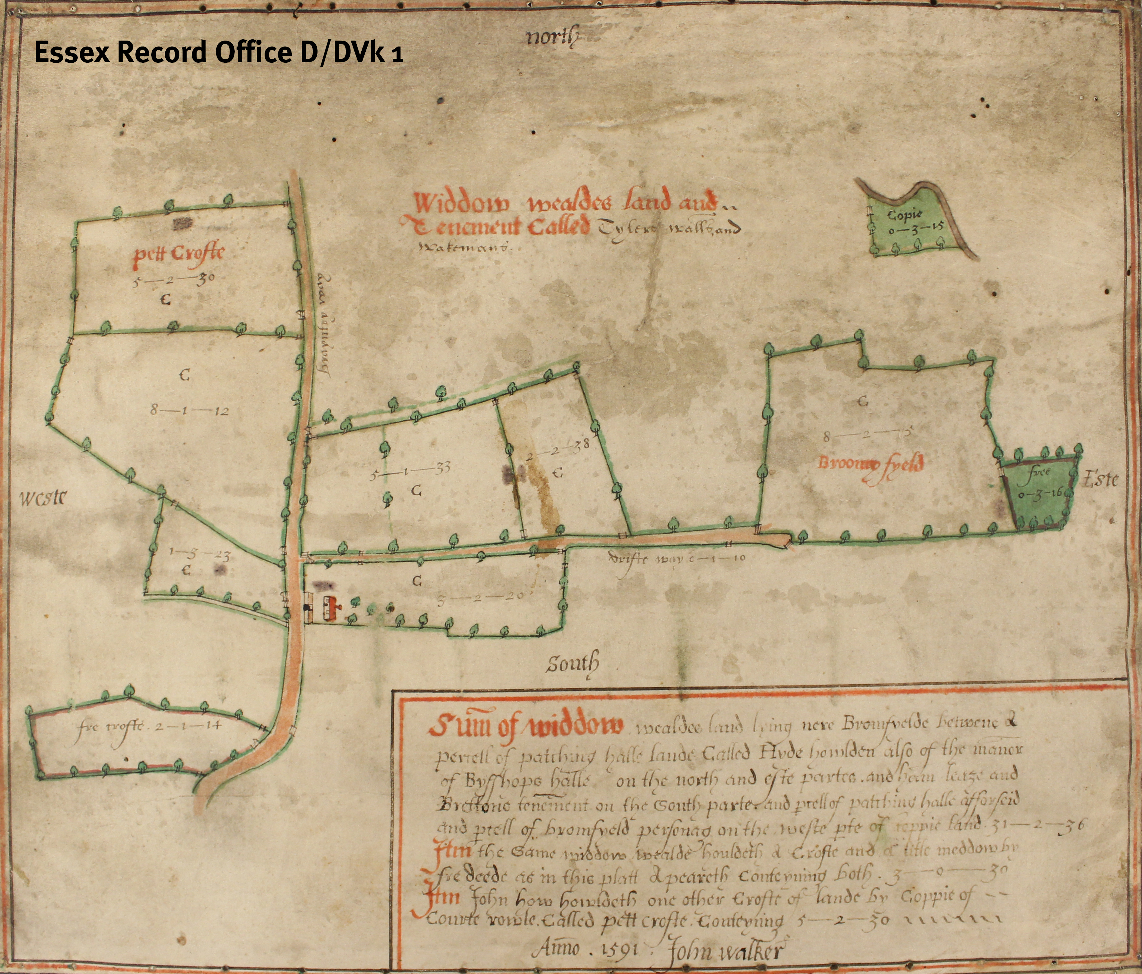
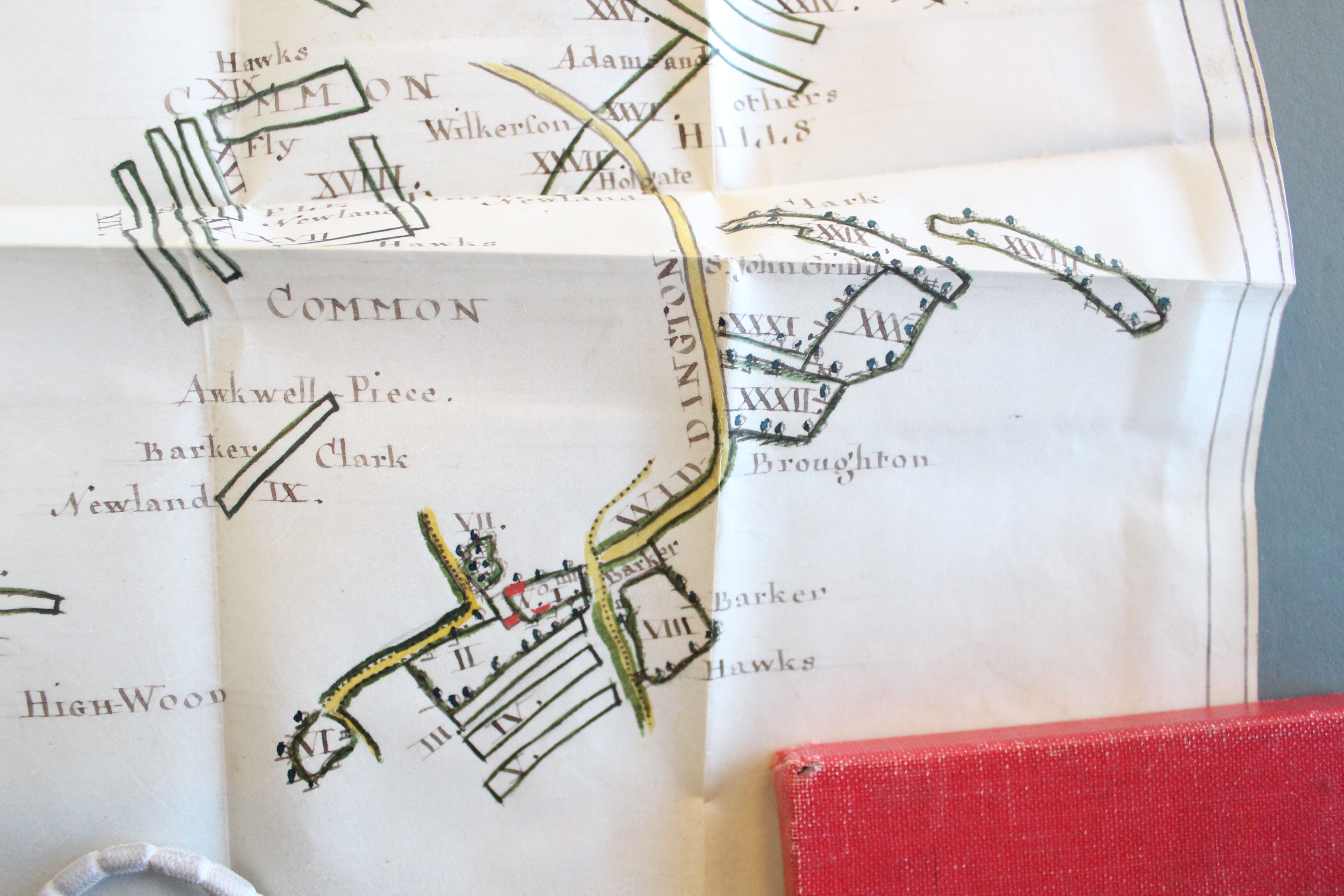
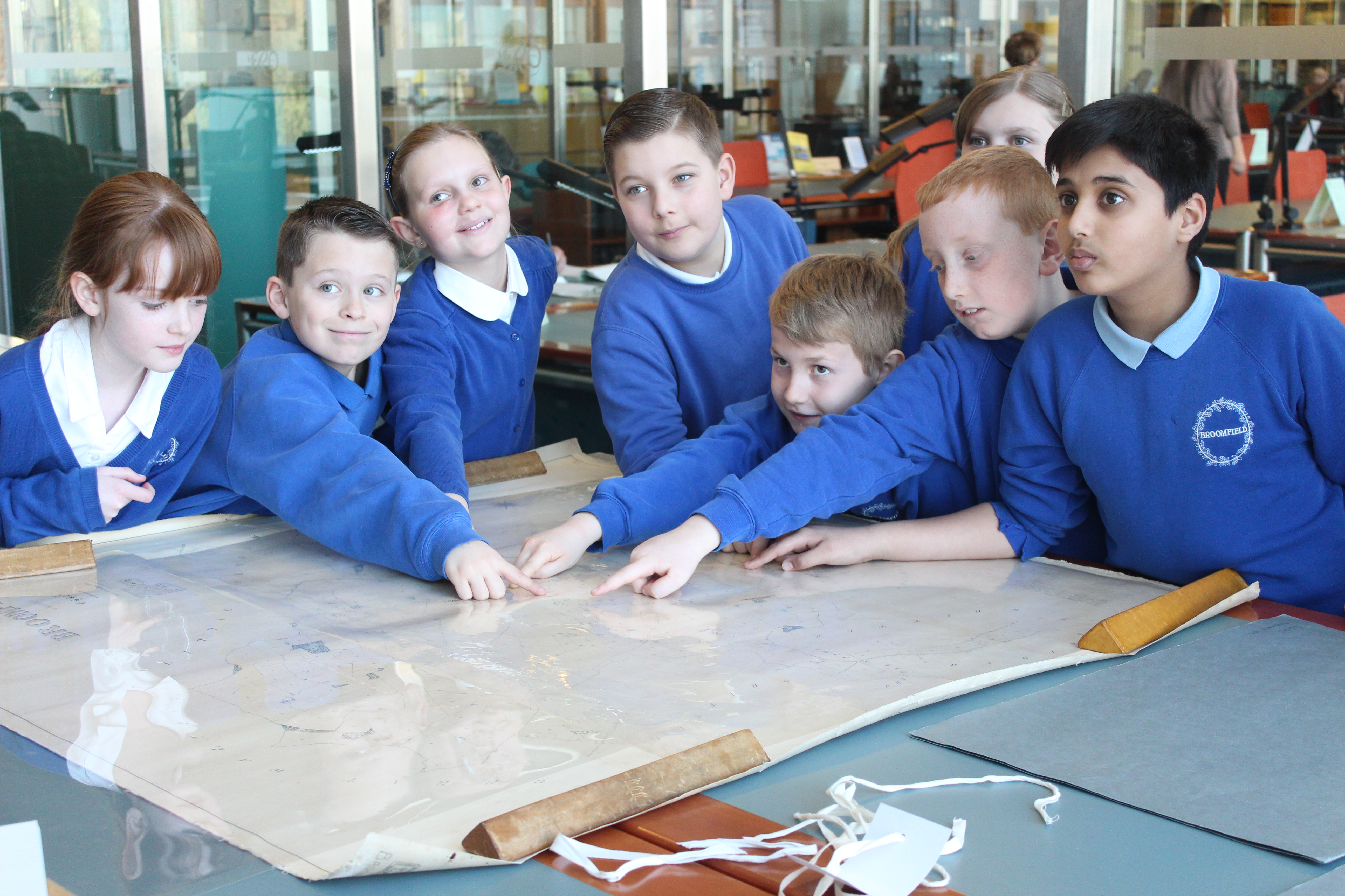
Then we looked at the earliest map of Broomfield which was made in 1591 by John Walker.We could see the beautiful colours to show the roads, houses and landmarks.  It was made for Widow Wealde and showed all of her land. D-DVk 1 watermarked 
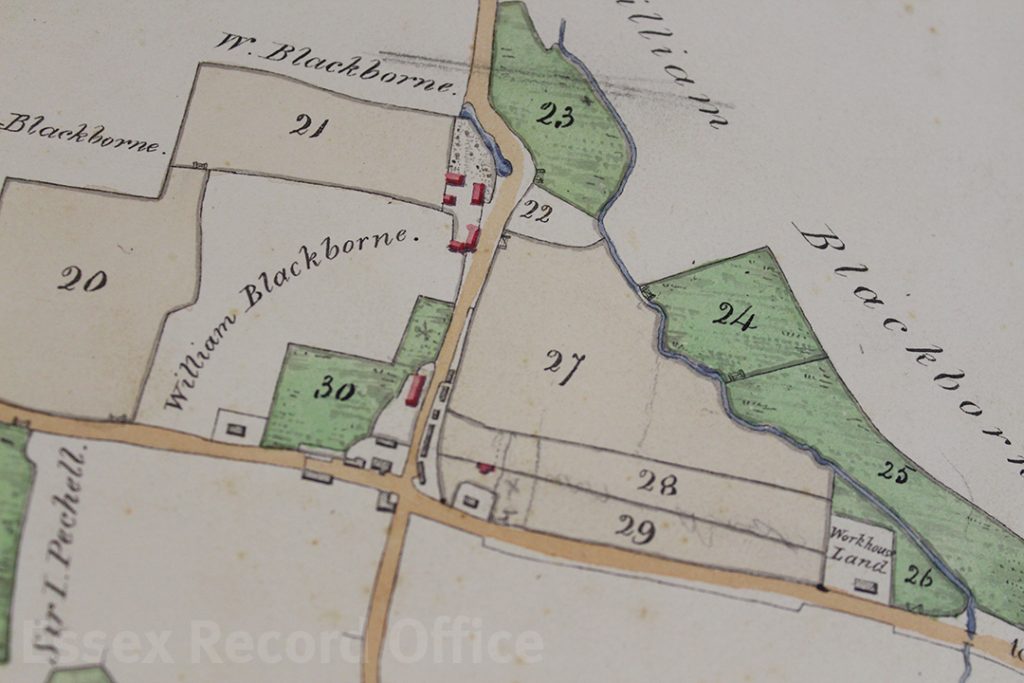
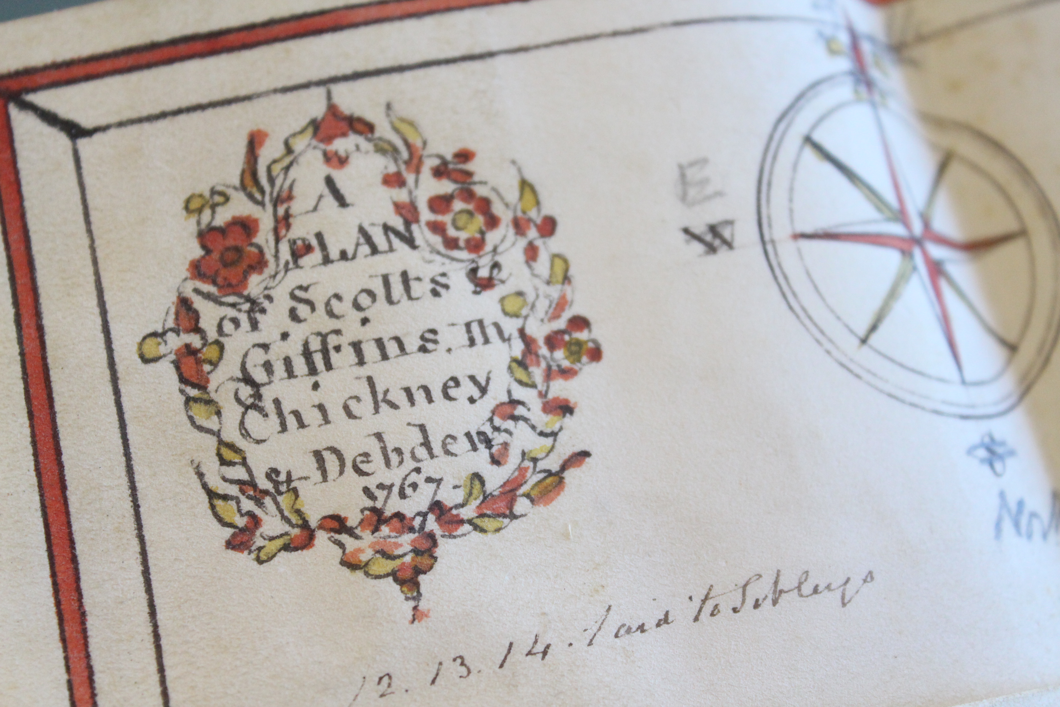
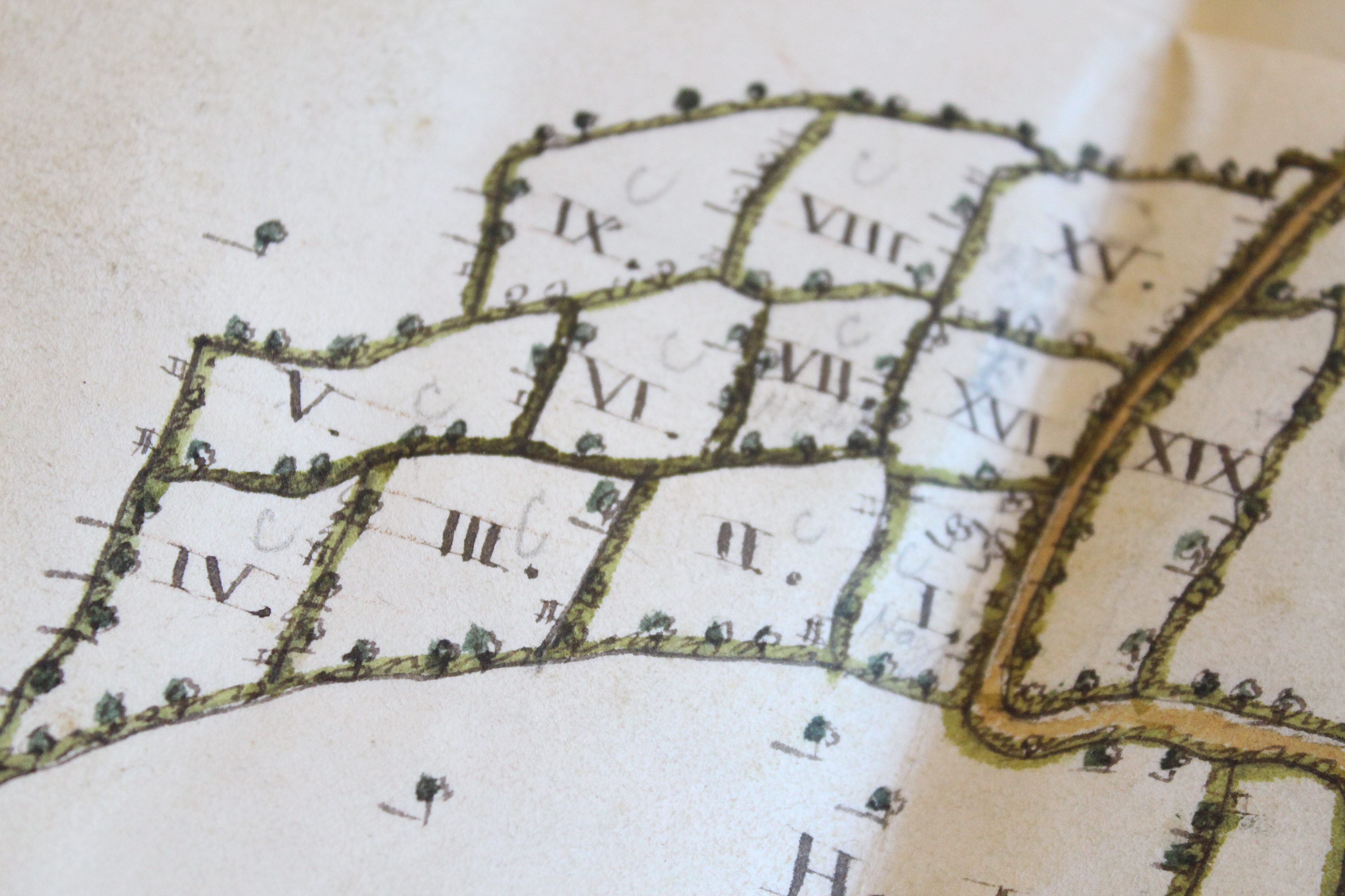
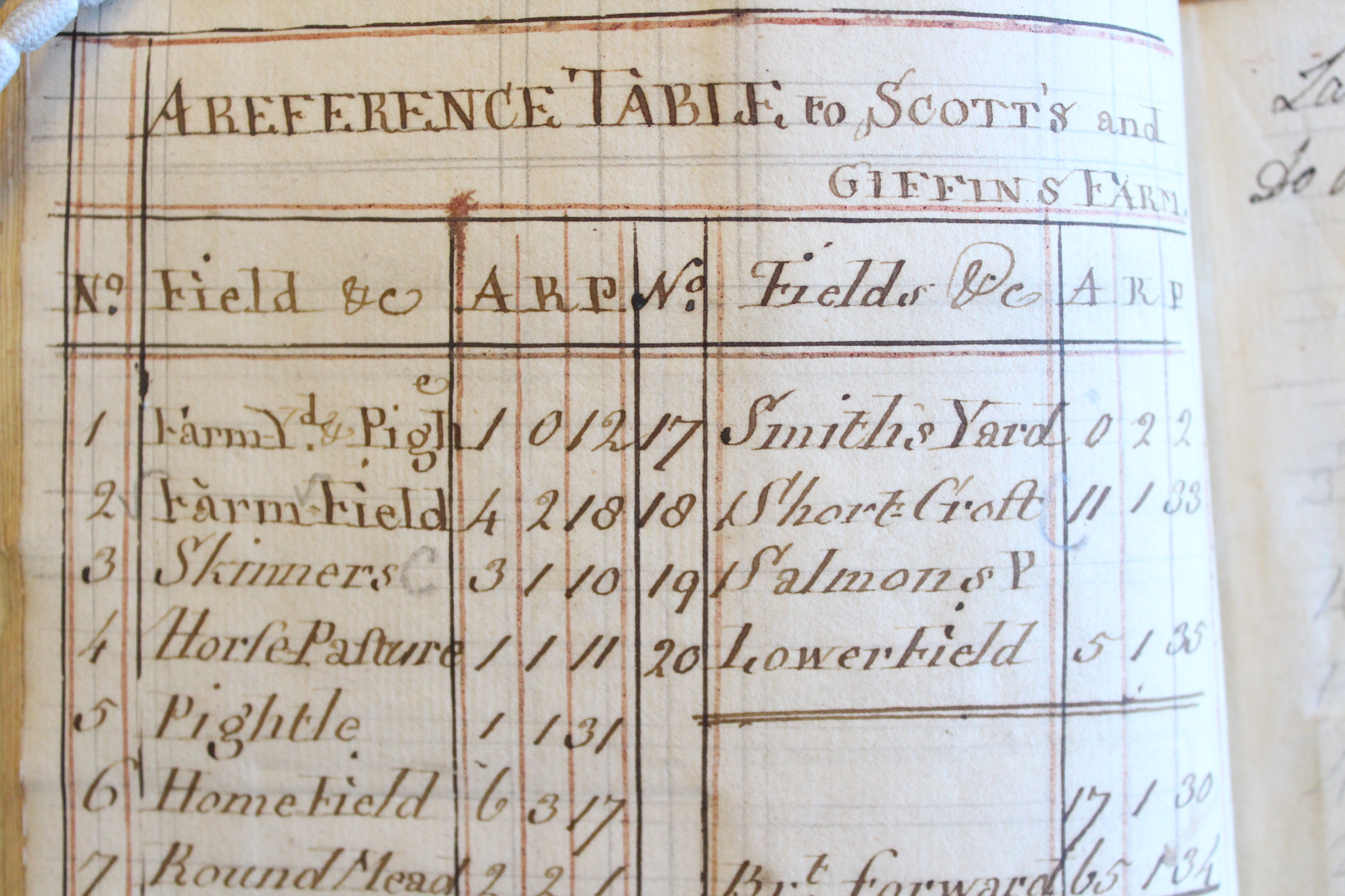
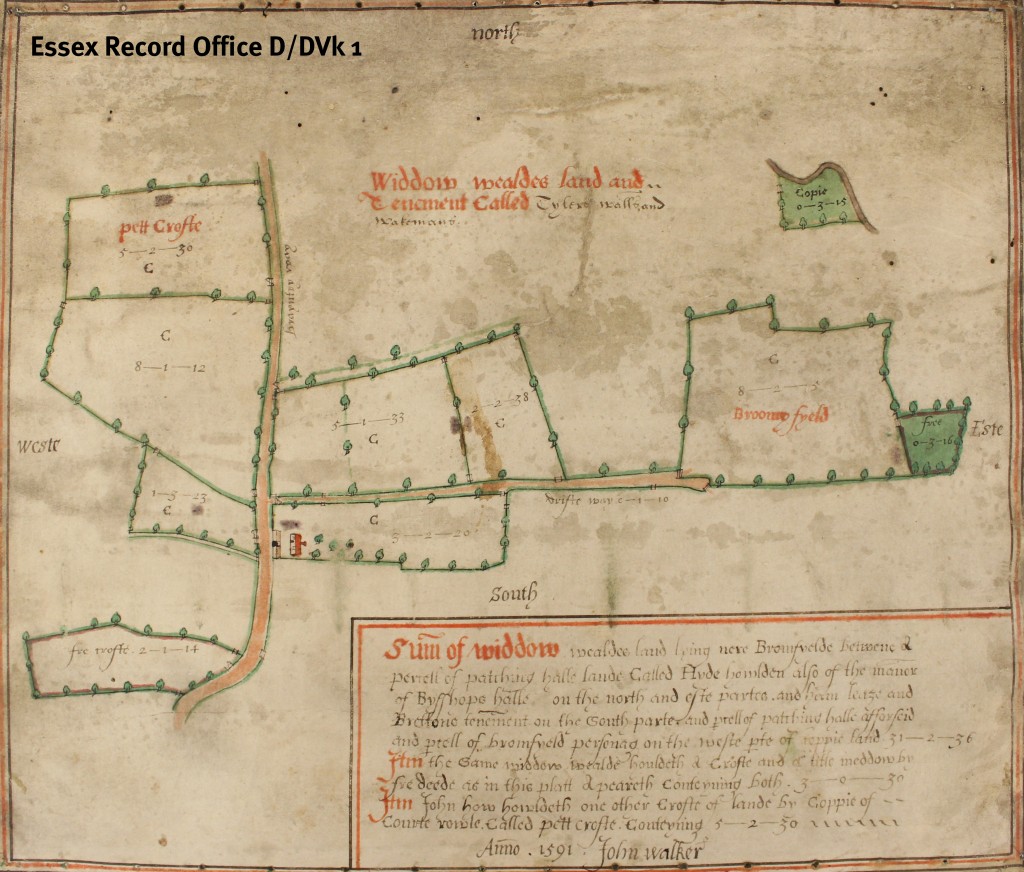
The next map we looked at was created and drawn by hand in 1771 of Broomfield, it is 244 years old. It showed a field called Drakes Fut, which is near our school.  It is now called Dragon Foot Field. We talked about a legend from 1,00 years ago.  Every day workers would build a bit of Broomfield Church and use strange red bricks and tiles that they found in the field.  But in the night, when they were sleeping, a dragon would take all the bricks and bury them back in the field. Imagine how the builders felt when the dragon took their building materials! They must have felt frustrated and scared. Nowadays, we know the bricks and tiles were made by Romans and there was a villa in that field. Bricks and tiles from the villa can be seen in the walls of Broomfield Church.

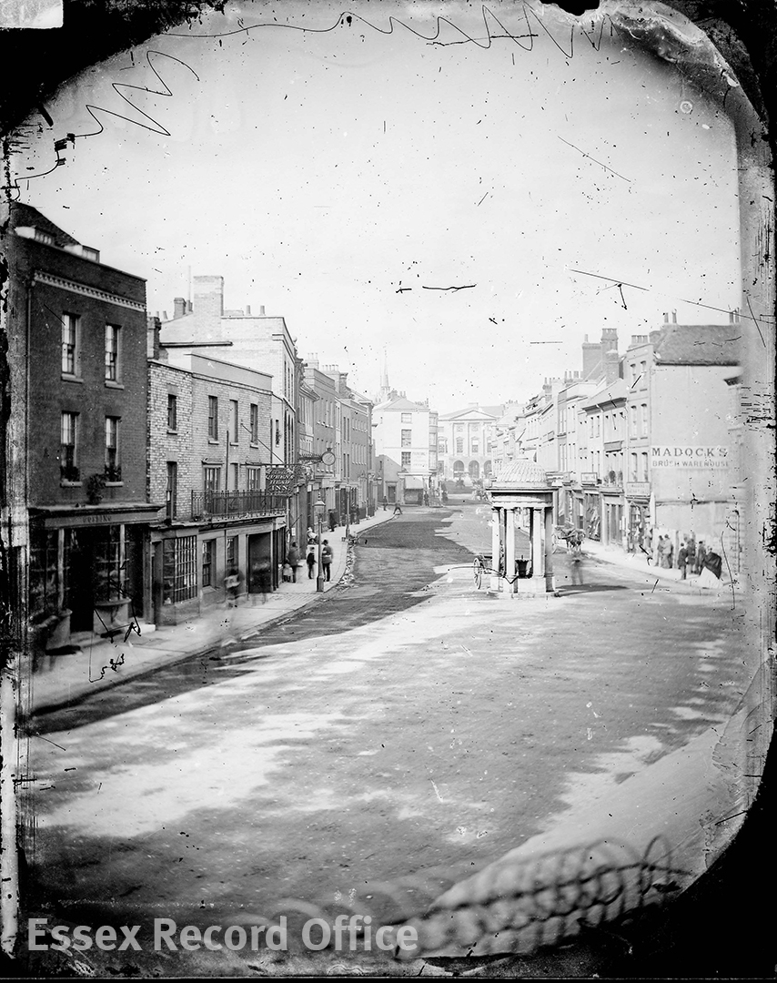
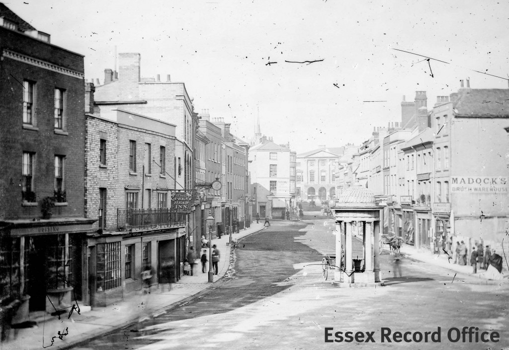
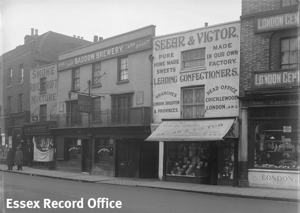
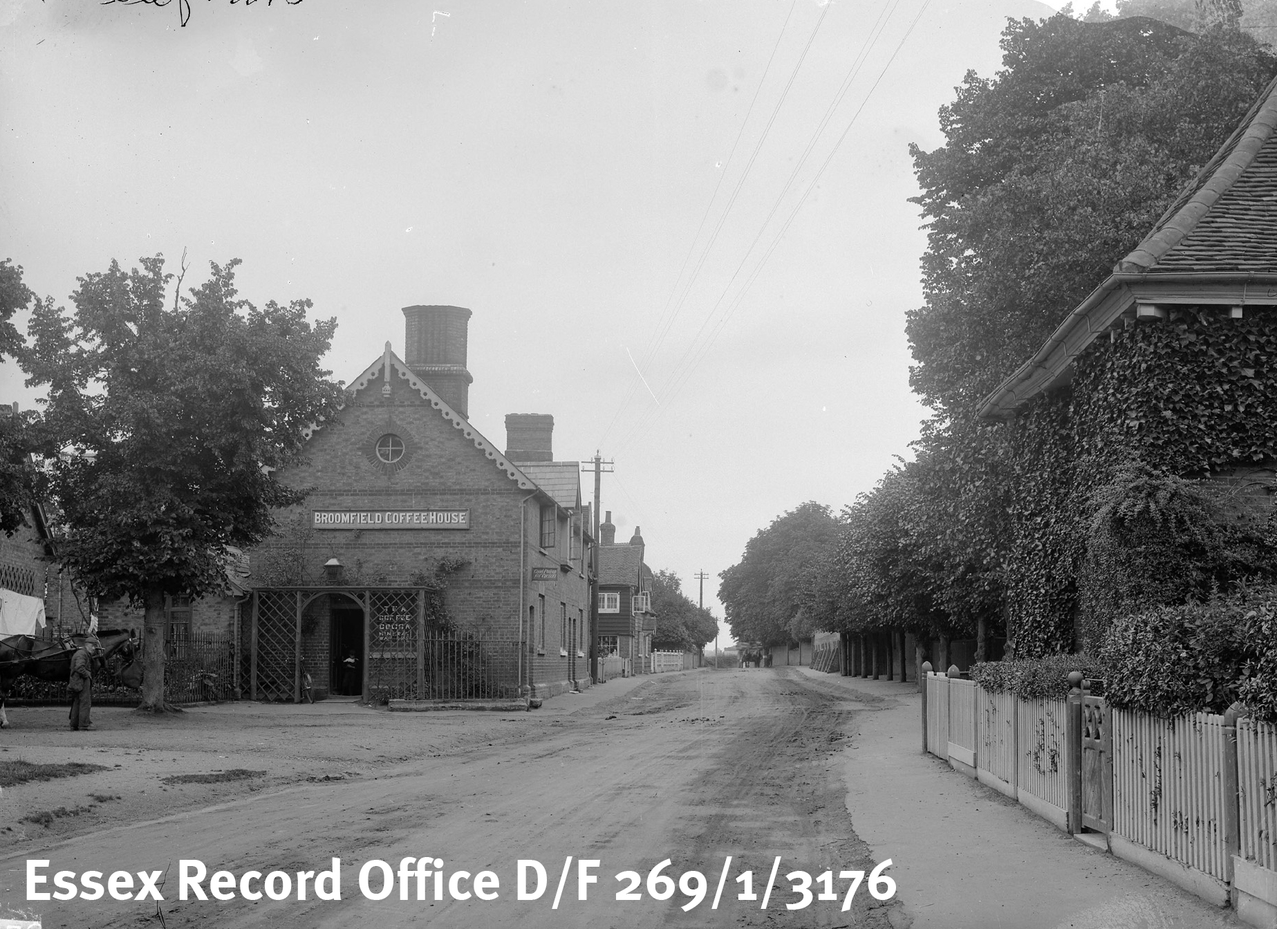
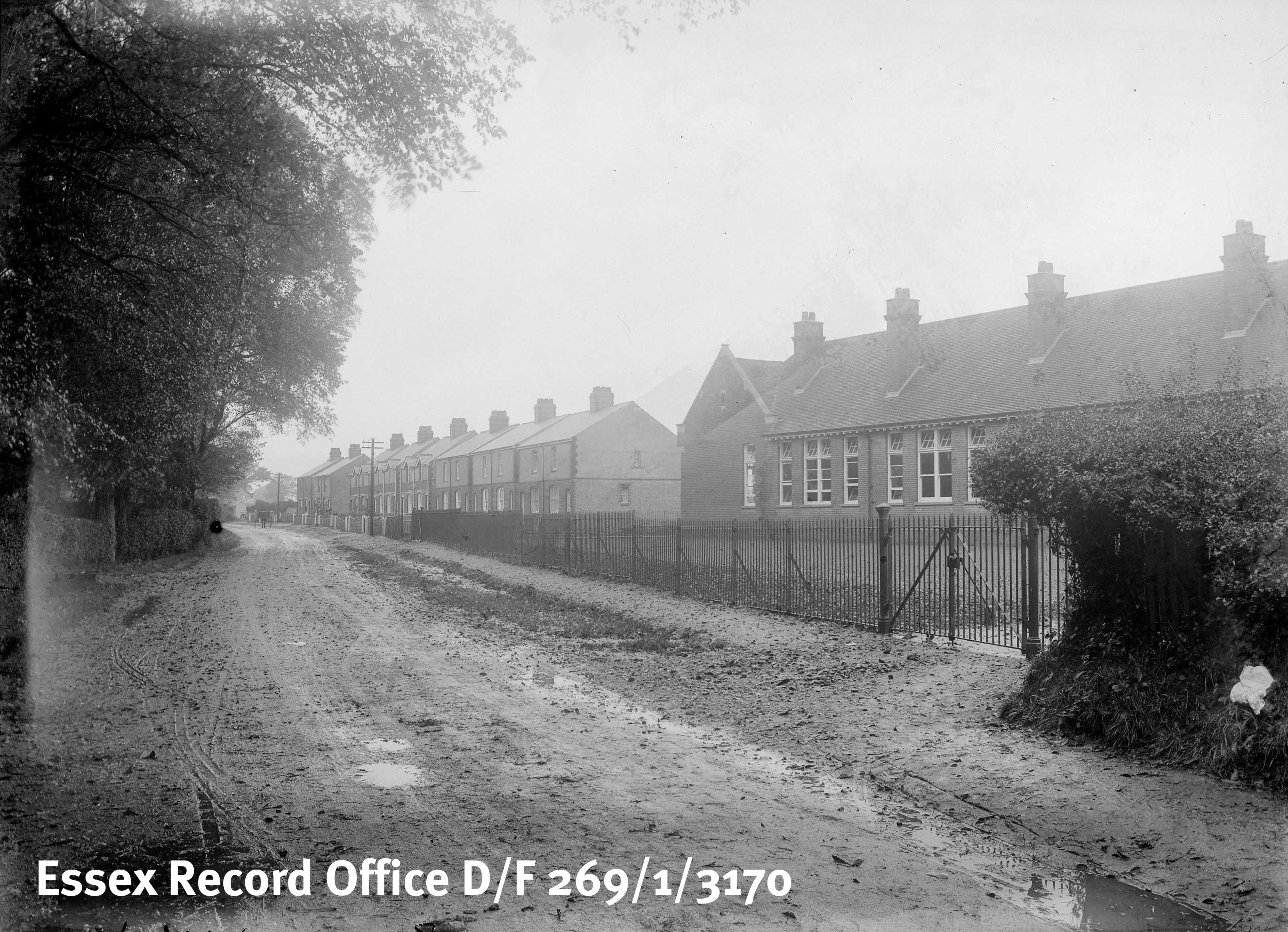
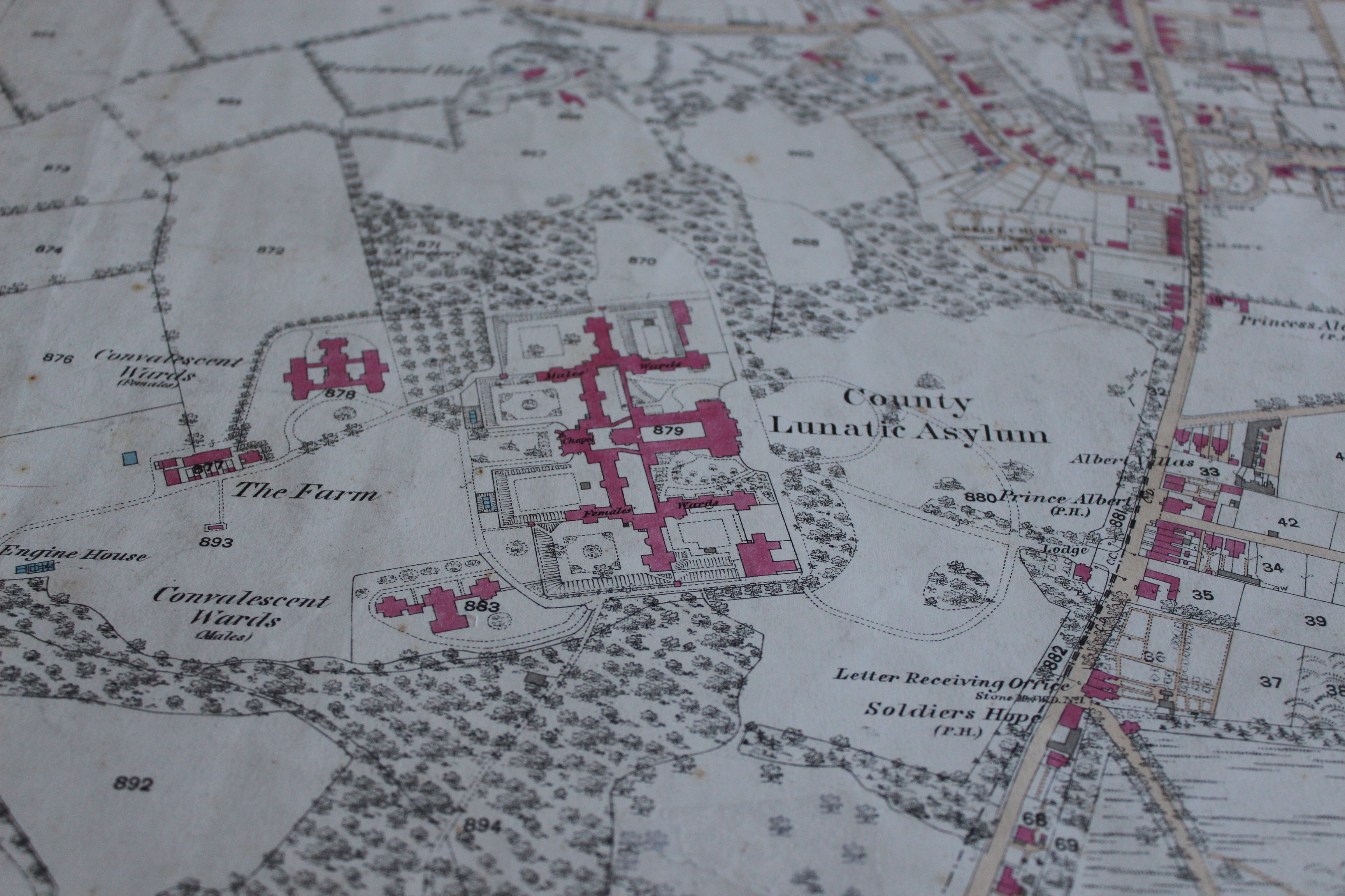
Shortly after, we were showed a map from 1919 in Broomfield. There were 2 coffee shops and here is a photograph to prove that it really did exist.  We were surprised that people used to go out for a coffee, just like we do today.  Coffee shops were there to stop people from spending all of their money in the pubs. But even 100 years ago there were no roads, just mud. The road outside Broomfield Primary School was just mud too – and it looked VERY muddy.

D-F-269-1-3176

One of Broomfield’s two coffee shops (from the Fred Spalding Collection)

D-F-269-1-3170

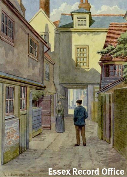
Broomfield School and a very muddy unmade road (from the Fred Spalding Collection)

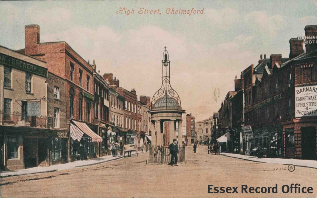
There is a pub called The Saracens Head on the High Street in Chelmsford.  We saw a photograph if it showing the American soldiers who used to go there to interact and relax. Back in the Second World War, Mr Wiffen’s dad (who lived in Broomfield) had heard planes fighting overhead when he was a boy.  Would you like it if bullet cases were falling on your shed?  That’s what he could hear, but he was probably in his Anderson Shelter.  Forty years later, he found a spent bullet case (probably from those fights) in his back garden.

Broomfield has lots of things in the ground from different periods of history.  How would you feel to be standing on history, or to never find artefacts that could be worth millions! We had an amazing time looking at the spectacular maps.

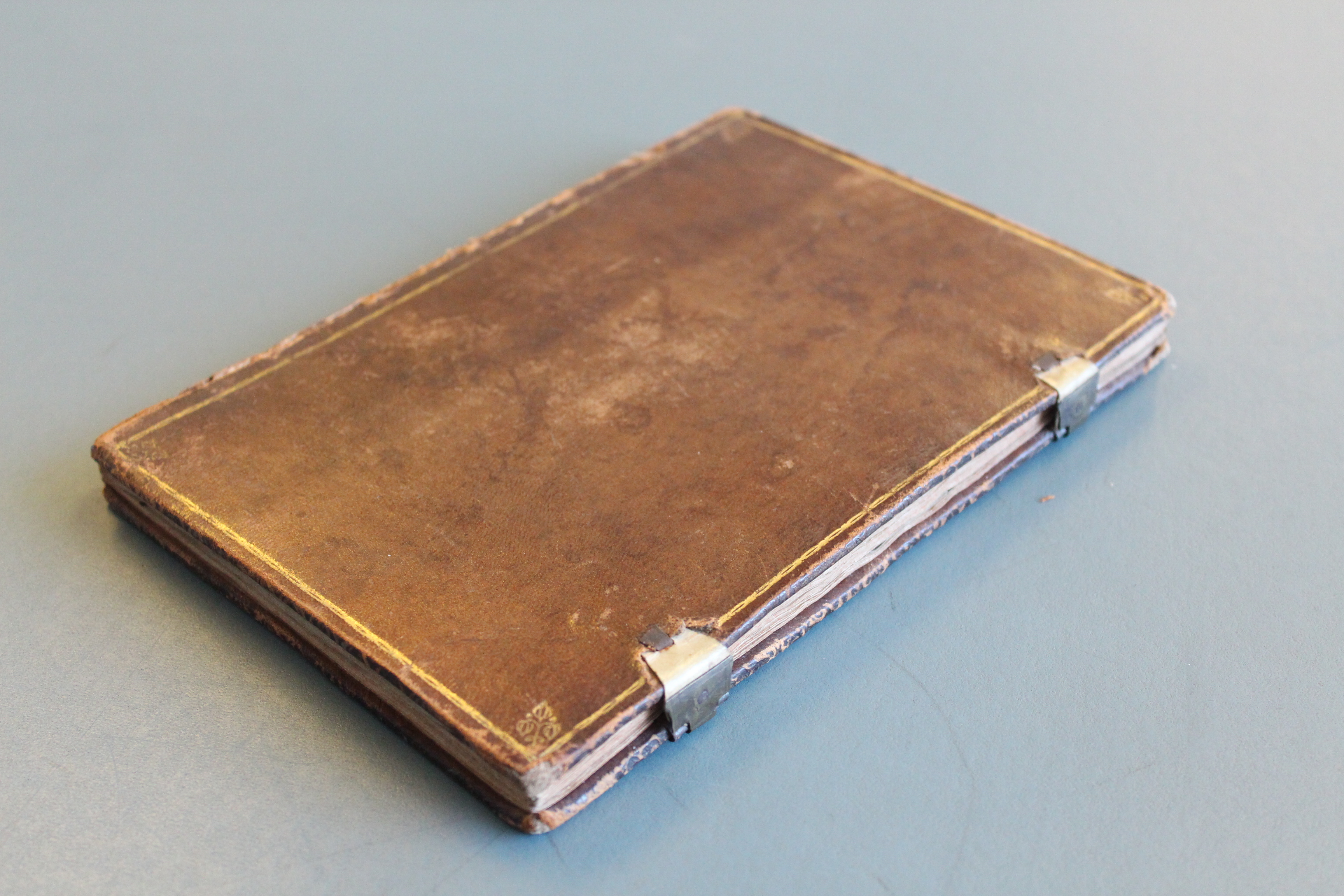
After that we carefully opened a box that was in another box with another padded cover.  Inside was a special bible that Charles I had before his gruesome and terrifying beheading happened. Somehow, Charles’s librarian Patrick Young, got his hands on it and gave it to his granddaughter Sarah who gave it to the Broomfield Church. IMG_5880 IMG_5883 
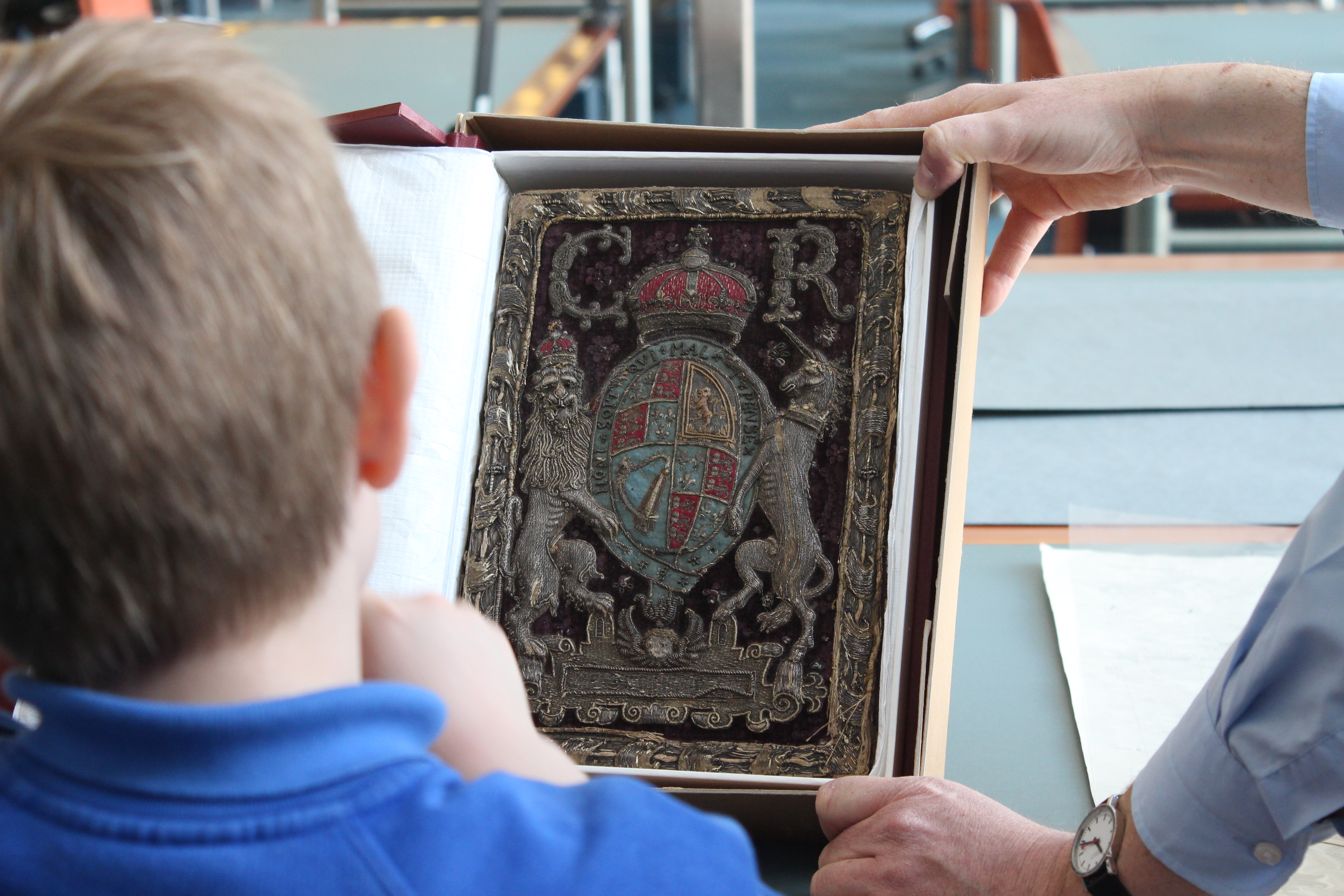
When the Church was being renovated, apparently the builders dropped it by accident!  They decided to give the responsibility to the ERO to protect the Bible forever. The Bible has an amazing silver outline with a glorious red velvet cover, decorated with a lion, a unicorn, a crest of arms and initials. IT MUST’VE COST MILLIONS!!!!!  The lion was very detailed with tiny silver stitches – the mane swerving in different directions and the ribs and claws very clearly seen.  He has two beady bead eyes.

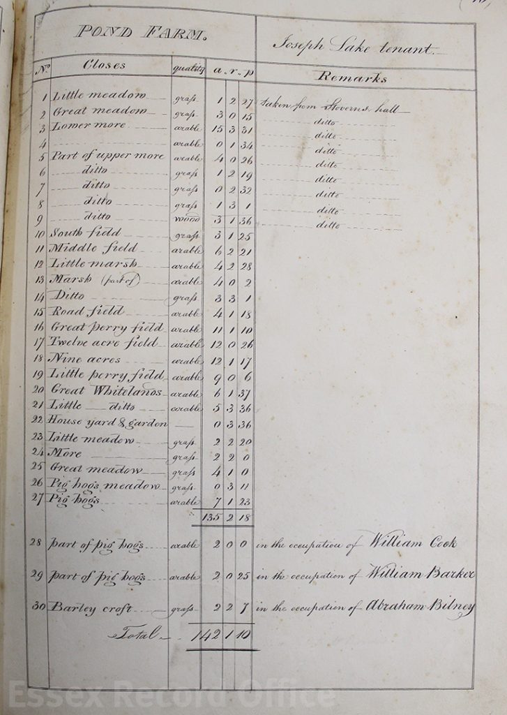
The ERO looks after Log Books from different schools, and here is a page from Broomfield Primary School in 1912.  The book sat on a special pillow to protect the spine and showed the beginning of the school summer holidays.  the school was closed so that the children could go and help with pea picking for the harvest.  Food was important – everyone needed to help collect enough food to get through the next winter.  That is why we have six weeks off in the summer.   Luckily we don’t actually have to pick peas any more!

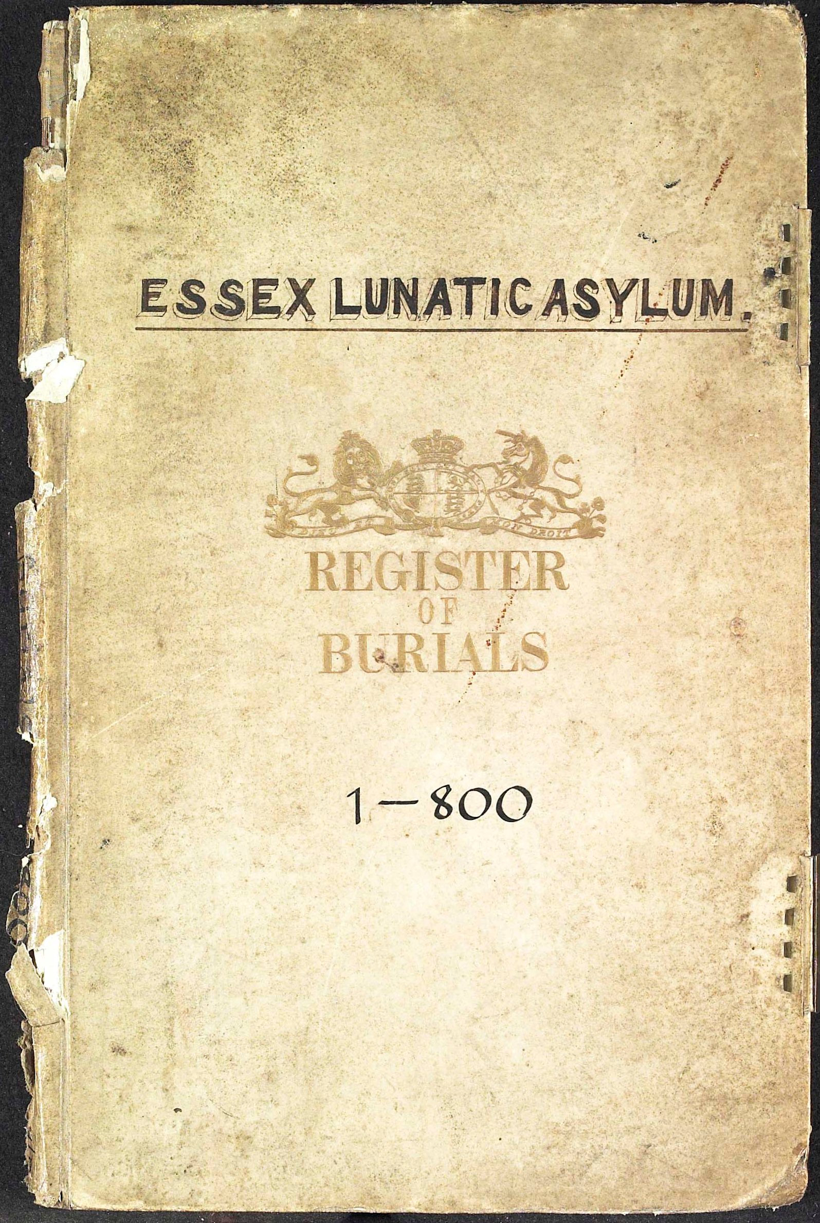
Eventually, we reached the storage room after a long walk from the library. The storage room keeps all of the documents and old books safe. The humidity and temperature was cool enough to preserve them for even longer than usual. To access the room, Mr. Wiffen had to scan his staff card in a laser. We had to be quick going in because the door shut after 30 seconds!

As soon as we got in we felt a lot cooler and looked at huge rolls and lots of shelves and books. First of all, he showed us the stacks. These have codes on them to help staff find the right document quickly. They are moveable so they can fit more of them in. There are 8 miles of shelves altogether. He also told us that the red pipes let out a special gas during a fire to prevent the special files from burning.  Water would damage the documents, and so would foam, so gas is safer for the documents.  However, if the fire alarm goes off you have only 45 seconds to escape!

Next, Mr. Wiffen showed some precious packages, one of which was an Anglo Saxon document from 962 AD, written on parchment (Animal skin). They were deeds from Devon, part of Lord Petre’s collection. This is the oldest item in the collection.

IMG_5913

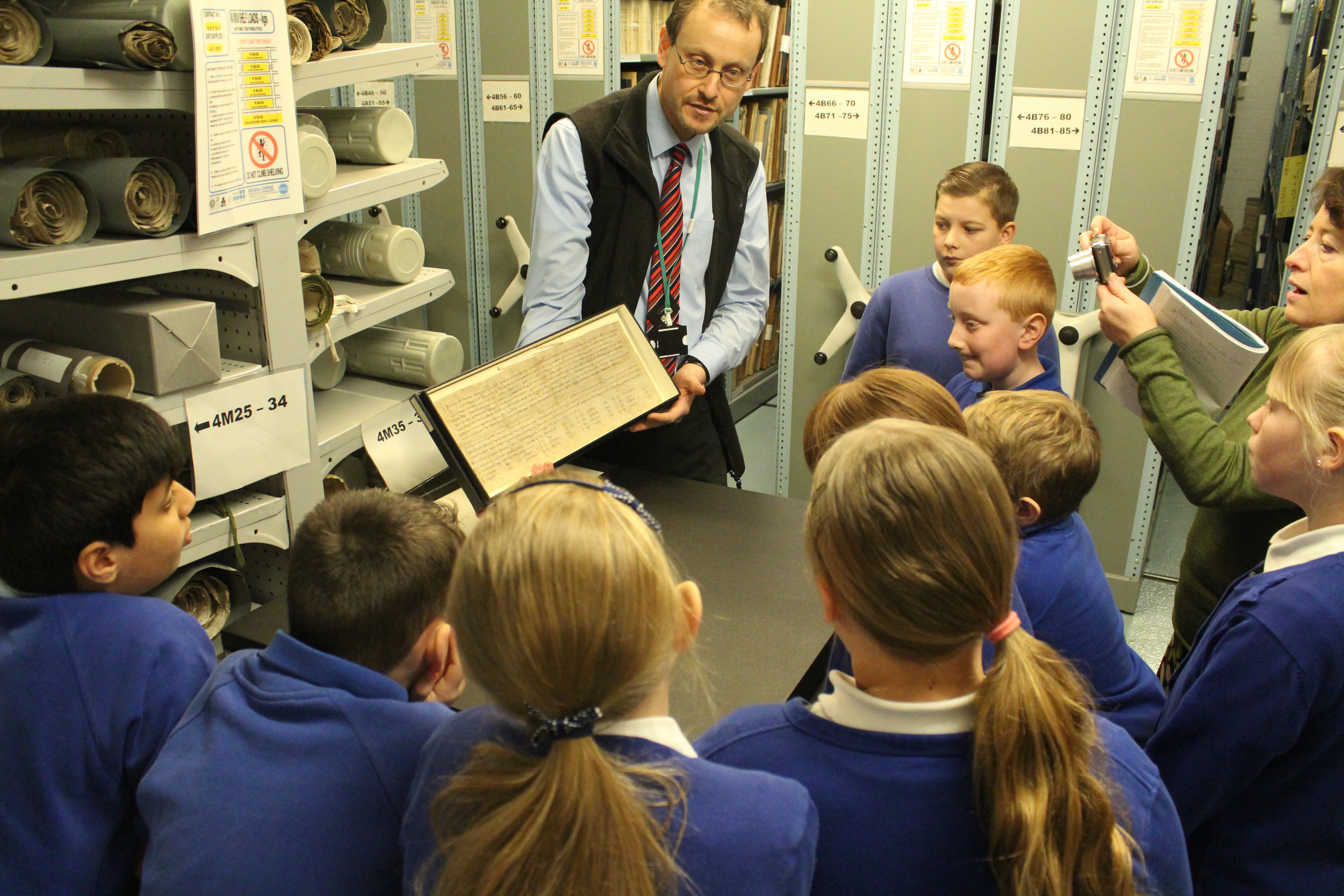
Looking at the ERO’s oldest document, an Anglo-Saxon charter from 962 (D/DP T209)

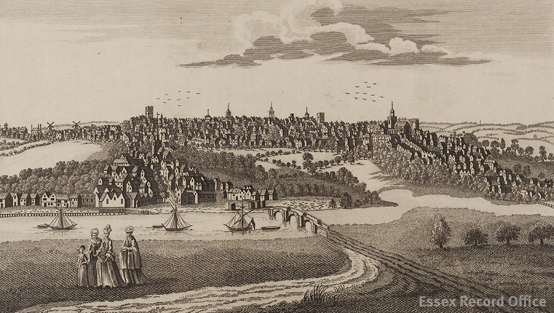
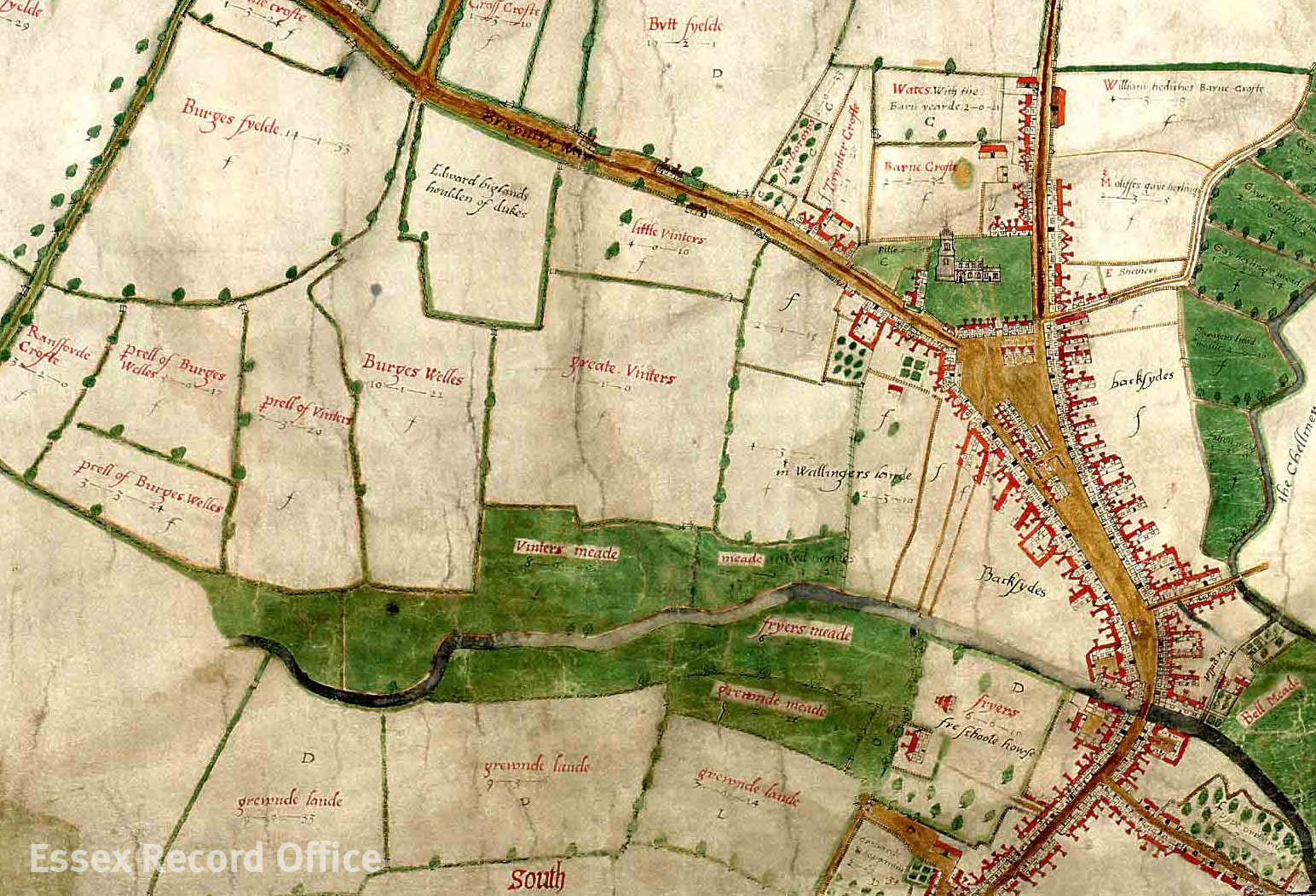
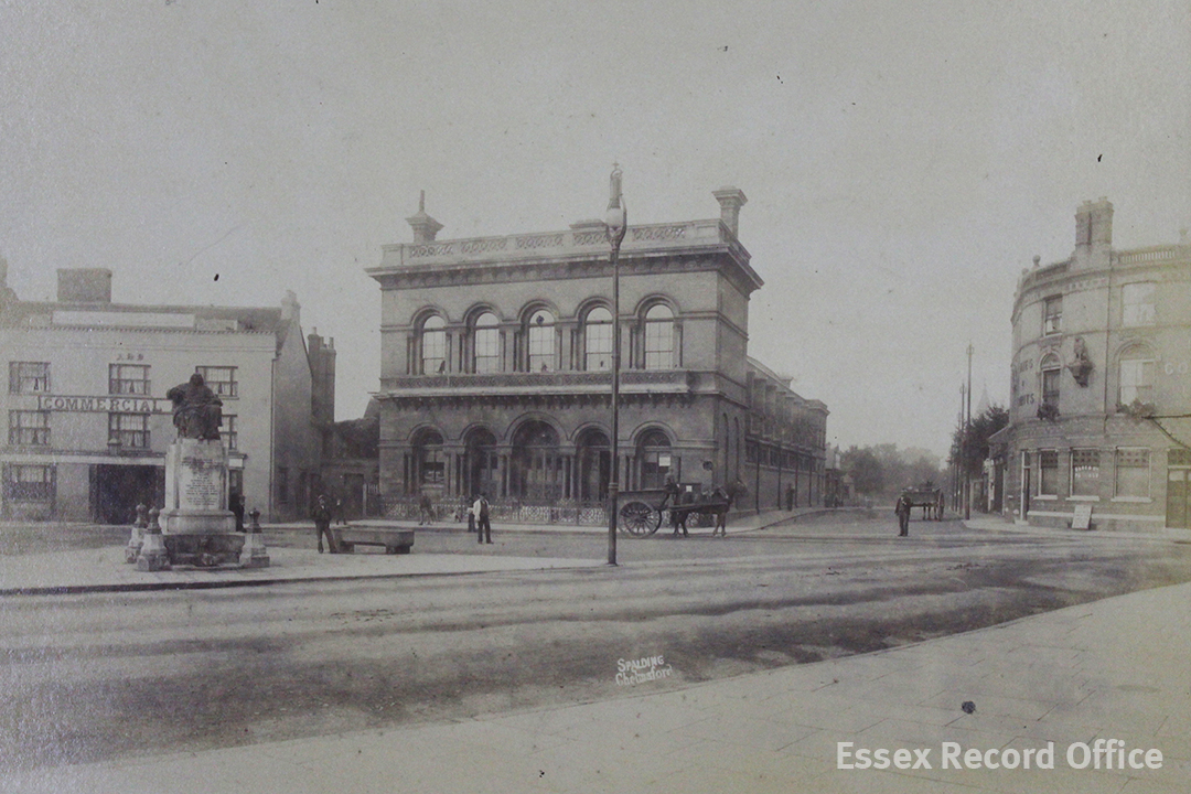
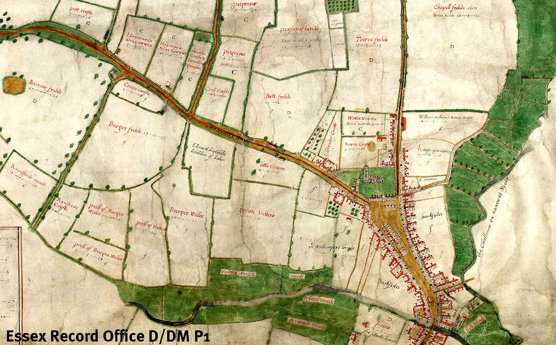
He then showed us a huge, hand drawn and hand coloured old map of Chelmsford from 1591, by John Walker. Even though it was old, the colours were bright and beautiful.  On the edge of Chelmsford, were two little lines to show the town gallows.  Who would have thought they would build grizzly gallows in such a beautiful town? And right behind the town centre was a field called the Back Sides, where John Lewis will be built!

John Walker's map of Chelmsford, 1591

John Walker’s map of Chelmsford, 1591 (D/DM P1)

Lastly, we scurried out past the timed doors and saw a strange thing.  It did look peculiar, but it was one of the camera’s dust covers: a chicken tea cosy! If you live in Australia and want a photograph of a document, they will use the really good camera to take an image and then send it to you.

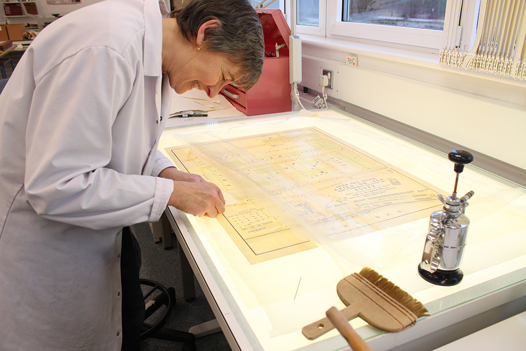
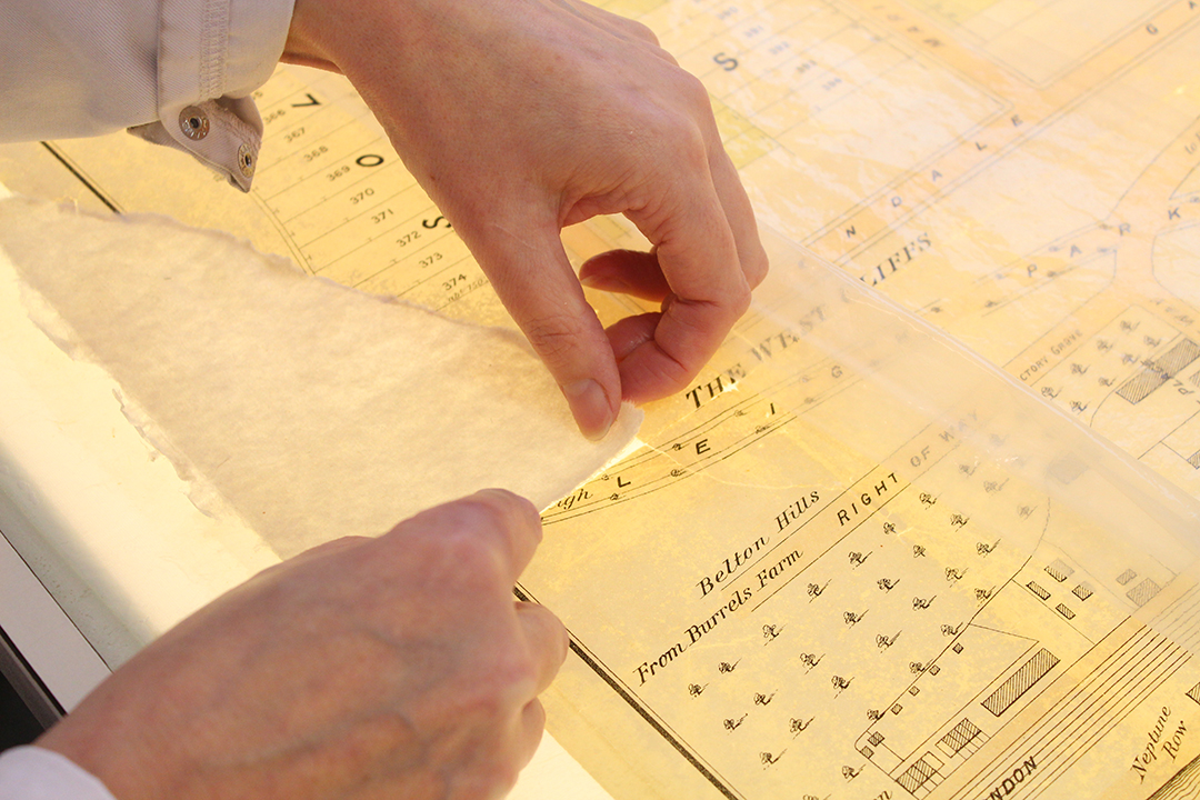
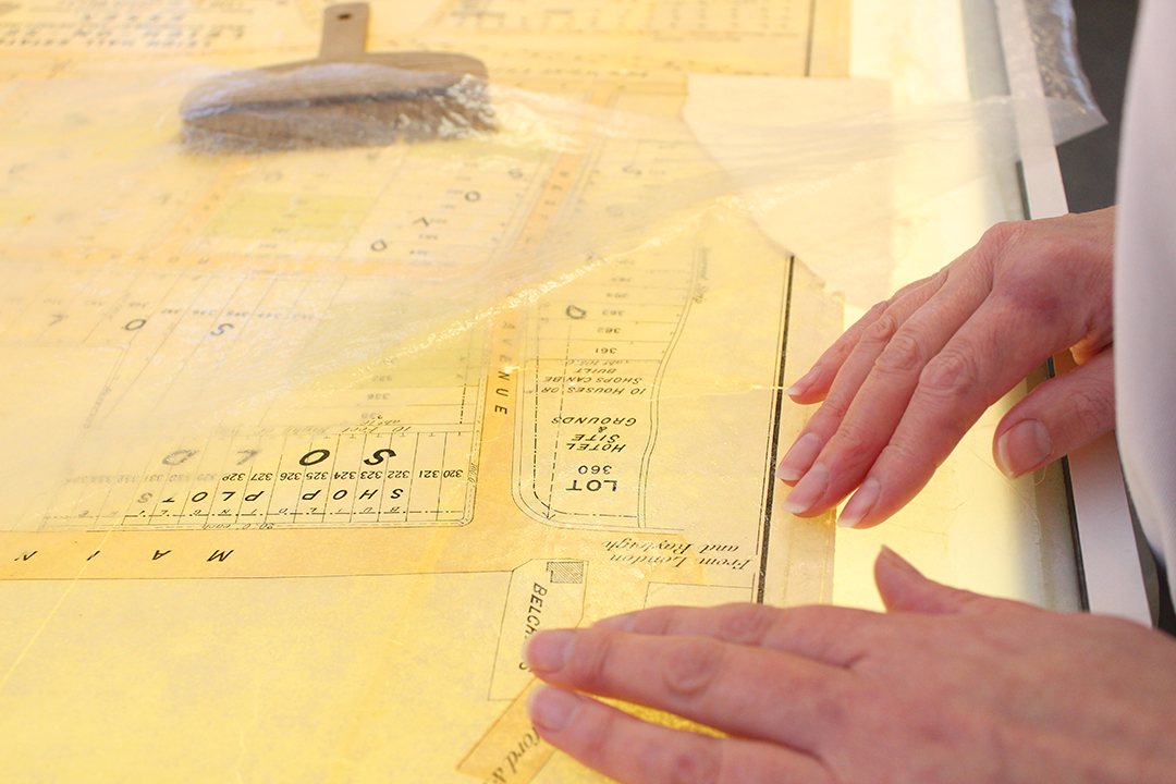
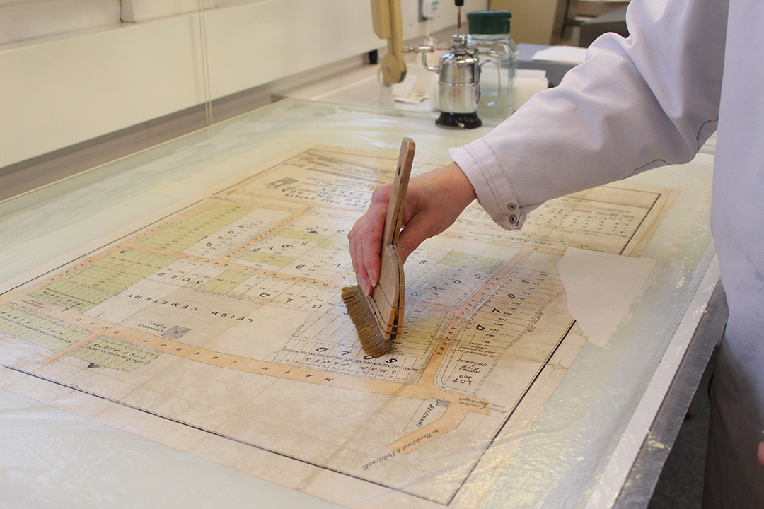
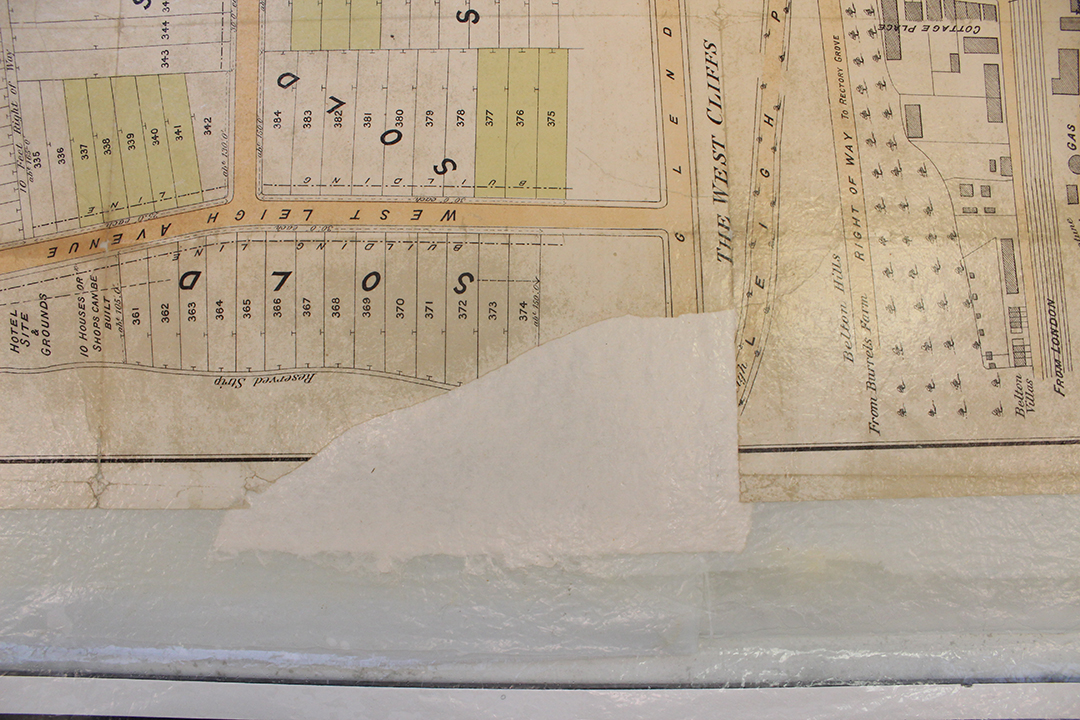
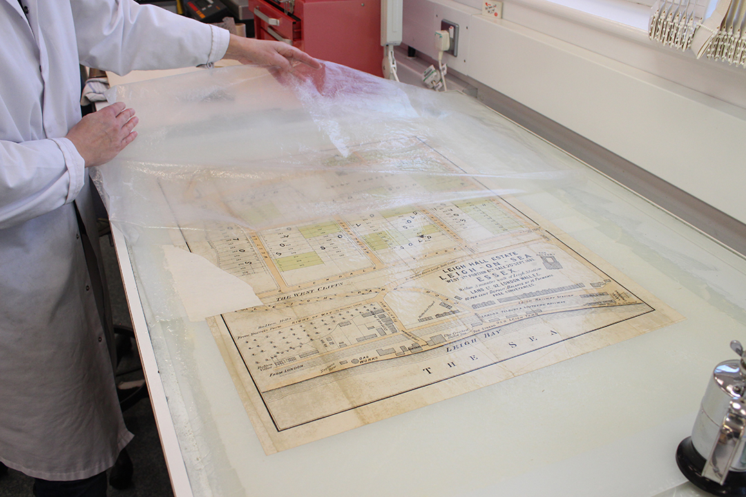
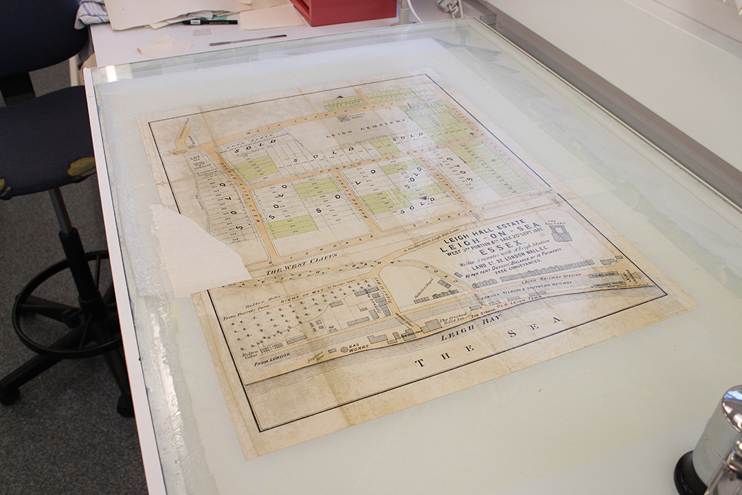
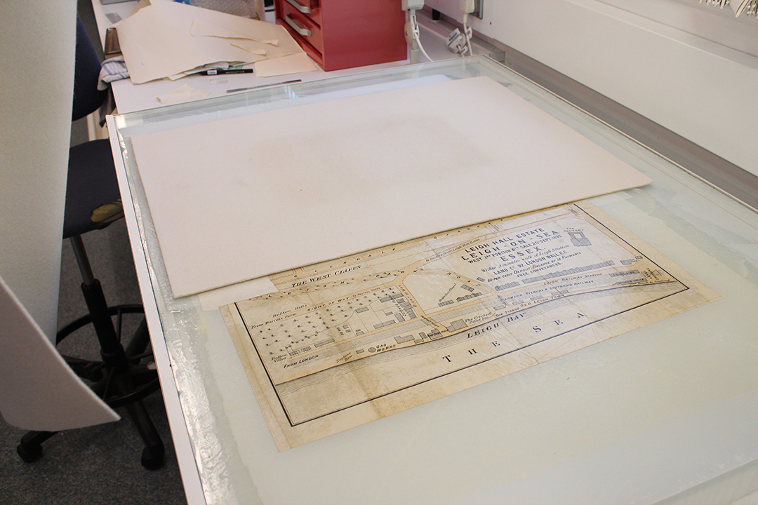
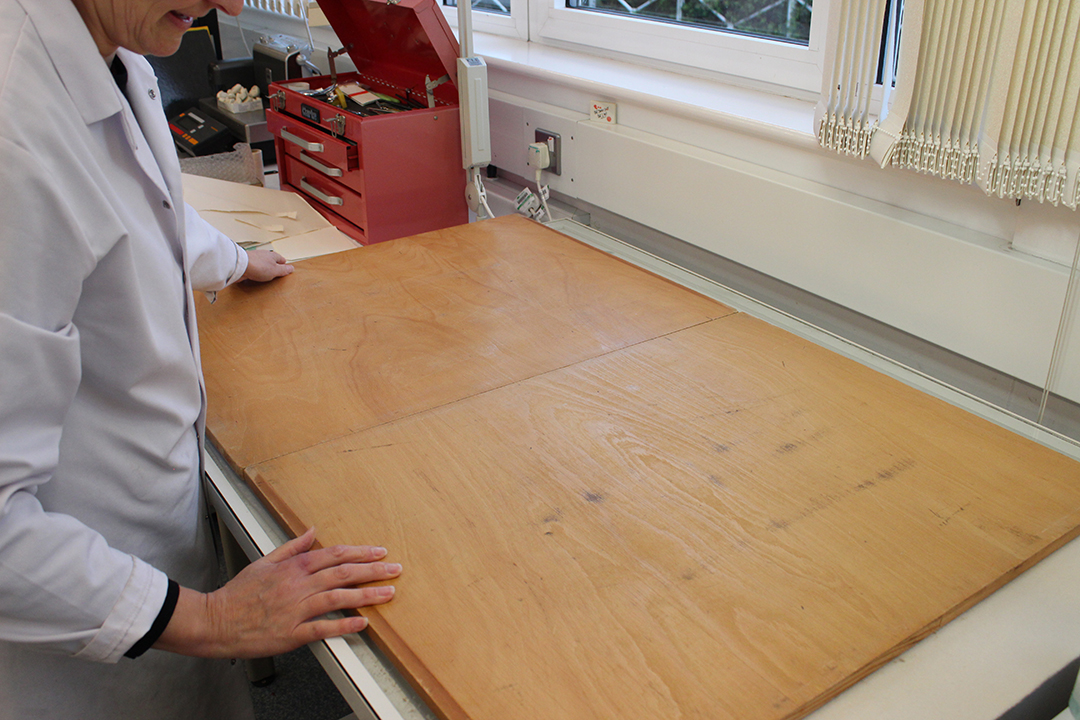
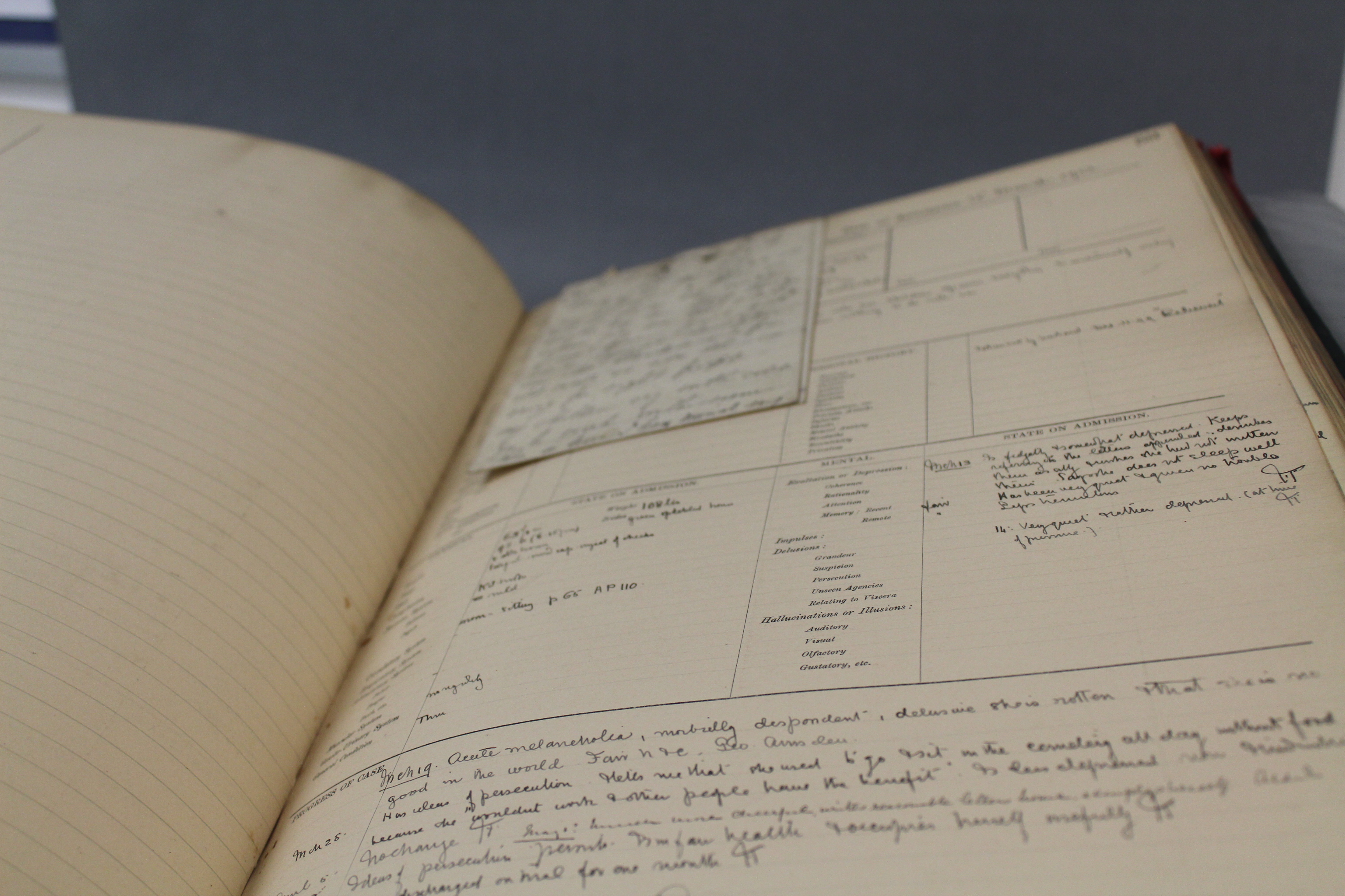
Then we continued our journey to the Conservation Room. The Conservation Room is a room where they carefully fix and clean documents, maps and letters. A lady called Diane showed us all the things that she needed, and some things that she couldn’t fix. For instance a letter, which was folded up into a bundle and tied up, had been burnt by fire and had got very brown.  It felt harder than metal – however it would be very, very easy to break if anyone tried to unroll the document.  Nobody would ever know what was written on it.  On the other hand, some Americans have now invented a machine, which mysteriously x-rays the bundle and scans the letters by looking at the ink inside, and makes a reconstruction that shows you what it had on it before it went in the fire. Maybe one day somebody will be able to put this document in and see what it is all about.  Right now, all we know is a date of 1917, which we found when we examined it. IMG_5955 
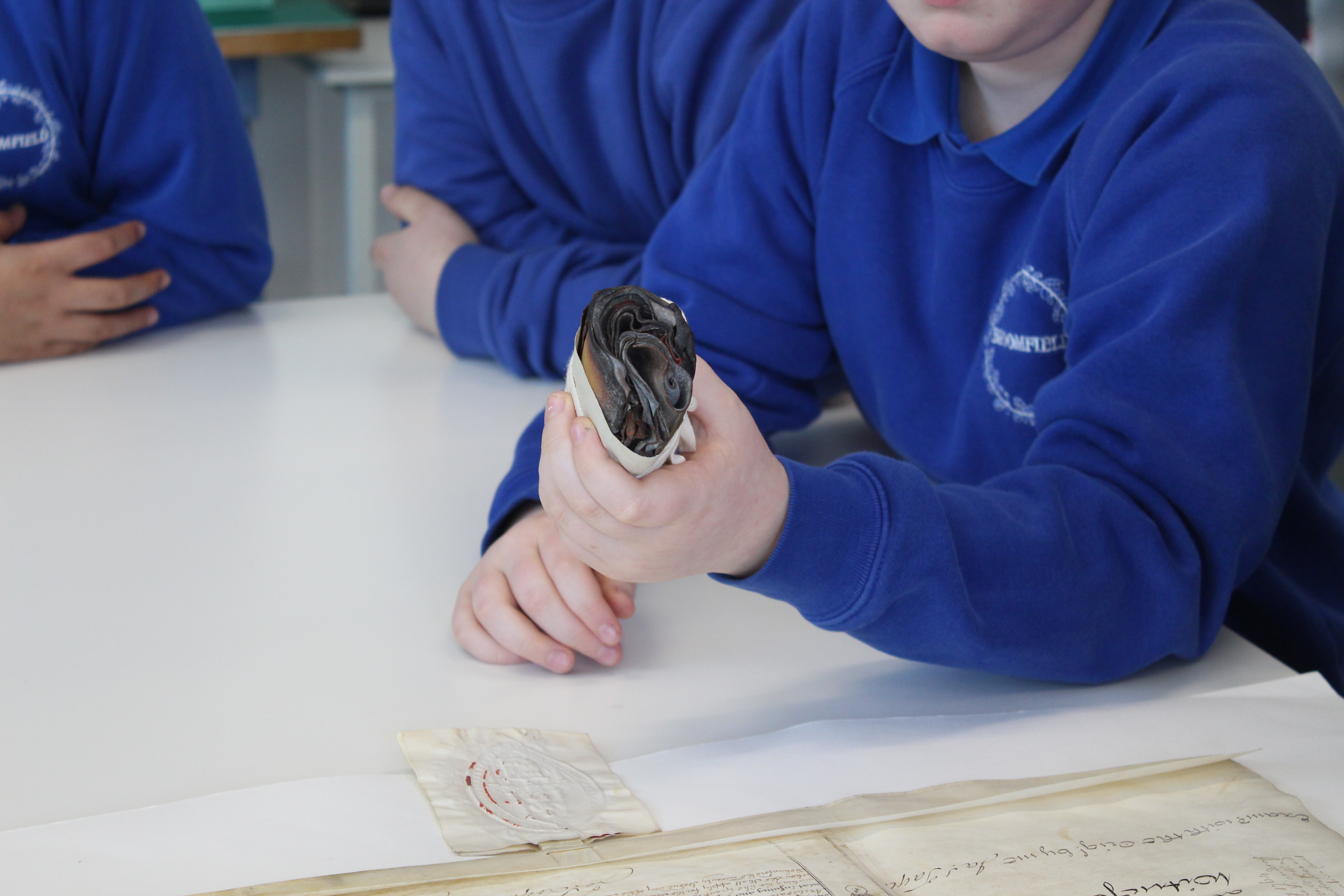
Next Diane showed us a paper document that had lots of mould on it. She said it would never come off, so if you at home have very special letter or something else, make sure it’s not in your loft where mould will develop. The only writing on this was ‘{Be is re……..day of……year of the reign of our……. of Great Britain, Franc…….and fo forth.’  The rest of the paper had disintegrated. As well as that, we were allowed to hold a real piece of parchment.  It is animal skin and is very strong.  It lasts much better than paper so we could touch it. There also was large a circular thing made of wax. It looked a giant coin because it had Queen Victoria on her throne. On the other side, it was a picture of her on a horse.  A quarter of it had been smashed on the floor. Most of words were in Latin, however most of it we could read. These big seals were attached to important documents to show that the King or Queen agreed with what was written inside it.

IMG_5966 
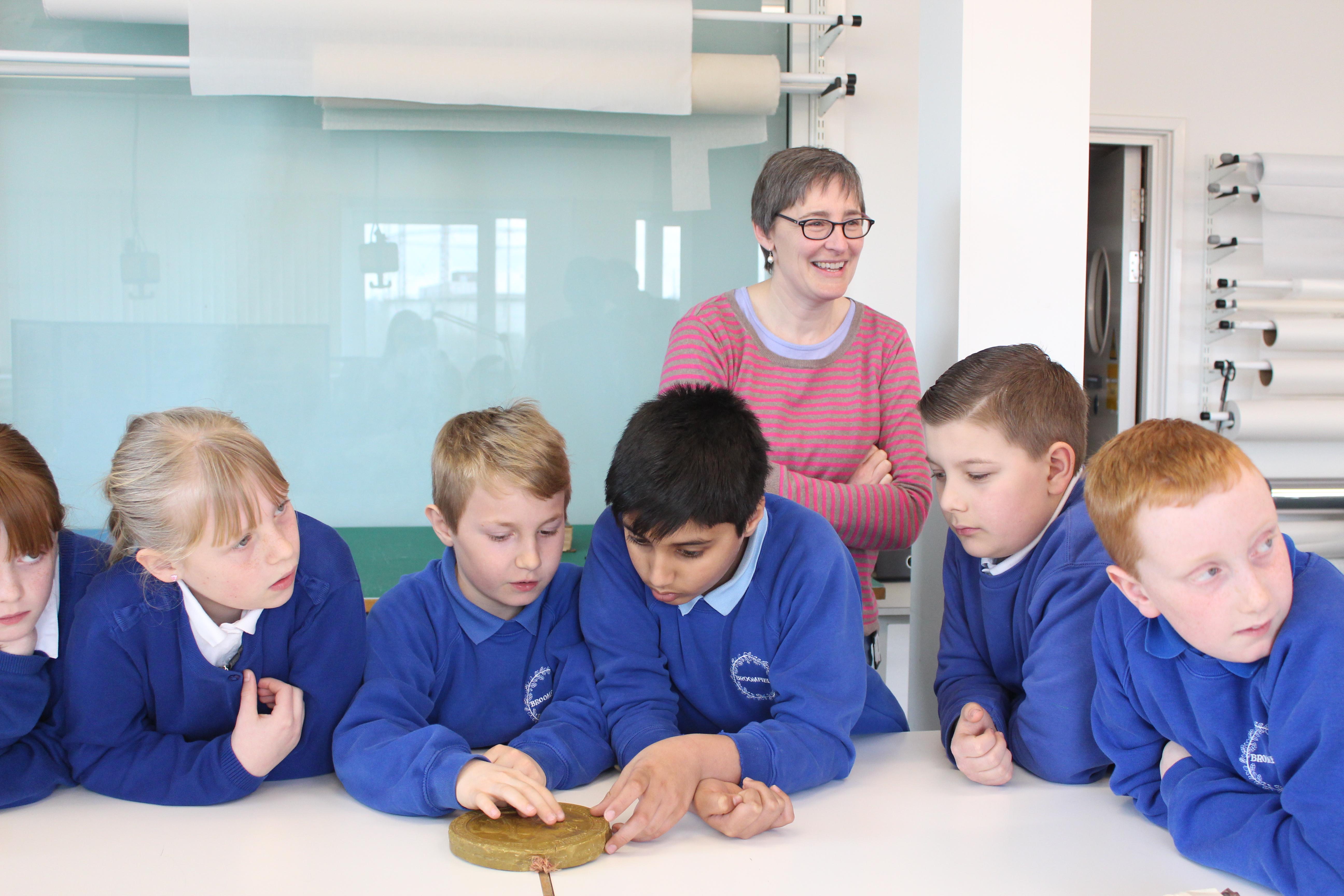
Last of all, Diane showed us scientific equipment such as a measuring container that could make sure that when she fixed using different liquids, she had the right amount of it. For example if she needed a litre of water, she could make sure there’s not too much and not too little.  There were other scientific instruments to make sure the temperature and humidity were exactly right in the room all the time.  It was interesting to see how Science and History were used together in one job.

We had a mind-blowing time at the ERO, our brains were stretched. It was an experience of a life time and an adventure beyond words. We had no idea it would be so interesting and would like to say thank you to the ERO for giving us an amazing tour, we learnt lots! It’s a brilliant place to find out many things. The people who work there are very kind and friendly.  They were experts and shared all their knowledge and information with us from generations ago. We were mad at Mrs McIntyre (our teacher) for making us leave, and were desperate to stay to find out more about our own pasts and where we lived. We hope to be back soon…

By Ben, Grace, Evie, Akmal, Toby, Ben, Grace, Lucas and Bella, Broomfield Primary School

New team member: Rachael Smith

Name: Rachael Smith

Role: Archive Assistant

IMG_5078

Why did you want to work at ERO?

I have always had an interest in history and my previous job with Essex Libraries gave me lots of skills that transfer well to ERO. I was first introduced to archive services whilst I was studying architecture at university; the vast resources available on historical buildings aided my studies immensely which gave me a real appreciation for archives.


Describe an average day at ERO for you:

I’m only just starting to experience what an average day is like as I started working at ERO during the annual stocktake, during which I met the rest of the ERO team and was introduced to the various tasks that are required to keep the Searchroom and the repositories in running order. I helped with jobs such as the creation of a photographic catalogue of the ECC art collection, and checking the physical contents of each shelf location against the digital record we have on Seax. My favourite day was when I spent time in conservation helping to clean the Fred Chancellor plans.


What do you do when you’re not at ERO?

I am a keen long distance runner, regularly running cross country. My passion is architecture and I love travelling to study buildings. I am from a family of artists so you’ll mostly find me drawing or painting, but I do also enjoy technical 2D and 3D drawing on various CAD programs. What most people don’t know about me is that I am on a darts team!


Can you tell us about an interesting document you have come across while at ERO?

This would have to be the Arbitrator’s Award map of Epping Forest (Q/RDe 1) that is due to be included in an outreach event in 2015. This is the largest map that I have ever seen at 30’6” by 12’9”. It was created in 1882 following the Epping Forest Act of 1880. It is fascinating to think about how long it must have taken to draw this map by hand.


New Accession: a little book of surveys

We have recently acquired a little leather-bound book incorporating coloured plans on parchment dating from 1767 of three estates in north west Essex (now catalogued as D/DU 2963/1). Each plan is accompanied by a reference table on paper listing all the fields and their acreages. The surveys seem to have been commissioned by a Mr Collins and carried out by a Mr Hollingworth.  They are of Scot’s Farm in Debden, Bishop’s Farm in Widdington and Sibleys in Chickney.

The book is of diminutive size but exquisitely executed and detailed. The map of Bishop’s Farm in Widdington struck is in particular, as it shows a farm made up of strips of land.

We are very pleased to have acquired this little book for our collection as it can now be made available to researchers for the first time.

IMG_5026


IMG_5028


IMG_5030


IMG_5032


IMG_5036

Secrets from the Asylum

Tonight on ITV the inimitable pub landlord, Al Murray, amongst others, will be discovering the secrets of their ancestors’ lives. One of Murray’s ancestors was committed to an asylum and the show will follow his discovery of what that meant for her and the other asylum “inmates”.

1st Edn OS Map 25" showing the County Lunatic Asylum in 1975

1st Edn OS Map 25″ showing the County Lunatic Asylum in 1875

After The Asylum Act of 1845 it became a requirement for each county to have its own asylum. The Justices of the Peace in Essex opened their County Asylum at Warley near Brentwood in 1853 at a building cost of some £66,000. It was then designed to hold 450 inmates. The institution finally closed its doors in 2001 and much of the site has now been re-developed into luxury flats. To get a flavour of what the asylum was like at the end of its life this website has a number of very good pictures.

A/H 10/2/5/18 - A page from one of the female case books. The words used to describe her illnes are somewhat different to how we would describe them today. "Acute melancholia, morbidly despondant..."

A/H 10/2/5/18 – A page from one of the female case books. The words used to describe her illness are somewhat different to how we would describe them today. “Acute melancholia, morbidly despondent…”

Those documents which had survived the passing of time and the closing of Warley Hospital have now been passed to us at the Essex Record Office. These include Managers’ Minutes, Reception Orders, Case Books and Patient Indexes. We also have a range of Burial Registers which were kept by the Justices of the Peace. The majority of these documents fall under our A/H 10 reference and many of these can be searched in the Record Office, though it is worth bearing in mind that most records less than 100 years old are closed to the public and will have to be searched by one of our archivists (the exception to that being the Burial Registers which are held under references Q/ALc 12/1 to Q/ALc 12/5 and these are currently available to view on our catalogue Seax).

Q/ALc 12/1 - This is the first of 5 burial registers for the graveyard at Warley Hospital. They run from 1856 to 1935. Some burials of patients from Warley are also recorded in the parish graveyard of St Peters, South Weald.

Q/ALc 12/1 – This is the first of 5 burial registers kept by the Justices of the Peace for the graveyard at Warley Hospital. They run from 1856 to 1935. Some burials of patients from Warley are also recorded in the parish graveyard of St Peter’s, South Weald

Q/ALc 12/1

Extract from Q/ALc 12/1

If you are interested in what you discover with Al Murray tonight and want to find out more about life in the asylum or if you think you may have a relative who may have been in the County Asylum, please feel free to visit us or get in touch to discover the secrets that our records might hold.