The strange case of Sarah Moore

As the nights draw in it’s the perfect time to gather to hear tales of dark happenings in the past. Here, bestselling novelist Syd Moore tells us about how she first became interested in researching Essex witches, ahead of her talk at our screening of Witchfinder General on Friday 26 October 2018 – find all the details here.

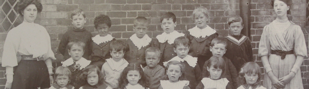
Best-selling novelist Syd Moore who will be speaking about her research into Essex witches at ERO

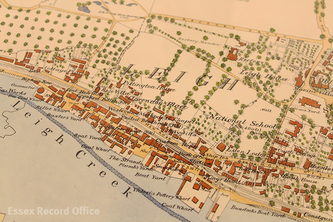
I first encountered Sarah Moore, when I visited the pub in Leigh on Sea named after her. It was shortly after it had opened and the name piqued my curiosity. This was mainly because a) we share the same surname and b)  in my experience it’s unusual to come across a pub named after someone who isn’t famous or a king, queen, lord, lady, duke, admiral, marquis etc. When I asked about it at the bar the staff told me the brewery chain that owned the place often ran competitions to name their pubs. Regularly they would chose winners with a local flavour. Sarah Moore, I was informed, was the subject of a Leigh legend – an evil sea-witch who raised the Great Storm of the Estuary, caused great havoc about the town and sank a plethora of boats.  When I probed further I learned the story of Sarah Moore. Which, if any of you don’t know, goes like this:

Sarah Moore was a bent and bitter old witch, who made her living sitting by the estuary down in Old Leigh, telling fortunes and selling sailors ‘a good wind’ for a penny. The latter was a common practice along various coasts. The ‘witch’ would take a length of string or ribbon and ‘tie’ the wind into it.  The sailor would buy it. Then when out at sea, if they desired wind, they would untie the string. A single knot would loosen a breeze, two would summon a strong wind, and three would unleash a storm. Allegedly one day, a foreign captain rocked up in Leigh. He was a zealous man and, when he heard about Moore and her spells, he forbade his crew to consult her, give her any money or buy any wind. As the legend goes, when Moore heard about this she flew into a rage and, in revenge, summoned up The Great Storm of the Estuary. This, she threw at the vessel as it sailed out into the open sea. The poor boat rocked from side to side, with all aboard much afeared. The crew tried with all their might to get the sails down but, alas, the rigging kept snaring.  One of them cried out in a moment of awful horror, ‘This is the work of the witch. It’s the witch!’ Whereupon, the story goes, the captain picked up an axe, ran to the mast and felled it with three hefty strokes. As soon as the mast hit the deck the storm instantly subsided. When the beleaguered crew got the wounded ship back to Belle Wharf, they saw, there on the floor the dead body of Sarah Moore, three axe wounds across her corpse.

This was a splendid tale, I thought at the time, full of intrigue, horror, suspense and supernatural murder. And as soon as I heard it my interest was immediately fired up. But I was left full of questions: was the story really a myth or a legend? Had Sarah Moore been a real person? Was there some truth in parts of it? Any of it?

In a strange synchronicity, at about the same time, I was asked to present a pilot for a TV series about legend and lore of the land. Cunningly I suggested we look at Sarah Moore and, microphone in hand, ventured out with the team to quiz a whole host of strangers about the legendary sea-witch.  I heard variations of the tale many times, but nobody really knew whether Sarah had ever existed. A couple of Leigh locals suggested it was possible that the myth had been stitched together from various Essex witch stories and that Sarah was a conflation of sorts. It wasn’t what I had been expecting to hear, to be honest. And although I was disappointed I determined to keep on going with my own private research. Which I did. And over the next few years I delved deeper into the myths and legends of Leigh and its surrounding areas, and read up on local history. Yet I did not find much else about the witch.

Until one day when my friend, the writer Rachel Lichtenstein, invited me to go with her to the Essex Record Office. Believe it or not it hadn’t dawned on me that I might be able to find out more about Sarah outside of history books.  Neither was I aware that anyone could pop along to the offices. Somehow I had it in my head that it was something you could do only if you were a professional researcher or a historian or historic writer or had some other kind of credentials. So the whole trip really was a bit of a revelation.

That afternoon spent at the Record Office I discovered the numerous resources: books, reports, various antique volumes, microfiche.  With great excitement I dived straight in to see what I could find. It took me several visits but one dark and stormy afternoon, almost as I was about to give I up, I hit upon a record!

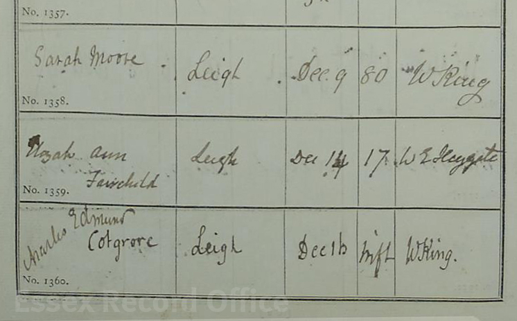
Burial record for Sarah Moore at St Clements church, Leigh-on-Sea, 14 December 1867 (D/P 284/1/38 image 87)

This was the burial entry in the St Clement’s church register for one Sarah Moore. It was dated the 9th of December, 1867 and was my ‘light bulb’ moment. I remember sitting in the record office as the rain pelted against the windows and feeling flooded with light. For not only did the record confirm my hunch that Sarah had been a living breathing woman, it also gave me a solid date around which to research. Another thought that immediately struck me was the fact she had died in 1867. The Great Storm of the Estuary had occurred in 1870. Sarah couldn’t possibly have been responsible for raising it, even if you did believe poor dispossessed old women had control over meteorology.  She had been dead for three years. This realisation prompted me to conclude that Sarah had been scapegoated for the event posthumously. During my further research I was to learn that this was not the only natural disaster that had been attributed to her. All of this evoked a tremendous amount of pity for the woman, and despite the centuries that separated us, I felt outrage on her behalf. The feeling spurred me on to explore the real woman behind the myth and to tell her untold side of the story.

Soon I found her on the census of 1851, by which time she had been twice widowed and left with a great number of children to provide for. In fact, Moore had a terrible life.  Perversely over the years, her association with witchcraft and tragedy, metamorphosed her reputation into a ‘wicked’ one. Through careful consideration I was able to track the route that had facilitated the switch from tragic victim to sinister oppressor and highlight this in the novel, that was published in 2011, The Drowning Pool. It was the start of a career investigating the other miscarriages of justice that occurred in our county: the Essex Witch Hunts.

If you would like to hear more about them I will be speaking on the 26th of October at the Record Office, before a screening of the very relevant classic horror film The Witchfinder General.

Syd Moore’s new book Strange Casebook is out on Halloween.

Filling the holes in history

History sometimes gets a bit tatty around the edges. Most of the documents we look after were originally created as working items, things to be used, referred to, added to, amended, and carried around.

Wear and tear is inevitable, but fortunately modern conservation techniques can make once fragile documents much stronger again and allow us to make them accessible to researchers.

This map shows a plan of a late Victorian development in Leigh-on-Sea that will be on display at Leigh-on-Sea on the Map on Saturday 18 February 2017. It dates from 1893, and had several small splits in it and a rather large hole on one edge. To make it ready for display we took it to our expert conservator Diane Taylor. This short photo story will take you through the process of how the biggest hole in the map was repaired.

IMG_2581 1080x720

Senior Conservator Diane Taylor working on a plan of the Victorian development of the Leigh Hall Estate, dating from 1893 (D/DS 365/2/1). The map shows part of an important stage in the development of the town, when open land was sold off in plots for new houses to be built.

The process begins with preparing a sheet of Japanese tissue paper, a very fine but strong tissue paper which will be used as a backing for the map to give it strength. The tissue is laid onto the glass surface of a large light box, and sprayed with a fine mist of distilled water, then covered with an even layer of wheat starch paste, which will act as an adhesive. The map itself is then also sprayed with distilled water and laid on top of the tissue (the idea of getting documents wet sounds alarming, but many kinds of older paper and ink can get wet without disintegrating). The map is then covered in a sheet of transparent polythene and smoothed down with a wide flat brush.

IMG_2579 1080x720

Diane carefully shapes a piece of new, traditionally-made paper to fit the hole as precisely as possible, with just a small overlap. Wheat starch paste adhesive is used to adhere the infill to the map and the tissue backing.

IMG_2585 1080x720

Using the light box, Diane closely examines the other smaller splits in the map and makes sure they are all closed up and securely adhered to the tissue backing.

IMG_2588 1080x720

Once the infill is in place and the splits carefully realigned, the map is again covered with the polythene sheet and a wide brush is used to smooth everything down.

IMG_2589 1080x720

The main repair will now need to be left to dry, and the edge of the piece of infill will then be trimmed to be flush with the edge of the map.

IMG_2594 1080x720

The polythene is peeled back to reveal a repaired but wet map.

IMG_2595 1080x720 IMG_2597 1080x720

The map is covered with thick felts to absorb the water and begin the drying process.

IMG_2602 1080x720

Wooden boards are placed over the felts to press them and draw water out of the map.

After drying, the edges of the tissue backing and the infill repair will be trimmed, and the map will be clean and strong and ready for researchers to use.

Join us at Leigh-on-Sea on the Map on Saturday 18 February 2017 at The Forum in Southend to see this map alongside several others tracing the development of Leigh from a small fishing village to the town we see today. Find full details here.

Leigh-on-Sea on the Map

“a pretty little town, well stock’d with lusty seamen”

This vivid description of Leigh-on-Sea comes from William Camden’s Britannia, a survey of Great Britain and Ireland published in 1586.

We are diving in to Leigh’s history at the moment ahead of Leigh-on-Sea on the Map on Saturday 18 February 2017, when we will be displaying a selection of our historical maps and images of Leigh at The Forum in Southend, showing its transformation as development spread ever further out from the small old town area that hugs the Thames shoreline.

Here we share some sneak peaks at some of the maps and postcards we will be bringing with us to display.

Leigh tithe map, 1847 (D/CT 217B)

IMG_8898 1080 watermarked

Extract from the Leigh tithe map, 1847 (D/CT 217B)

The centrepiece of our display will be Leigh’s tithe map, which dates from 1847. The map shows Leigh just before the coming of the railway, when it was still a small fishing town or village.

Tithe maps are brilliant sources for researchers interested in the history of their family or a particular property or place, as each plot on the map is numbered. This is because the maps are accompanied by a list of who owned and occupied each property, as they were used to work out how much tax people should pay based on the value of their property. The system of taxing people according to the value of their property replaced a much more cumbersome medieval system of people rendering a tenth of their agricultural produce to the church.

Railway map, c.1854 (D/DS 177/1)

IMG_2624 1080 watermarked

This 1854 map shows the route the London, Tilbury and Southend Railway was to take through Leigh, cutting through a swathe of existing buildings (D/DS 177/1)

Soon after the tithe map was prepared in 1847, another map of Leigh was produced which shows us the dramatic transformation the old town was about to undergo. This map was prepared in connection with the building of the London, Tilbury and Southend Railway, and shows the somewhat brutal course the track was to take through the town.

Although each building is numbered and presumably linked to a schedule giving names of owners of the properties through which the railway would pass, the whereabouts of the schedule is unknown. The map shows all the familiar Leigh landmarks, including the Bell and Ship inns, the Billet and Smack public houses, the Coast Guard House, the Custom House and individual wharfs and quays.

The building of the railway sliced the old town in two, marooning the High Street on a thin strip of land along the edge of the Thames. Victorian progress was rarely halted by the presence of old buildings that today we would consider precious, and in Leigh the presence of steep cliffs meant there was no alternative but to drive the railway through the town.

Leigh postcard 38 front 1080 watermarked

Leigh-on-Sea High Street in the late nineteenth century, in the part of the old town which was sandwiched between the new railway line (behind the buildings on the left) and the Thames (behind the buildings on the right). The Crooked Billet Inn still survives, as do several of the buildings shown in this picture. (ERO postcard collection, Leigh-on-Sea no. 38)

Ordnance Survey maps

The best maps which show the development of Leigh from 1890 to 1939 are the large scale ordnance survey maps of the “County Series”.

These were made in three waves – the first edition, made in the 1870s, the second edition, from the 1890s, and the New Series, made between the 1920s and 1940s. The county was entirely mapped in two different scales, 6” to the mile and the fabulously detailed 25” to the mile.

IMG_2654 1080 watermarked

Later copy (1964) of the first edition Ordnance Survey map of Leigh which was made in 1873 (MAP/CM/142/1)

Unfortunately we do not have an original 25” to the mile first edition OS map showing Leigh, but we will be bringing a well-known copy of it that was made later. The original map dated from 1873, and we can see that by this time Leigh remained a fairly small place, although now with a railway running through its centre. We can see that adjustments had been made to existing buildings to accommodate the railway, and that a ‘New Road’ had been built alongside it.

Amongst the new buildings shown are the Smack pub in a new building across the street from its original site (which by this time was underneath the railway line) and, on the hill below the church, a new National School which was built in 1852.

IMG_2636 1080 watermarked

Ordnance Survey map of Leigh, 1897

Leigh was resurveyed in 1897 for the second edition of the County Series. By this time, much of the open land around the old town had been divided up to be sold as plots, and new streets had been planned out, with pockets of building underway. This sort of development is seen frequently in our maps of Victorian Essex. Plots were either bought by individuals who then built their own houses, or purchased by developers who built who rows or streets of houses. Some plots were reserved for shops or hotels.

IMG_2644 1080 watermarked

Ordnance Survey map of Leigh, 1922

The next major survey of Leigh took place in 1922, and the map which resulted shows a fairly spectacular explosion of new housing that had been built since the 1890s. The town we see in this map resembles much more closely the town we can see today. Beside the railway, a tramline had been built running along The Broadway from St Clement’s church, past the Grand Hotel, and then along Leigh Road into Southend.


Southend bomb map, 1945 (D/BC 1/4/3/3)

The most recent map which will be on display was made soon after the end of the Second World War, and shows where bombs and other missiles were dropped on Southend, including Leigh, during air raids. If you live in Leigh, was your house near one of these bomb sites?

IMG_2615 edit 1080 watermarked

Map showing where bombs fell on the Southend district during the Second World War, 1945 (D/BC 1/4/3/3)

For more historic maps and images of Leigh, join us at Leigh-on-Sea on the Map on Saturday 18 February 2017, 10.00am-3.00pm, at The Forum, Elmer Square, Southend-on-Sea, SS1 1NE. Entry is free, but if you could make a donation to support our work we would really appreciate it.