With series 5 of Great Railway Journeys continuing tonight on BBC2 episode 18 sees Michael Portillo journeying from the edge of the metropolis in Ilford to Tilbury before crossing the Thames to Gravesend. As with episode 17 we thought we would take a look at some documents related to some of the sights he will be seeing along the way.
The London, Tilbury and Southend railway was granted an act of parliament in 1852 to begin purchasing land; by just 1854 it had reached as far as Tilbury. The railway was intended to link up the growing industries along the north bank of the Thames such as the chalk works at Tilbury and the burgeoning towns of Prittlewell and Southend. Perhaps most importantly for the railway company, the line allowed their customers easy access to the company’s own pier just across the Thames at Gravesend, already a common embarkation point for overseas travel from England.
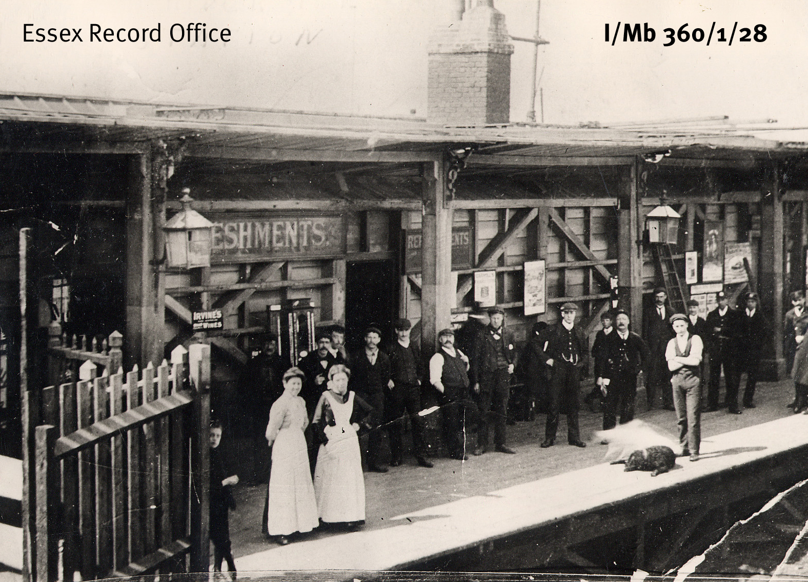
Riverside Station, Tilbury, 1920
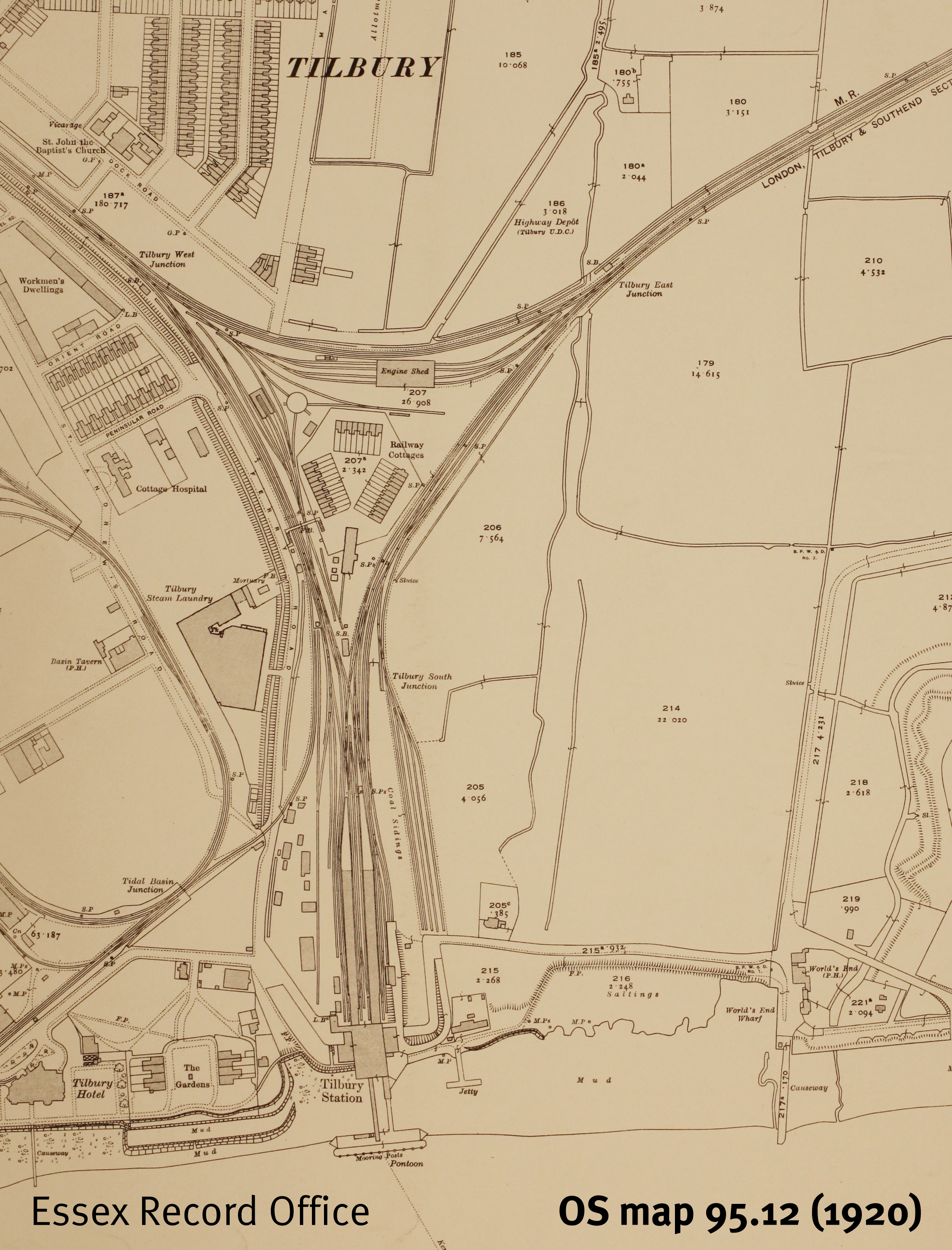
Ordnance Survey map of Tilbury from 1920 showing the distinctive triangular arrangement of the railway lines, with workers’ cottages in the middle. Click for a larger version.
With the coming of the railway to Tilbury and the increasing prevalence of steam ships, Tilbury became an attractive location for the East and West India Dock Company to build a new port. It was well positioned downstream and therefore more convenient for ships than docks belonging to their competitors further up-stream in London. Ground was broken in 1882 and the photograph below shows the opening of the docks in 1884 with much fanfare. The port quickly became the most important deep-water port on the Thames and was integrated into the Port of London in 1909.
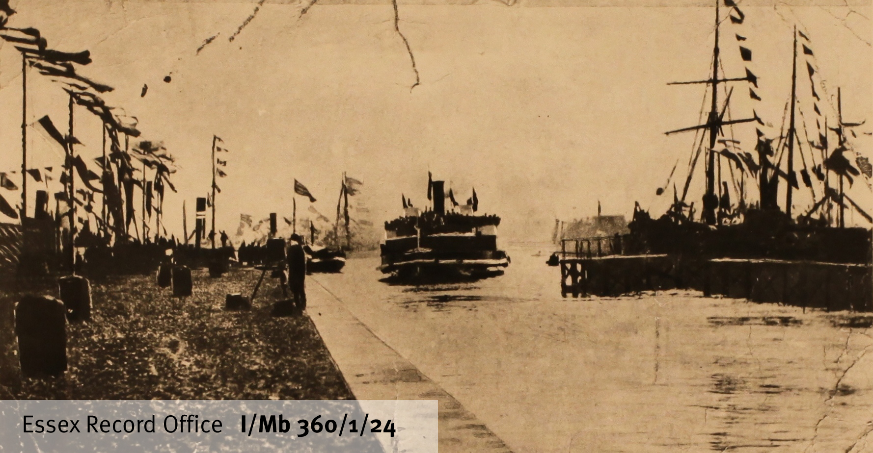
Opening of Tilbury Docks, 1886

Port of London Authority map of Tilbury Docks, post 1909 after it was taken over by the PLA
Amidst all the clamour of industry and squeezed between a gasworks and the dock itself lies the jewel in Tilbury’s crown. Before industry and the railway Tilbury was important for another reason. Henry VIII had built a simple “D” shaped blockhouse there with an opposite number in Gravesend to defend the Thames with their guns and by drawing a chain across the river between them. With the threat of the Spanish Armada in 1588 the fort was improved and repaired and it was here that Elizabeth I reportedly famously rallied her rag-tag army with the words “I may have the body of a weak and feeble woman but I have the heart and stomach of a king, and a king of England too”.
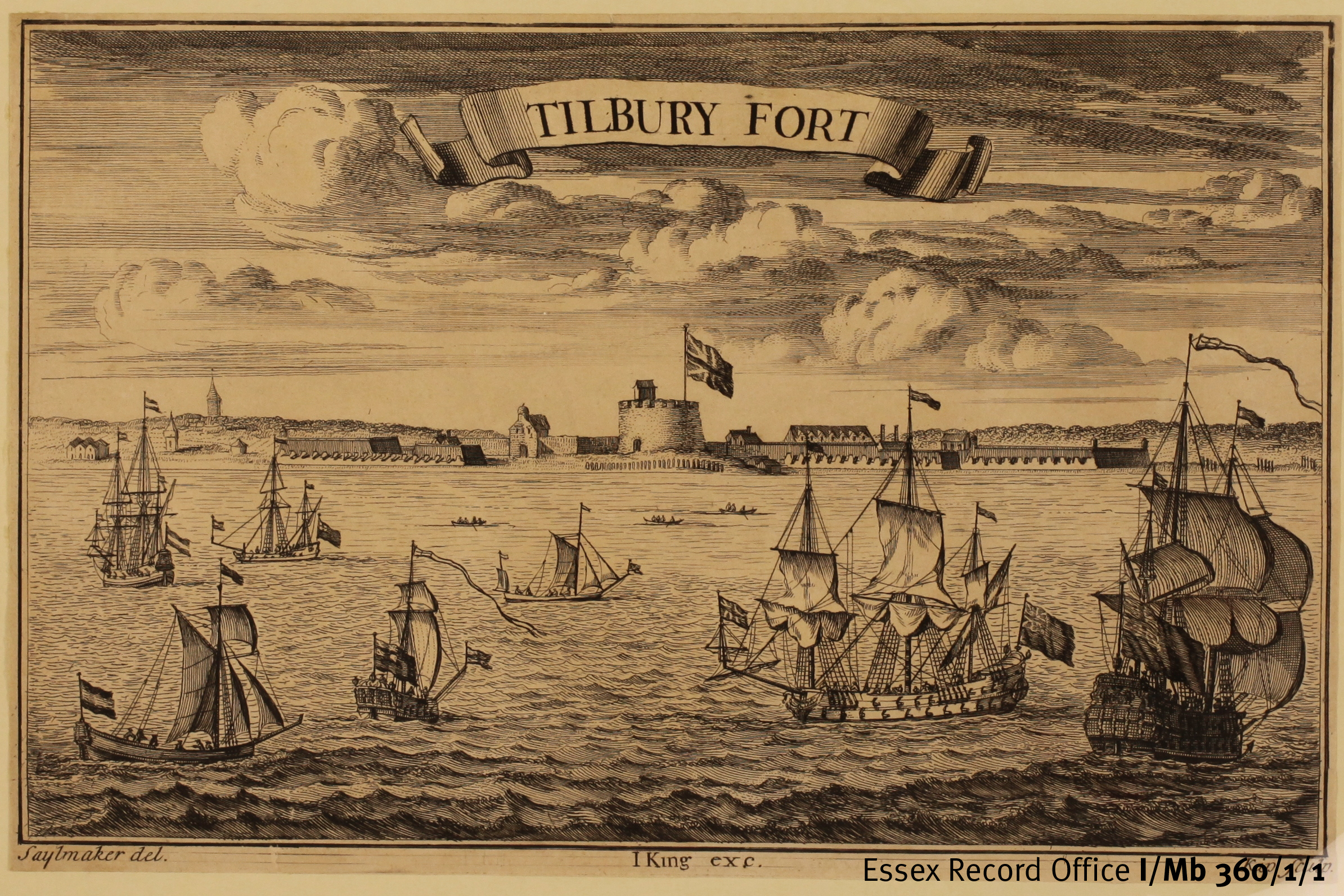
Print of Tilbury Fort. There are several views of the Fort in our collections, many of which have been digitised and can be viewed online on our catalogue Seax
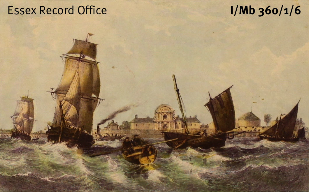
Coloured print of Tilbury Fort
Modern European military thinking greatly influenced Charles II during his exile from Britain and led to the redevelopment of Tilbury Fort into its modern star shape in the 1670s. The Fort was held by the Parliamentarians in the Civil War and was refortified in the Napoleonic wars and again in 1914. The Fort straddled the border of the parishes of West Tilbury and Chadwell, with the officers quarters being on the West Tilbury side and the other ranks in Chadwell. This is reflected in the parish burial registers, with officers appearing in the West Tilbury registers, and the men in the Chadwell registers.
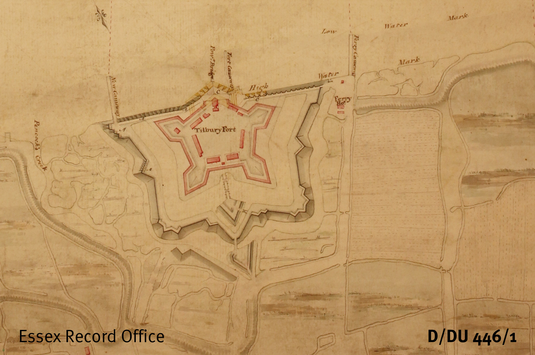
Extract from map of the Thames around Tilbury and Gravesend, showing Tilbury Fort in 1780. South is at the top of the map, and north at the bottom.