Right of Way: A historically contentious issue

During our closure due to the Covid-19 pandemic we have been working hard adding new entries to our catalogue “Essex Archives Online“. Archivist Katharine Schofield takes a look at one of these documents which reveals that rights of way disputes aren’t a modern invention.

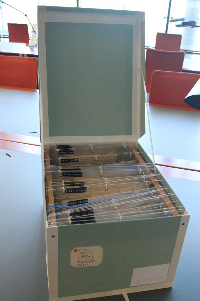
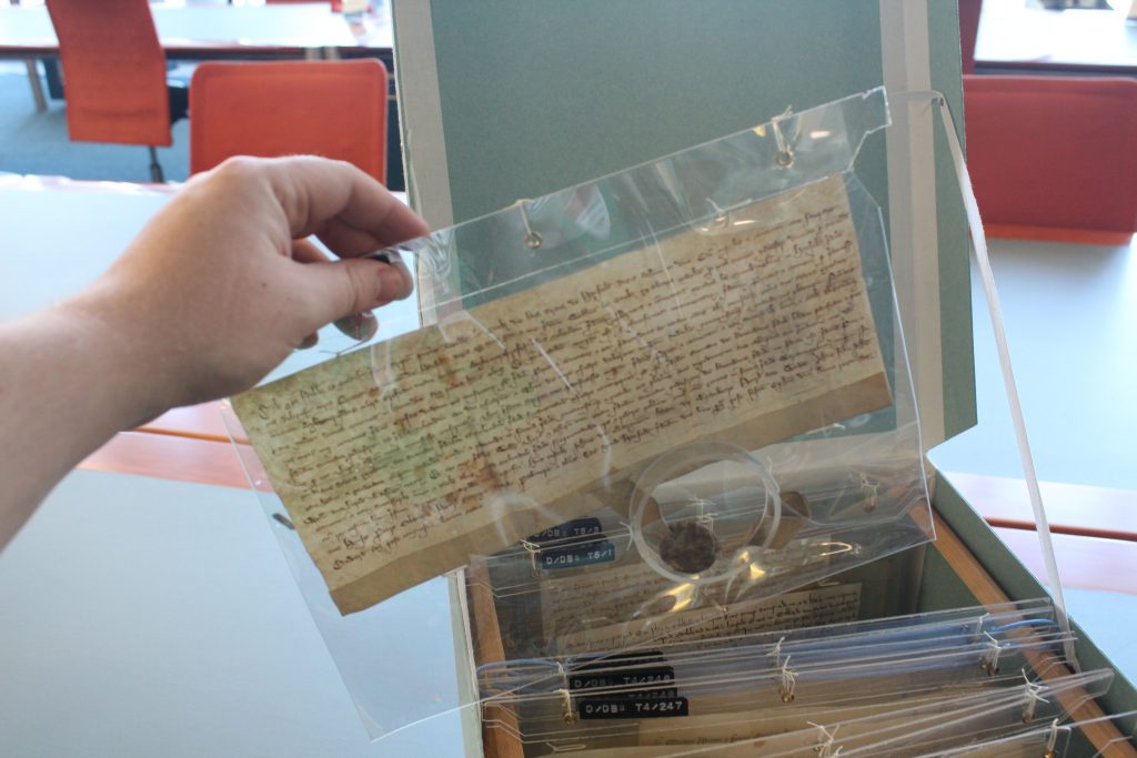
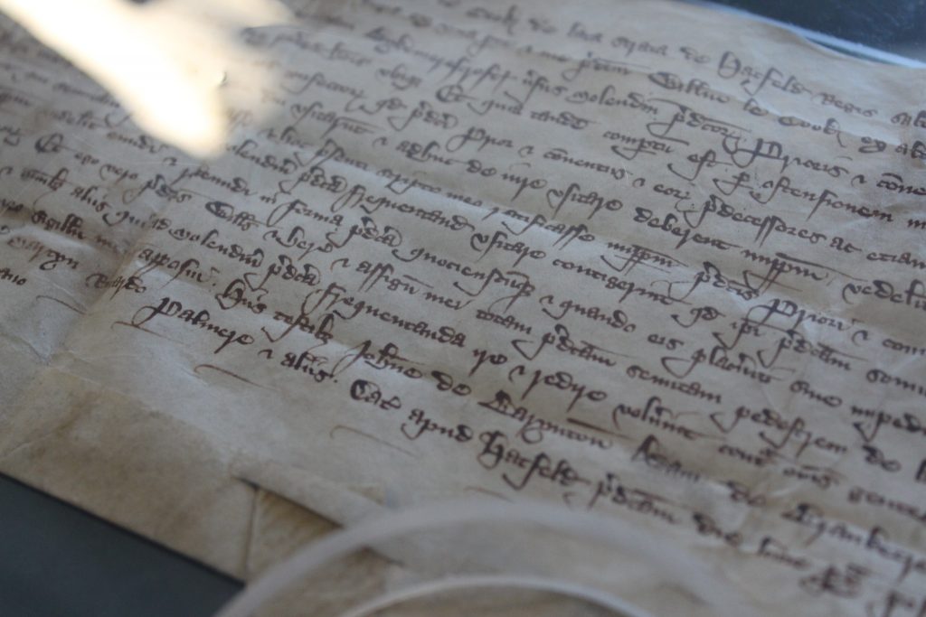
Among the entries added to our online catalogue during ‘lockdown’ are calendars of medieval deeds, dating from the early 13th century onwards, relate to various small properties mostly in Hatfield Broad Oak.  The deeds are part of the Barrington collection (D/DBa).

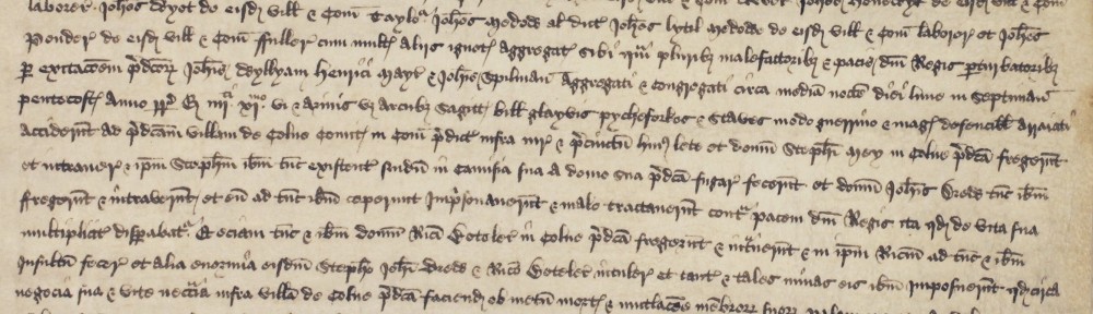
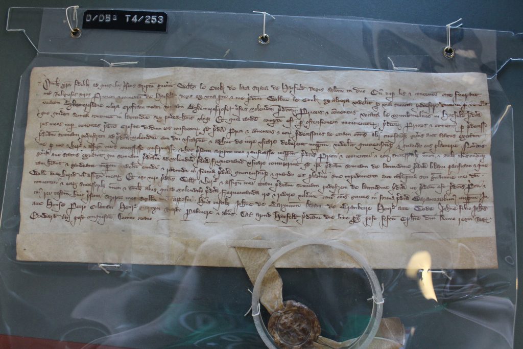
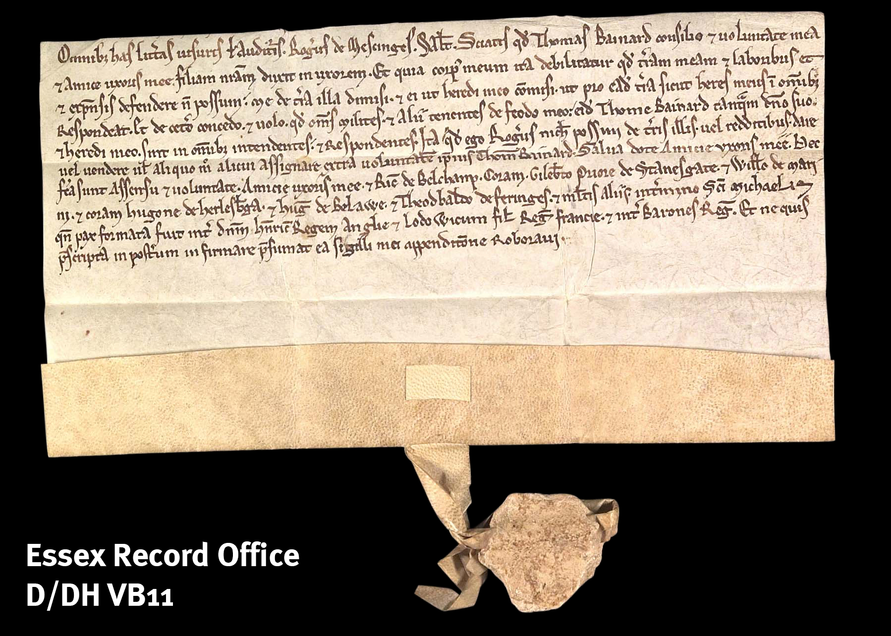
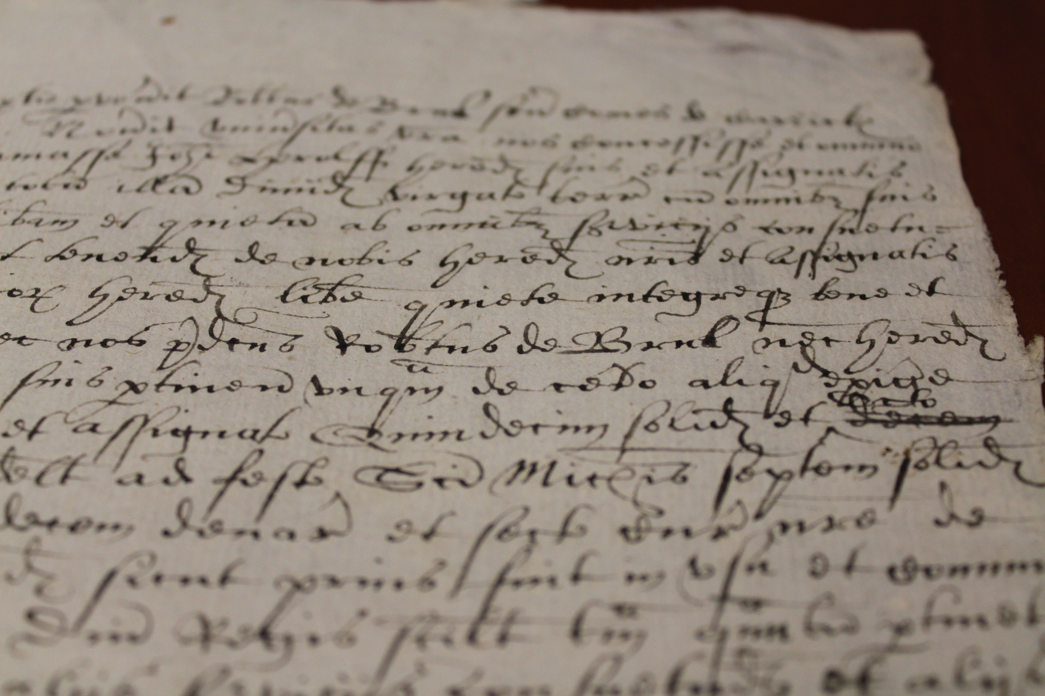
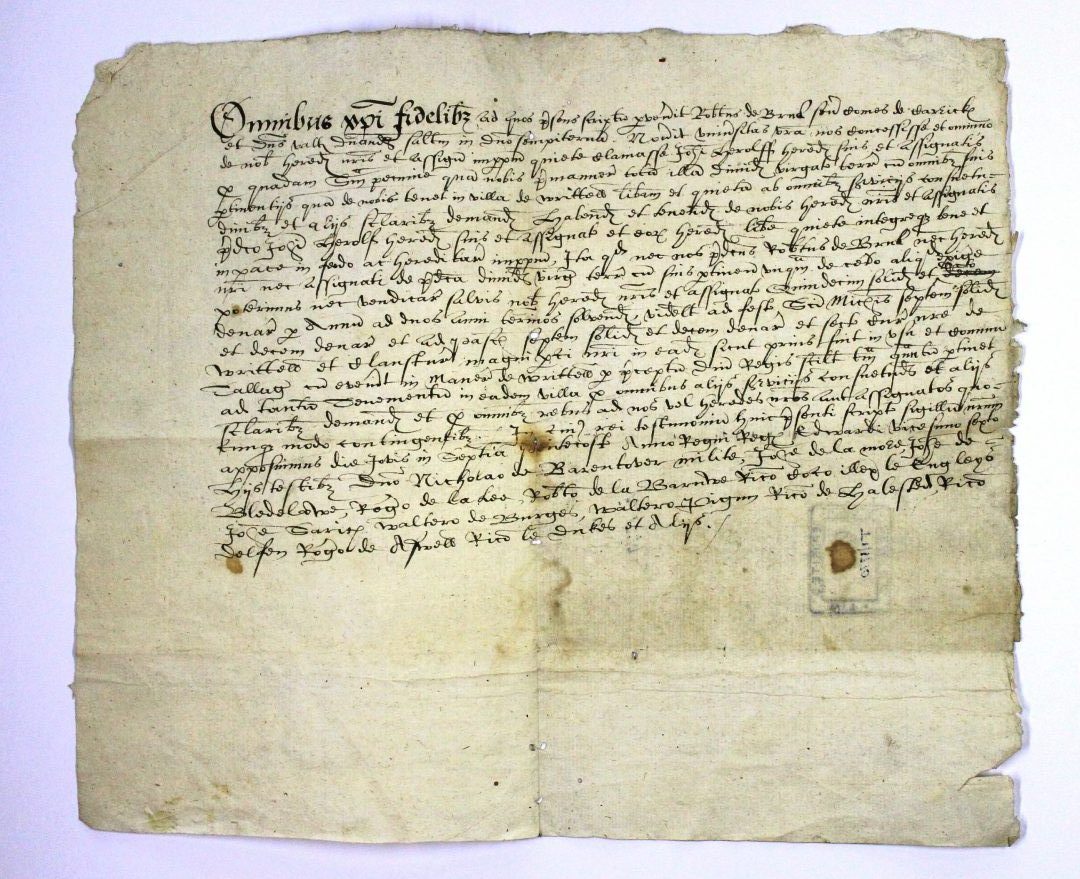
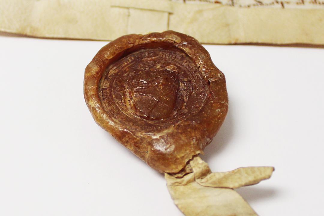
Not all of the calendared deeds related to the Barrington family’s possessions at the time, although they may have subsequently acquired the land.  They include the ratification of an agreement (D/DBa T4/253) between William le Cook of Broad Street and Hatfield Priory, dated at Hatfield Broad Oak on the Monday after Epiphany in the 18th year of the reign of Edward III (10 January 1345) and it concerns a dispute over access.  John de Barynton’ is listed as the first of the witnesses.

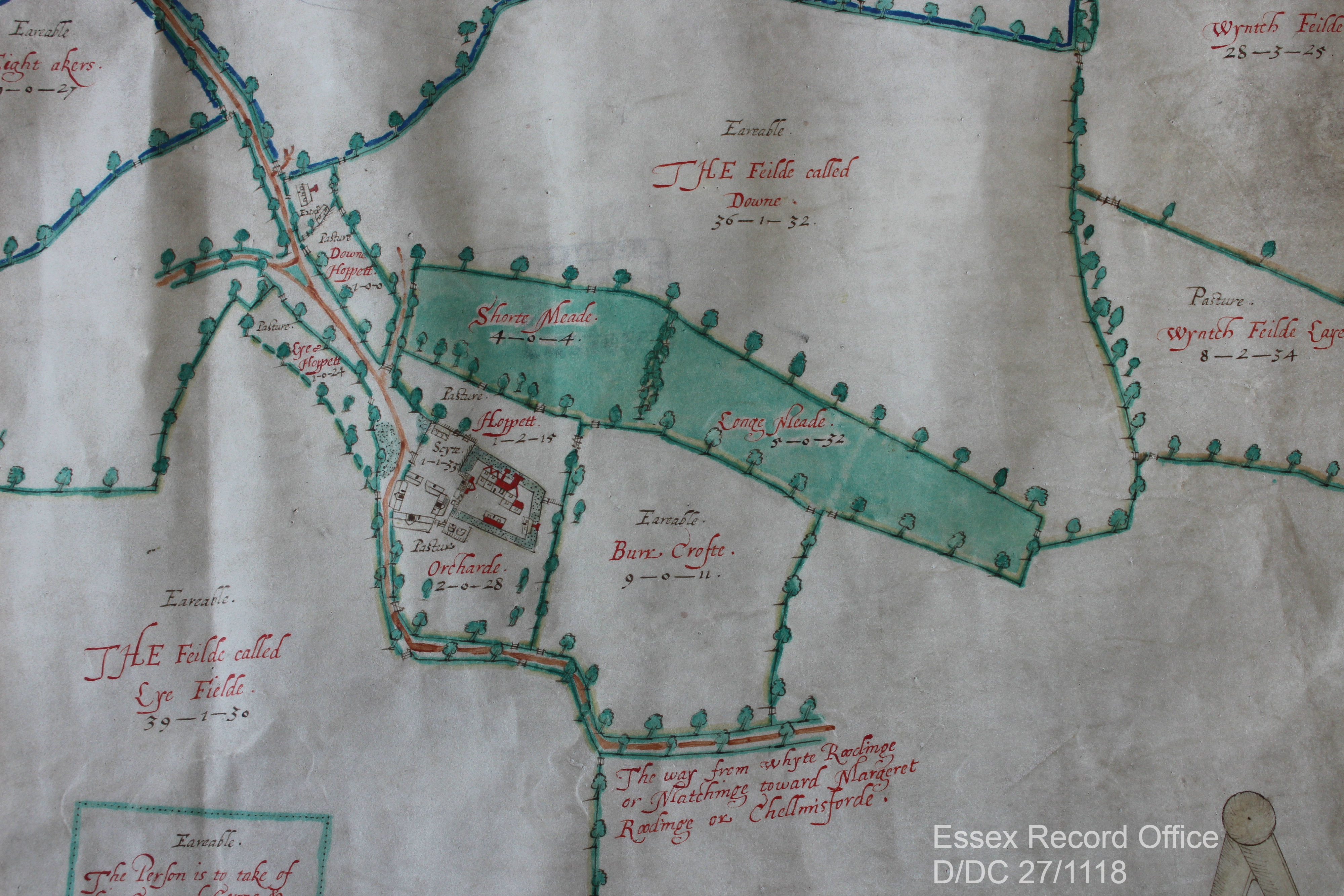
The access in contention is described as a footpath 6 feet wide leading through Bykmereslane beyond William’s property Bykmerescroft towards Munkmelnes where the Priory’s mill was located.  Canon Francis Galpin identified Bykemere Street or Lane as the present-day Dunmow Road (B183) past the junction of the High Street and Broad Street (Essex Review volume 44, page 88).  He described the name as a corruption of Byg (or big) mere, probably derived from the nearby ponds.  The ponds still visible on maps today presumably provided the water power needed for the Priory’s mill.

The agreement recites that there had been ‘contention’ between William and the Priory over the footpath.  The Priory produced deeds from their archives (ostensionem munimentorum), made by William’s predecessors, tenants of Bykmerescroft.  The archives had demonstrated that the Priory and all others were accustomed to use the footpath to the mill and had the right to do so.  Consequently, William agreed to make rectification.

Mills were a vital part of the medieval economy.  At the beginning of the 13th century, it has been estimated that there were between 10 and 15,000 mills in England.  They were also a key part of the income of a manorial lord.  Lords were able to compel their tenants to use their mills, paying for the right to do so.  It has been estimated that payments from mills made up 5% of manorial income at the beginning of the 14th century (John Langdon ‘Lordship and Peasant Consumerism in the milling Industry of Early Fourteenth Century England’ Past and Present 145, pages 3-46, November 1994).  The Priory was anxious not to have access to their mill disrupted and their record keeping ensured that they were able to prove their rights and request remedy.

Even today, among the many people visiting the Record Office and using the archives, it is not unusual for people to try to solve access problems, although mostly by using Ordnance Survey maps, rather than medieval deeds.

Changing land usage in Essex

Archive Assistant Neil Wiffen reflects on the changing pattern of land usage and the historic value of meadows to the Essex landscape.

There is currently much in the media about climate change and environmental degradation. We hear on almost a daily basis about the threat to different ecosystems and landscapes, as well as about worldwide species loss. We in the UK are not immune, and subjects such as the loss of meadows and the threat to bees are now quite common topics of discussion. Recently the BBC reported that, ‘over 97% of wildflower meadows have been lost since the 1930s, that’s a startling 7.5 million acres (3 million hectares). Species-rich grassland now only covers a mere 1% of the UK’s land area’ (http://www.bbc.co.uk/earth/story/20150702-why-meadows-are-worth-saving).

What have bees and meadows got to do with the Essex Record Office (ERO), we hear you ask? Well, working among our wonderful archives we are used to seeing lost landscapes of the past as depicted in maps or described in documents – a land before industrial agriculture and large-scale urbanisation.

One important, almost universal feature of any parish’s landscape would have been that ‘species-rich grassland’ mentioned by the BBC. They were generally described as meadows, which the ERO’s trusty copy of the Oxford English Dictionary (1933) defines as, ‘a piece of land covered with grass that is mown for use as hay. In later use often extended to include any piece of grass land’ (pasture, on the other hand, was used for general grazing of livestock). Look at any tithe, enclosure or estate map and there the meadows will be, often listed and somewhere along the way appraised as well.

Part of 1609 map of White Roding showing meadowland
Extract from John Walker junior’s 1609 ‘trewe and perfect’ plan of the ‘landes belonging to the Mannor of Mascalls Bury … within the parish of White Roodinge’ (D/DC 27/1118). It depicts the ‘Longe’ and ‘Shorte’ meadows adjacent to the moated house. Another important aspect of the farm and household economy, the orchard, can also be seen close by the house. Do note the spelling of arable as ‘Eareable’ – one can almost hear the Essex accent across the centuries!

— An image of the same location from Google Satellite, 2019.

The importance of meadows to people in the past was immense, particularly before the introduction of fodder crops, such as turnips, through the 17th and 18th centuries. Meadows were mown for hay in summer which was then used to feed overwintering livestock. Therefore the amount of hay harvested determined the number of cattle that could be kept over-winter. So a good hay crop was an essential product of the agricultural year, with the whole community coming together to ensure it was harvested and stored successfully.

The high regard that meadows were held in can be seen by how they were valued. When the Escheator compiled the Inquisition Post Mortem (TNA, C 134/74/19) on the death of Nicholas Dengayne in 1322/3, his manors of Colne Engaine and Prested Hall (Feering) were valued. The 240 acres of arable land in the former was valued at 4 pence per acre, while 140 acres in the latter was 3 pence per acre. By comparison the 6 acres of mowing meadow at Colne Engaine and 5 acres at Prested Hall were all valued at 2 shillings per acre –  the equivalent of 24 pence per acre, or six to eight times the value of the arable land.

Quite what types of grasses and flowers these ‘traditional’ meadows were made up of is unknown, but we have to assume in an age before widespread use of agricultural chemicals they were very species rich with lots of insects as well. Not all ‘grassland’ was equal to a well-established meadow. By the 1930s 302,803 acres of ‘permanent grass’ was recorded in Essex (The Land of Britain: the Report of The Land Utilisation Survey of Britain part 82 Essex, copy  in ERO Library, Box 95), of which 92,300 was for hay – possibly this was mainly ancient meadows. The remaining 210,503 acres might not have been of the highest quality but rather a result of the agricultural depressions of pre and post First World War. This would have been the case with the 38,977 acres of ‘rough grazing’ – not all grassland was equal!

A local meadow in glorious technicolour! Along with various grasses there is knapweed, scabious and lady’s bedstraw. The honeyed aroma of the latter is intoxicating on a sunny day!

Now, we are beginning to appreciate our meadows once more and recognise their value as habitats to vital wildlife. While there has been a great loss of meadows, more are being planted, for example by conservation charity Plantlife. Perhaps our maps and documents will guide where new meadows could be sown?

What can you find out about your local landscape history? Check our introduction to the main sources for starting a place history, then come and explore what we have in our Searchroom.

Magna Carta: Essex Connections – Roger de Mescinges

In our final blog post in the run up to Magna Carta: Essex Connections on Saturday 23 May, we look at a document that is something of a post-script to our recent Magna Carta, but it is an interesting medieval document we wanted to share.

The document is a grant made by Roger de Mescinges [Messing] of all his lands, knights and other tenements of his fee to his son-in-law Thomas Bainard (D/DH VB11).

There are two key features which make it particularly interesting: first, it is possible to give this a definite date, which is unusual in medieval deeds, and second, it gives us an insight into the mindset of a landowner during the unrest following the granting of the Magna Carta in 1215.

Its date can be narrowed down very precisely, because of the reference it makes to the Treaty of Lambeth, which was agreed on 11 September 1217 between the rebel barons, the new King Henry III, and Prince Louis of France, who agreed to give up his claim to the English crown.

After listing the witnesses, this deed states that it was made in the time ‘when peace was made between the lord Henry, King of England and Louis son of the King of France and between the barons of the king’.

It’s also interesting to read that Roger de Mescinges was giving his land to his son-in-law because his own body was ‘so debilitated’ that it was not possible for him to defend his land, labourers and possessions. Land and with it wealth and possessions were held by those able to physically defend it.  After nearly three years of civil war, with a great deal of fighting taking place in Essex, Roger de Mescinges had decided that a younger man was needed to defend his land.

D-DH VB11 watermarked

Find out more about Essex connections with the Magna Carta with us on Saturday 23 May.

Magna Carta: Essex Connections

To explore the significance and legacy of this famous document, both nationally and for Essex, join us for talks from:

  • Nicholas Vincent, Professor of Medieval History at the University of East Anglia, who has been leading a major project researching the background to Magna Carta
  • Katharine Schofield, ERO Archivist, on Essex connections with Magna Carta and the impact it had on the medieval county

Saturday 23 May, 1.15pm for 1.30am-4.15pm

Tickets: £8, including tea, coffee and cake

Please book in advance on 033301 32500

Robert the Bruce – Essex man

As the people of Scotland prepare to vote in the independence referendum, Archivist Katharine Schofield examines how Essex is able to claim a connection with Robert the Bruce, who from 1306 became King Robert I of Scotland. 

D/DP T1/1770 - names Robertus de Brus

D/DP T1/1770 – names Rob’tus de Brus

The Bruce or Brus family held lands in Writtle, Hatfield Broad Oak, Terling, Hatfield Peverel, Lamarsh and Southchurch from a grant made by Henry III in c.1237/8 to Isabel de Brus.  She was the daughter of David, Earl of Huntingdon (brother of Malcolm IV and William I of Scotland) and Matilda, the daughter of the Earl of Chester.  Isabel’s brother John inherited the title of Earl of Chester from his uncle.  When John died in 1237 the earldom reverted to the Crown, and today is one of the titles of the Prince of Wales.  In compensation Henry III granted lands to his sisters and heiresses, one of whom was Isabel, wife of Robert de Brus, 4th Lord of Annandale (the great-grandparents of Robert the Bruce), who received various lands in Essex (if you get as confused with the genealogy in this post as we did, here’s a handy family tree).

Among the earliest records in the ERO are records of the Brus family in Hatfield Broad Oak and Writtle.  The deeds, although undated, almost certainly relate to Sir Robert de Brus, father of the future king of Scotland.  Deeds of grants of meadow land in Hatfield Broad Oak of c.1280 and c.1300 (D/DBa T1/44, 50-51126, 157, 159) refer to part of the demesne meadow land of Sir Robert de Brus which adjoined the land being granted.

A release and quitclaim (renunciation of all future claims) which survives as a later copy was made on 22 May 1298 by Robert de Brus senior, Earl of Carrick, of half a virgate (approximately 30 acres) of land in Writtle to John Herolff (D/DP T1/1770).  Robert de Brus inherited the earldom from his wife, and today this is another one of the Prince of Wales’ titles, which he uses in Scotland.  Another quitclaim was made at Writtle on 4 August 1299 by Robert de Brus, described as lord of Annandale (dominus vallis Anandie) and lord of Writtle and Hatfield Broad Oak to Sir Nicholas de Barenton [Barrington] of 21 shillings annual rent for lands in Hatfield Broad Oak (D/DBa T2/9).


D/DBa T1/4 – This seal which belongs Sir Robert de Brus and shows the saltire or St. Andrew’s Cross, now an integral part of the Scottish flag.

In about 1295 Sir Robert de Brus, Earl of Carrick, exchanged 5½ acres of land in Hatfield Broad Oak for 5¾ acres held by Hatfield Priory (D/DBa T1/4).  Brus’s seal survives on this deed and shows the saltire, still used today on Scotland’s flag, with a lion above.  The seals of Scottish nobility began to include the saltire or St. Andrew’s Cross from the late 13th century.

D-DBa T1-4

D/DBa T1/4 – in its entirity.

When Alexander III of Scotland died in 1286, his four year old granddaughter, Margaret, the Maid of Norway, was the closest heir to the Scottish crown.  She died in 1290 in the Orkney Isles en route to Scotland, leaving no obvious successor and Edward I King of England was asked by the Guardians of Scotland, who had been appointed to govern during the minority of the queen, to arbitrate between the many different claimants to the throne in what became known as the Great Cause.  There were 15 claimants, including Edward himself, but the two main claimants were two great-grandsons of David, Earl of Huntingdon (a grandson of David I, r.1124-1153): John Balliol, grandson of David’s daughter Margaret, and Robert de Brus, grandson of Isabel, Margaret’s younger sister (again, this family tree helps!).

In 1292 Edward I selected John Balliol, who had the best claim.  However, Balliol proved an ineffectual king and in 1296 Edward I took the opportunity to invade Scotland.  Having defeated the Scots at Dunbar, he deposed Balliol, took over the throne of Scotland and removed the Stone of Scone, which was used for the coronations of the Scottish kings, to Westminster.  The Scots fought back and the following year William Wallace defeated the English at Stirling Bridge.  Battles and guerrilla warfare followed.

In 1304 the Sir Robert de Brus, mentioned in the Essex documents, died and his son more commonly known as Robert the Bruce inherited his father’s claim to the throne.  At Brus’s death he held the manor of Writtle from the king for half a knight’s fee and the manor in Hatfield Broad Oak for another half.  Feudalism meant that all land was held from the Crown in return for military service, the provision of a knight.  Land that was held for one knight’s fee meant that Brus had to supply a knight (or sometimes the monetary equivalent) to the King for military service.

File:Robertthebruce.jpg

Robert the Bruce in a much later depiction

On 25 March 1306 Robert the Bruce was crowned king of Scotland at Scone.  As a result all his English lands were attainted or forfeited to the Crown.  The majority of the lands were later granted by Edward II to Humphrey de Bohun, Earl of Hereford and Essex.

There is one final reference to the Brus family in an extent (description of landholding) of the manor of Writtle dating from c.1315, possibly relating to the grant to de Bohun.  This describes free tenants of the manor who held land from deeds of the lord Robert de Brus [per cartam domini Robert de Brus], who is further described as father of the present lord King [pater domini Regis nunc est].